Maps have been indispensable tools for navigation, exploration, and storytelling throughout history. Among the various elements that bring maps to life, the depiction of mountains, hills, and plateaus stands out for its blend of utility and artistry. The Old Cartography Top-Down Mountains & Topography Assets Megapack offers a rich collection of assets that emulate the intricate style of antique maps, making it a perfect resource for fantasy map creators.
BUY AND DOWNLOAD The Old Cartography top-down mountains & topography assets Megapack here :
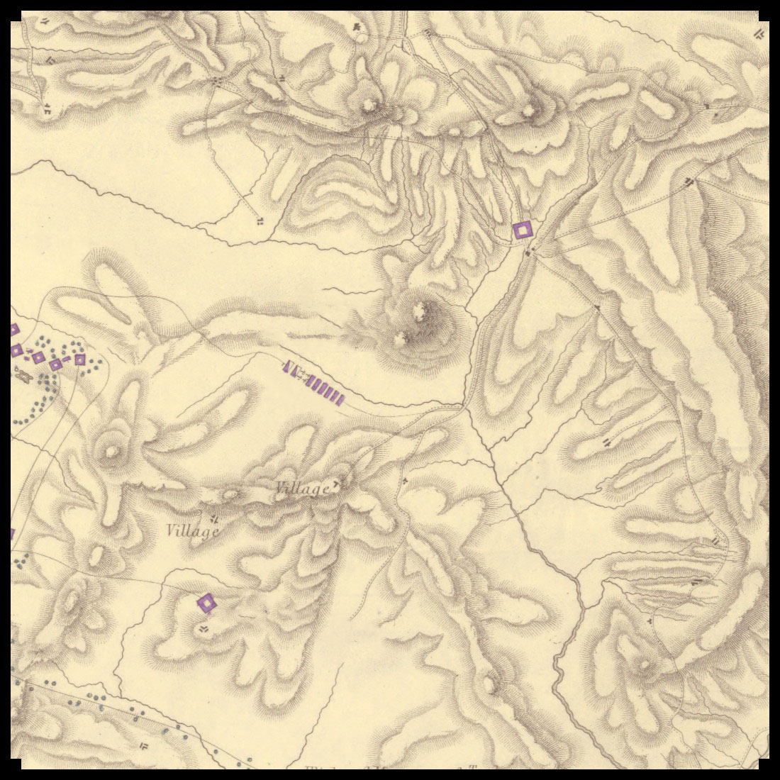
Historical Context of Top-Down Topographic Representations
In antique maps, the representation of geographical features like mountains and hills was not only functional but also a form of artistic expression. Early cartographers used symbols and illustrations to convey the terrain’s physical characteristics, often in a stylized manner that reflected the artistic conventions of their time. For instance, the Tabula Rogeriana created by Muhammad al-Idrisi in 1154, and Abraham Ortelius’s Theatrum Orbis Terrarum from 1570, are notable examples of how mountains and hills were depicted using exaggerated forms and detailed linework.
In these historical maps, mountains were typically shown in a profile view, stacked or lined up to convey their presence on the landscape. This method was not geographically accurate by modern standards but provided an immediate visual cue about the terrain’s ruggedness and elevation changes. Hills were often depicted as smaller, rounded forms, while plateaus were shown with flat tops and distinct edges.
Utility and Aesthetic Value
The primary utility of these representations lay in their ability to communicate complex topographical information quickly and effectively. Travelers and explorers relied on these maps to understand the lay of the land, anticipate obstacles, and plan their routes. The use of contour lines and shaded relief techniques evolved over time, enhancing the maps’ precision and readability.
In addition to their practical uses, these topographic elements held cultural and decorative significance. Maps were often commissioned by royalty and nobility, serving as symbols of power and knowledge. The artistic embellishments, including elaborate mountain ranges and lush forests, added an element of prestige and beauty to these documents, making them treasured works of art.
Examples in Fiction
The influence of antique cartography extends into modern fantasy literature, where maps play a crucial role in world-building. J.R.R. Tolkien’s Middle-earth maps, for example, draw heavily on antique map styles, featuring detailed mountain ranges and forests that mirror the aesthetic of historical cartography. Similarly, George R.R. Martin’s A Song of Ice and Fire series includes maps that use top-down representations to depict the varied terrains of Westeros and beyond.
The Old Cartography Top-Down Mountains & Topography Assets Megapack
This asset pack is a treasure trove for map enthusiasts and creators, offering a variety of top-down elements that mimic the style of antique maps. The pack includes:
- Top-Down Mountain Parts: Segments that can be combined to form mountain ranges, providing flexibility in designing unique landscapes.
- Top-Down Plateau Parts: Elements to depict flat-topped elevated areas, essential for creating diverse terrains.
- Top-Down Hill Parts: Rounded forms that can be used to illustrate gentle slopes and rolling landscapes.
- Top-Down Individual Mountains and Hills: Standalone elements for specific geographical features.
- Old Cartography Trees: Iconic tree illustrations that add a touch of historical authenticity.
- Contour Line Paths: Lines that indicate elevation changes, enhancing the map’s topographic detail.
Conclusion
The Old Cartography Top-Down Mountains & Topography Assets Megapack is more than just a collection of map elements; it is a bridge to the past, capturing the essence of antique cartography while providing modern utility. By combining historical aesthetics with practical functionality, this pack empowers creators to craft maps that are not only useful but also visually stunning and culturally rich. Whether for storytelling, game design, or personal enjoyment, these assets offer a timeless appeal that echoes the grandeur of maps from centuries past.