In the intricate tapestry of cartographic history, ancient maps serve as windows into the past, offering insights into the landscapes, settlements, and cultures of bygone eras. Central to the visual language of these historical maps are the representations of towns, cities, villages, and various landmarks, each symbolizing a rich tapestry of human habitation and activity. The Old Cartography Medieval Cities & Towns Landmarks Mega Collection – Vintage assets encapsulates this essence, offering a treasure trove of assets meticulously designed to evoke the charm and allure of medieval cartography.
BUY AND DOWNLOAD The Old Cartography Medieval cities & towns- Landmarks Mega Collection – Vintage assets here :
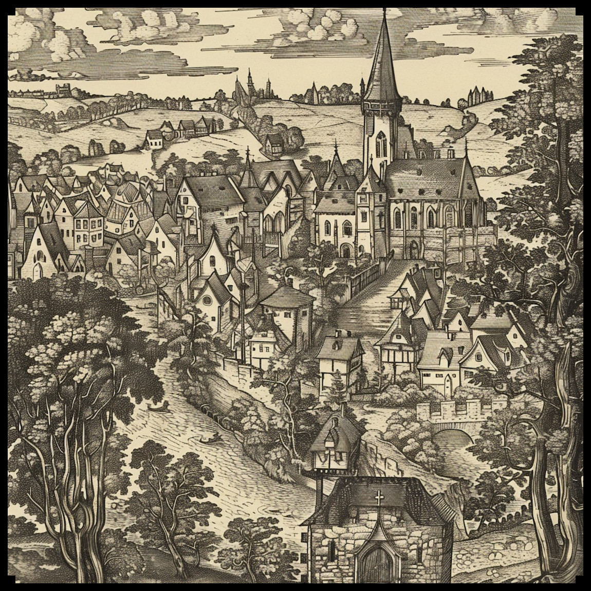
A Glimpse into the Past: Iconography in Ancient Maps
Ancient maps, whether crafted by skilled cartographers or talented artisans, were not merely navigational tools but also works of art. These maps, often adorned with intricate illustrations and symbols, provided a visual narrative of the world as perceived by our ancestors. Among the most prominent features were representations of towns, cities, villages, hamlets, and landmarks, each meticulously depicted to convey vital information to travelers and explorers.
Real-Life Inspiration: Drawing from Historical and Fictional Sources
The aesthetic and functional elements of the Old Cartography Medieval Cities & Towns Landmarks Mega Collection draw inspiration from a rich tapestry of real and fictional sources. Historical maps such as the iconic Mappa Mundi and the medieval Hereford Cathedral map exemplify the intricate detail and symbolic representations characteristic of ancient cartography. In literature, works like J.R.R. Tolkien’s Middle-earth maps or the fantasy realms depicted in Dungeons & Dragons lore serve as vibrant examples of how maps can breathe life into fictional worlds.
Utility and Cultural Significance: Beyond Navigation
Beyond their practical utility for navigation, the representations of towns, cities, villages, and landmarks on ancient maps held profound cultural significance. They served as markers of human settlement and civilization, reflecting the societal structures, economic activities, and religious beliefs prevalent in different regions. Temples, churches, castles, windmills, and watermills featured prominently, highlighting the intersection of architecture, technology, and spirituality in medieval societies.
Aesthetic Appeal: The Artistry of Old Cartography
In addition to their utilitarian function, the representations found in ancient maps also possessed a distinct decorative charm. The meticulous craftsmanship and attention to detail showcased in these maps transformed them into objects of beauty, sought after by collectors and enthusiasts alike. The Old Cartography Medieval Cities & Towns Landmarks Mega Collection pays homage to this tradition, offering assets that not only serve practical purposes but also add a touch of historical elegance to any project.
Conclusion: Navigating the Past with Old Cartography
As we delve into the world of ancient maps, we uncover a rich tapestry of human history, culture, and imagination. The Old Cartography Medieval Cities & Towns Landmarks Mega Collection serves as a gateway to this fascinating realm, offering a curated selection of assets that capture the essence of medieval cartography. From bustling cities to tranquil villages, from majestic castles to humble hamlets, these icons invite us to embark on a journey through time, where every landmark tells a story and every symbol holds a secret.