As an enthusiast of historical cartography and a fervent admirer of fantasy maps, I find great pleasure in exploring the intricate representations of medieval cities on ancient maps. These maps, often characterized by their detailed depictions of fortified cities, offer us a fascinating glimpse into the urban landscapes of bygone eras. In this article, we’ll embark on a journey through history and imagination, delving into the evolution of city mapping and the enchanting world of fantasy maps. We will also shed light on a remarkable asset pack titled Old Cartography Medieval Town Parts & Surroundings Assets – 349 assets MEGAPACK, which beautifully encapsulates the essence of medieval urban life.
BUY AND DOWNLOAD The Old Cartography Medieval Town Parts & Surroundings Assets – 349 assets MEGAPACK :
Medieval City Mapping: A Historical Perspective
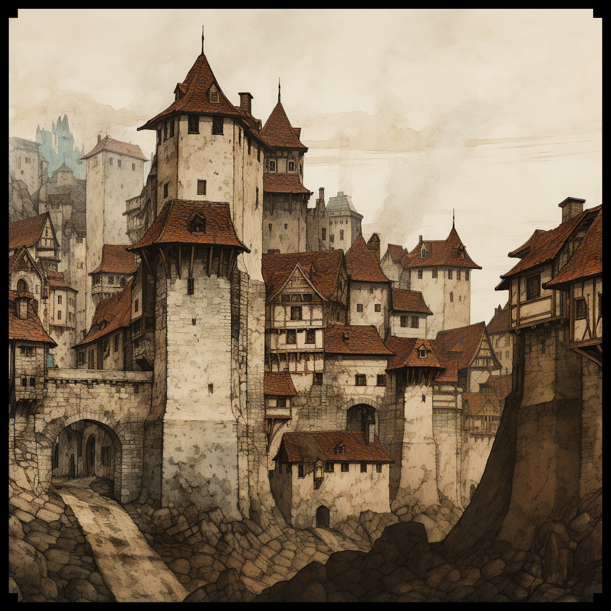
Medieval city maps, known for their meticulous attention to detail, often featured distinctive elements that set them apart from modern cartography. One of the most striking features was the representation of fortified cities with a unique perspective. This perspective, known as “bird’s-eye view” or “axonometric projection,” allowed cartographers to depict the facades and roofs of buildings simultaneously, providing viewers with a comprehensive understanding of the city’s layout. This technique not only showcased the architecture but also highlighted the hierarchical organization of the city into different districts or quarters.
Ramparts, Towers, and Gates: The Heart of Medieval Cities
The fortified nature of medieval cities was a prominent feature, and maps of the time did not shy away from showcasing these imposing structures. Ramparts or city walls, often adorned with crenellations, were depicted as protective shields encircling the urban center. Towers, both defensive and ornamental, dotted the walls at regular intervals, serving as watchtowers and symbols of power. Gates, with their intricate designs and portcullises, were the main entrances to these cities, each telling a story of its own.
The asset pack mentioned earlier, Old Cartography Medieval Town Parts & Surroundings Assets Megapack, perfectly captures the essence of these features, allowing modern map creators to evoke the spirit of medieval cityscapes.
Life in the City: Citizens and Surroundings
Medieval city maps went beyond mere architectural representations; they infused life into the urban sprawl. Tiny figures, representing city dwellers, were often depicted engaged in various activities, such as trading, socializing, or even strolling with their dogs. This human touch added vibrancy to the maps and offered a glimpse into the daily life of medieval citizens.
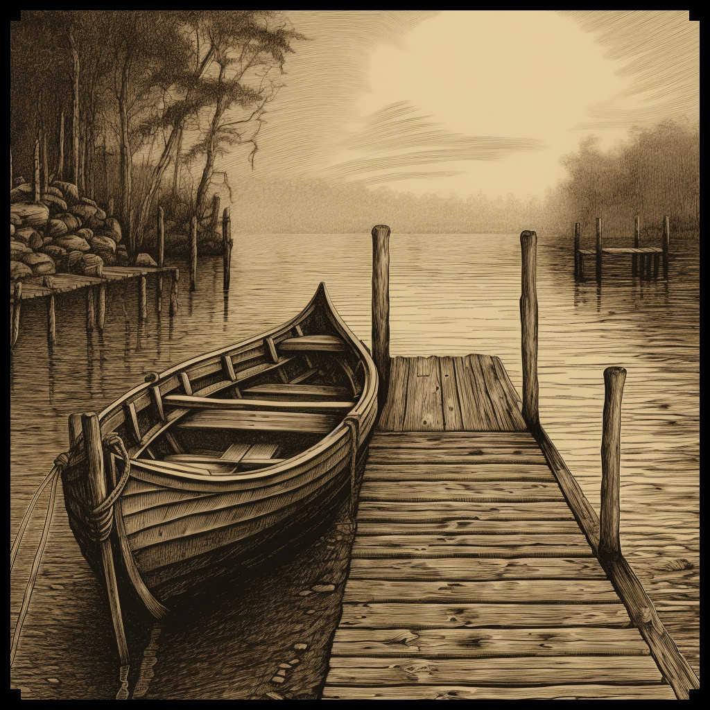
The surroundings of these cities were equally important and were often depicted with meticulous care. The countryside, rolling hills, and sometimes even distant forests framed the urban center, giving a sense of the city’s connection to its hinterland. Portrayals of bustling docks and harbors, with ships and rowboats, emphasized the importance of trade and commerce.
Fantasy Maps: A World of Imagination
While medieval city maps offer a window into the past, fantasy maps transport us to worlds of boundless imagination. These maps, often found in the pages of epic fantasy novels, serve as gateways to fictional realms filled with enchanted cities, mystical landscapes, and mythical creatures. In many ways, they draw inspiration from the rich tradition of medieval cartography, blending historical elements with imaginative flair.
Conclusion
In the realm of cartography, the representations of medieval cities on ancient maps and the enchanting allure of fantasy maps share a common thread of creativity and imagination. The Old Cartography Medieval Town Parts & Surroundings Assets pack, with its meticulously crafted assets, bridges the gap between these two worlds, allowing modern map creators to craft captivating cityscapes that resonate with the spirit of the past and the wonder of fantasy. Whether you’re a historian fascinated by the intricacies of medieval urban life or a fantasy enthusiast yearning to explore uncharted territories, thhis assets megapack offer a captivating journey through time and imagination, where the past and the fantastical converge in harmony.