Posted on Leave a comment

The Elder Scrolls Cartography Assets: Illustrating Cities, Temples, and Towers

The Elder Scrolls, Wonderdraft assets, fantasy cartography resources, settlements, towns, ruins, towers, altmer, orsimer, khajiit

Fantasy worlds, especially those as rich as The Elder Scrolls, inspire awe and immersion, largely due to their intricate maps and unique cultural landmarks. Beyond navigation, these maps serve historical, cultural, and aesthetic purposes that deepen players’ connection to the lore and landscapes of Tamriel. The Elder Scrolls-inspired Settlements, Towns, Ruins, & Structures – Vintage Assets Megapack offers an exquisite collection of icons that add an exotic touch and profound depth to any fantasy map, bringing the diversity and complexity of Tamriel’s cultures and architectures to life. From Altmer towers to Orsimer strongholds, these assets provide worldbuilders and cartographers with a set of tools to create maps that feel both historically grounded and visually captivating.

BUY AND DOWNLOAD The Elder Scrolls inspired Settlements, Towns, Ruins, & Structures – Vintage assets Megapack here :

1. Altmer Cities and Towers: Elegance and Legacy

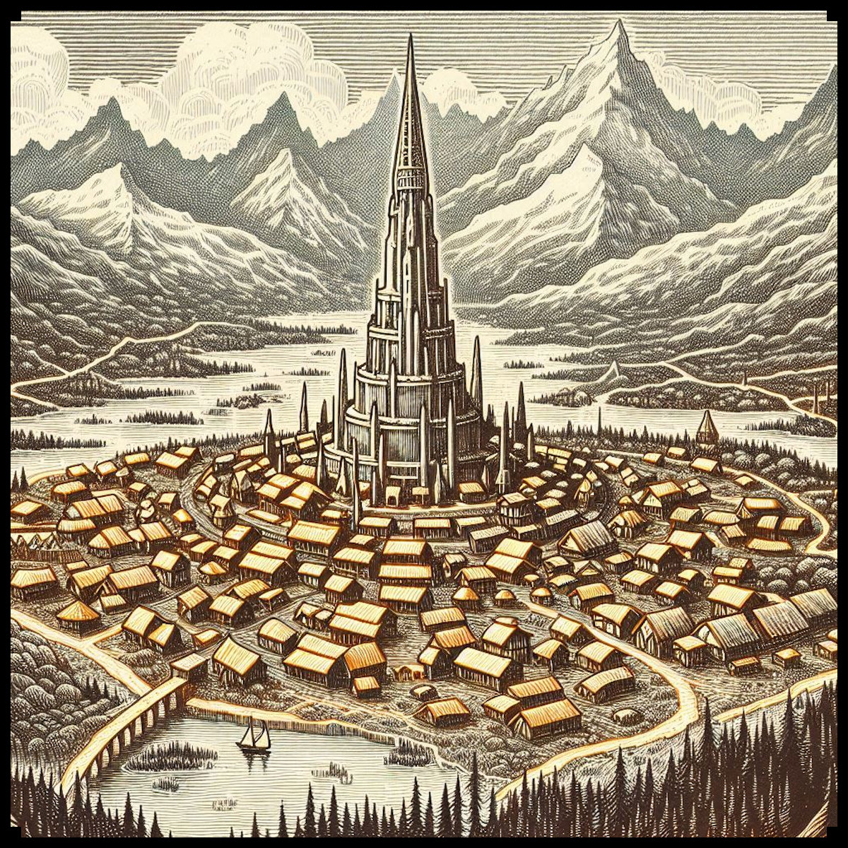
The Altmer, or High Elves, of Summerset Isle are renowned for their sophisticated architectural style, with cities and towers that embody their wisdom, artistry, and pursuit of perfection. Iconic structures like the Crystal Towers and Adamantine Towers represent the Altmer’s reverence for elegance and magical mastery. In this vintage asset pack, Altmer cities are portrayed with intricate spires and graceful designs, mimicking the towering beauty of their real-world counterparts. These soaring structures emphasize the Altmer’s aspirations and their deep connection to celestial forces. Maps featuring Altmer cities are more than simple navigation tools; they serve as visual reminders of the Altmer’s lasting influence and refined aesthetics. These towers don’t just mark locations—they symbolize enlightenment and grandeur, reaching toward Aetherius as if striving for divine perfection.

2. Bosmer Tree Villages: Harmony with Nature

In Valenwood, the Bosmer (Wood Elves) build their homes within the Graht-Oak Trees, enormous living structures that can house entire communities. Unlike traditional wooden buildings, Bosmer settlements are fully integrated into these massive trees, reflecting their Green Pact with Y’ffre, which forbids them from harming plant life unnecessarily. The assets representing Bosmer tree towns capture the organic, interconnected nature of these homes nestled among roots and branches, illustrating the Bosmer’s profound harmony with their environment. Maps that display Bosmer villages highlight the balance between nature and community, marking areas of spiritual and cultural significance where the Bosmer live in unity with the forest. These tree towns serve not only as symbols of shelter but as visual representations of the Bosmer’s naturalist lifestyle, emphasizing their inseparable bond with the lush landscape of Valenwood.

3. Argonian Temples and Pyramids: Mysterious and Resilient

Argonian architecture, often inspired by Aztec or Mesoamerican styles, radiates mystery and resilience. The stone villages and pyramid-like temples depicted in the assets convey a sense of durability and deep connection to the ancient roots of Black Marsh. These Argonian pyramids symbolize the enigmatic spiritual practices of their culture and their strong ties to the Hist, the ancient trees that hold ancestral wisdom. When these structures appear on maps, they not only mark Argonian territories but also represent the enduring spirit of a people who have thrived in Tamriel’s most challenging landscapes. Their structures reflect a steadfast strength, blending with the rugged environment to stand as proud testaments to Argonian survival and independence.

4. Dunmer Settlements and Curved Architecture of Morrowind

The Dunmer (Dark Elves) of Morrowind are known for their unique, curved architectural style that sets them apart from other cultures in Tamriel. Unlike the rigid and angular structures seen elsewhere, Dunmer architecture flows in organic, circular shapes, as seen in their temples, spiraling walkways, and rounded domes. This curved design is deeply rooted in the mystical and volcanic landscape of Morrowind, reflecting the Dunmer’s adaptability to their harsh environment. The assets in this pack capture the elegant and fluid lines of Dunmer structures, with sweeping spirals and softly rounded edges that give their buildings a harmonious, almost ritualistic feel. The Red Mountain, a central landmark often illustrated with fiery eruptions on maps, serves as a potent symbol of the challenges the Dunmer face. Maps featuring these curved structures not only highlight the geography of Morrowind but also express the deeply spiritual and resilient nature of the Dunmer people, whose culture is shaped by both fire and faith.

5. Dwemer Ruins: A Legacy of Lost Knowledge

One of Tamriel’s most mysterious landscapes is dotted with Dwemer ruins, remnants of an ancient, vanished civilization known for its advanced technology and intricate metalwork. These ruins, scattered across Skyrim, Morrowind, and beyond, are depicted as complex, industrial structures that stand in stark contrast to the natural world around them. On maps, Dwemer ruins serve as reminders of a forgotten era, evoking intrigue and speculation about the knowledge and achievements of this enigmatic race. The assets representing Dwemer ruins capture this distinctive design with intricate gears, metallic frameworks, and towering edifices that stand as silent monuments to lost wisdom. Cartographers place these ruins as cultural landmarks, transforming them into prime locations for adventurers and scholars alike to seek the secrets hidden within.

6. Khajiiti Cities and Temples: A Fusion of Cultures

The Khajiit of Elsweyr, with their oriental and Middle Eastern-inspired architecture, bring a unique and exotic flair to Tamriel’s map. Their cities and temples are characterized by domed roofs, pointed arches, and intricate carvings, reflecting their desert homeland and cultural diversity. These structures are symbols of the Khajiit’s adaptability and rich history of trade with other Tamrielic cultures. When represented on maps, Khajiiti cities are visualized as vibrant and exotic hubs, often surrounded by sand dunes or lush greenery. Their architecture provides protection against the harsh desert climate while embodying their spirituality and lively culture. Maps featuring Khajiiti towns and temples immerse players in the multicultural allure of Elsweyr, where the desert’s mysteries blend seamlessly with the ingenuity and artistry of the Khajiit.

7. Orsimer Fortresses and Strongholds: Resilience and Strength

The Orsimer, or Orcs, of Orsinium are famed for their imposing fortresses and rugged structures, which embody their values of resilience and might. Built atop mountains or within heavily fortified compounds, these Orsimer strongholds often feature both solid stone walls and, at times, reinforced wooden walls, designed to withstand both natural elements and hostile forces. The assets in this pack showcase Orsimer architecture with robust wooden or stone defenses, pointed stakes, and spiked towers that capture the Orcs’ warrior spirit and enduring fortitude. When depicted on maps, these strongholds signify the unyielding will of the Orsimer people and their determination to carve out a place in Tamriel despite centuries of struggle. These fortresses are more than strategic outposts; they are powerful cultural symbols, marking Orsimer territory with an unmistakable presence that underscores their fierce independence and pride.

8. Mountain Fortresses and Citadels: Commanding the Peaks

Across Tamriel, mountainous regions host fortresses and citadels that stand high above the surrounding landscapes. These strongholds, including those of the Orsimer, are strategically placed for defense, fortified with stone walls. The assets in the vintage pack illustrate these mountain strongholds with layered settlements and towering structures that embody the strength of a civilization that has endured countless invasions. Mountain fortresses on maps serve as symbols of authority, marking the dominance and resilience of those who inhabit them, from the Orsimer of Orsinium to the isolated tribes who have carved out lives in these lofty realms.

9. The Iconic Towers of Tamriel: White-Gold, Crystal, and Adamantine

No map of Tamriel is complete without the inclusion of its legendary towers: the White-Gold Tower in Cyrodiil, the Crystal Tower in Summerset, and the Adamantine Tower in High Rock. These towers are ancient, mystical landmarks woven deeply into Tamriel’s history, representing the pinnacles of magical and architectural achievement. Each tower holds profound historical and mythological significance, serving as centers of power, governance, and arcane knowledge. The White-Gold Tower, for instance, is both a literal and symbolic heart of the Empire, while the Crystal Tower shines as a beacon of Altmer magic. Maps featuring these towers are not just geographical markers—they are icons of Tamriel’s legacy, standing as emblems of realms of power, mystery, and majesty known across Nirn.

10. The Decorative and Utilitarian Aspects of Antique Map Design

Beyond their lore and geographic details, the vintage design of these map assets serves dual roles: practical navigation and decoration. Antique maps often feature intricate frames and borders, as seen in this asset pack, which not only embellish the map but also provide visual boundaries that draw the viewer’s focus to the contents within. Each icon and structure is crafted with an eye toward historical styles, creating a sense of immersion in a hand-drawn, antique cartographic aesthetic. These maps do more than guide—they tell stories, preserving cultural lore and geographical significance that enrich the player’s understanding of Tamriel.

Conclusion

The Elder Scrolls-inspired Settlements, Towns, Ruins, & Structures – Vintage Assets Megapack offers more than just a collection of icons; it’s a tribute to the complex histories, cultures, and mysteries of Tamriel. Each asset, from Altmer towers to Bosmer tree cities, captures the essence of the race it represents, adding an exotic flair and a profound depth to any fantasy map. By integrating these assets, cartographers and fans of The Elder Scrolls can create maps that are not only visually captivating but also culturally resonant, echoing the age-old stories and mystical landscapes that make Tamriel an unforgettable world.

Posted on Leave a comment

Fantasy Map Symbols and Ground Detail Assets: Adding Depth to Your Maps

shrubs, landforms, low terrain, wonderdraft assets, vintage cartography assets, fantasy map symbols, vines, vineyard

The art of cartography, especially in ancient and fantasy mapmaking, has always been more than a mere representation of geography. Maps tell stories—about the land, its people, its history, and even its culture. The Old Cartography Ground Details & Low Landforms – Assets Megapack masterfully revives the essence of ancient maps, offering 291 high-quality assets that bring fantasy worlds to life with unparalleled authenticity. Through these assets—grass, tall grass, thickets, shrubs, vines, low landforms, old cartography paths, and shading lines—I’ve tried to capture both the functional and artistic aspects of old maps, blending utility with the storytelling of map art. To understand the significance of these elements, let’s take a journey through history and explore the practical and cultural importance of these details in real-world and fictional cartography.

BUY AND DOWNLOAD The Old Cartography Ground Details & Low Landforms – Assets Megapack here :

Historical Role of Ground Details in Ancient Maps

In the ancient world, maps were not just tools of navigation; they were artistic representations of knowledge, power, and perception of the world. The earliest known maps, such as the Babylonian clay tablets (circa 600 BCE), utilized symbolic elements to represent terrain features like mountains, rivers, and fields. Greek and Roman maps, such as the Tabula Peutingeriana (a 4th-century Roman map), used illustrations to show paths, towns, and geographic boundaries, often with artistic flourishes that had cultural or religious significance.

The vegetation, landforms, and ground details on these maps were functional, serving as navigational aids, but they were also deeply intertwined with the mapmaker’s worldview. For example, in medieval European maps like the Hereford Mappa Mundi (circa 1300), vegetation such as forests and fields weren’t just geographical features but were also imbued with symbolic meanings, often representing danger, wilderness, or the untamed frontier.

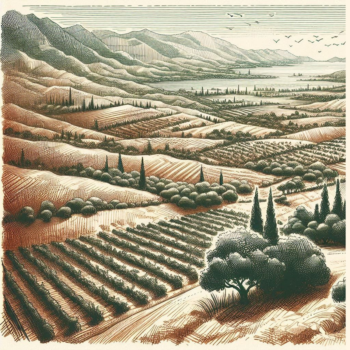
In a similar vein, vineyards represented not just agricultural lands but also the bounty of civilization and the fertility of the land. Vines symbolized order amidst chaos, a cultivated landscape in contrast to the wild thickets and forests. By including these elements in the Old Cartography Ground Details & Low Landforms – Assets Megapack, mapmakers today can evoke these same meanings, giving their fantasy maps depth and narrative.

Utilitarian and Cultural Functions of Ground Details

The ground details featured in this asset pack—thickets, shrubs, grass, tall grass, and vines—are essential for adding realism and functional depth to maps. Here’s how each of these elements historically and culturally enriched maps:

  • Grass and Tall Grass: In ancient cartography, grassy areas were often used to demarcate agricultural lands, grazing fields, or open plains. In Roman maps, open grassy areas indicated places suitable for settlement or military encampment. In fantasy mapmaking, these assets help fill empty spaces, providing a realistic representation of nature. Additionally, they guide the eye, offering visual breaks and texture that add to the immersive quality of the map.
  • Thickets and Shrubs: Thickets and shrubs have always served a practical role in representing the wild or unexplored regions of a map. In medieval cartography, forests were depicted as dense, dark regions often filled with dangers, and thickets signaled impassable areas or natural boundaries. In fantasy maps, they similarly serve to delineate areas that may be difficult to navigate, creating natural obstacles or strategic points for adventurers. Culturally, thickets have often represented the boundary between civilization and wilderness—a theme that persists in many fantasy worlds today.
  • Vines (Vineyards): Historically, vines have symbolized abundance and cultivation. In maps from the Roman Empire, vineyards were depicted to showcase agricultural wealth, and in medieval maps, they were often a symbol of prosperity. The inclusion of vines in a fantasy map offers not only a visual representation of farmland but also adds a layer of cultural richness, suggesting a region’s agricultural history and its ties to civilization.
  • Low Landforms: Landforms have always been a critical element in cartography. In ancient times, low landforms such as hills, valleys, and plateaus were marked using shading and elevation lines to give the map depth and to inform travelers about the terrain they would encounter. These landforms, while subtle in appearance, were vital in shaping how people navigated the world. In fantasy maps, low landforms serve a similar function, creating natural obstacles or strategic vantage points while adding a dynamic three-dimensional feel to a two-dimensional medium.
  • Paths: One of the oldest and most essential elements in maps, paths (or roads) symbolize human movement and interaction with the land. Roman maps like the Tabula Peutingeriana meticulously depicted road networks, crucial for military campaigns and trade. In fantasy cartography, the representation of paths provides a narrative direction for the map, guiding players or readers toward destinations, indicating trade routes, or highlighting the easiest ways through dangerous terrain.
  • Shading Lines: The use of shading lines on old maps was not just an artistic choice; it was a practical method for representing elevation and depth. These lines helped travelers understand the topography of the land, particularly in mountainous or hilly regions. In the Old Cartography Ground Details & Low Landforms – Assets Megapack, shading lines play a crucial role in grounding the various elements within the map, ensuring they feel cohesive and integrated. Shading lines prevent assets from appearing to “float” and give a better sense of depth and solidity. They allow assets to be anchored naturally into the terrain, enhancing the overall flow and realism of the map.

Decorative and Symbolic Aspects in Fantasy Mapmaking

While ancient maps were utilitarian, they were also highly decorative. Maps like the Carta Marina (1539), created by Swedish cartographer Olaus Magnus, didn’t just depict the geography of Scandinavia—they also featured sea monsters, ships, and mythological creatures, blending fact with fiction. This decorative aspect has carried over into modern fantasy cartography. The elements in the Old Cartography Ground Details & Low Landforms – Assets Megapack serve both functions: they add real-world detail to the map while also creating a sense of mystery and adventure.

For instance, a thicket in the middle of a map could signal a dangerous zone filled with monsters, while vines may indicate an ancient, abandoned vineyard. Each element tells a story and invites players to explore further.

Bringing Your Fantasy Maps to Life

The Old Cartography Ground Details & Low Landforms – Assets Megapack is not merely a set of decorative assets; it is a storytelling tool. By using these assets, mapmakers can evoke the same sense of adventure, danger, and discovery that ancient cartographers did in their work. Whether you’re filling in empty spaces with tall grass or breaking up the landscape with thickets and shrubs, these elements provide both visual interest and narrative depth.

For creators inspired by the likes of Tolkien’s maps in The Lord of the Rings or George R. R. Martin’s maps in A Song of Ice and Fire, the pack offers a treasure trove of possibilities. These assets allow for the creation of detailed fantasy worlds that feel as alive and intricate as the real world, with a timeless vintage aesthetic that grounds the fantastical in the familiar.

In conclusion, the Old Cartography Ground Details & Low Landforms – Assets Megapack offers a rich set of tools for fantasy mapmakers who seek to blend historical cartographic techniques with creative storytelling. Through the use of grass, thickets, vines, and shading lines, this pack not only enhances the visual quality of maps but also imbues them with the depth and meaning seen in the greatest maps of the ancient and medieval worlds. Whether you’re creating maps for a tabletop RPG, a novel, or a video game, these assets will help you craft a world that feels authentic, immersive, and steeped in history.

Posted on Leave a comment

Exploring Fantasy Map Symbols: The Wonders of Mountains and Hills

mountains ranges and hills, fantasy map assets, wonderdraft assets and symbols, etching illustration

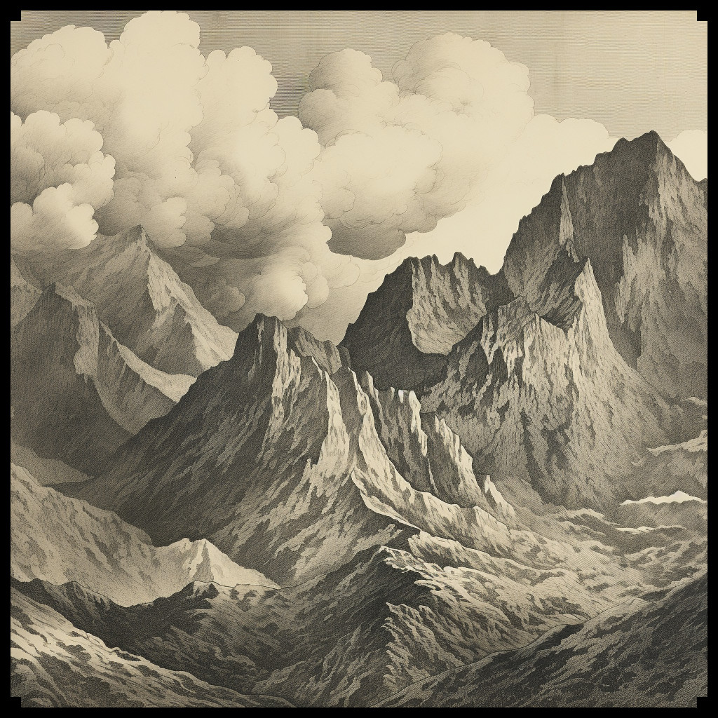
Maps have been pivotal tools for exploration, navigation, and storytelling throughout history. They combine practical utility with artistic expression, drawing inspiration from both the real world and the realms of imagination. In the realm of cartography, antique maps provide a rich source of inspiration for fantasy maps, fostering a bridge between history and creativity. This article delves into the significance of mountains, hills, and related features in both antique and fantasy maps, while showcasing the Ultimate Vintage Mountains & Mountain Ranges + Hills – 265 Assets Megapack, a collection that lovingly echoes the classic cartographic style.

BUY AND DOWNLOAD The Ultimate Vintage Mountains & Mountain Ranges + Hills – 265 Assets Megapack :

Mountains and Hills in Antique Maps

Antique maps are windows into the past, displaying a blend of geographical knowledge and artistic interpretation. The representation of mountains, hills, and related terrain features in these historical maps evolved over time and varied across cultures, but certain themes persisted:

Mountain Ranges: Antique maps often portrayed mountain ranges as towering, jagged formations. The Alps, illustrated in Ptolemy’s Geographia in the 2nd century, provide an early example of this style, with hatched lines indicating elevation.

Hill Ranges: Hills were depicted with gentler slopes compared to mountains, reflecting their smaller scale. A notable example is the “Tabula Rogeriana” by Muhammad al-Idrisi, where terrain features are illustrated with a mixture of artistic impression and geographical accuracy.

Individual Mountains: Prominent peaks, like Mount Fuji in Japanese Edo period maps, were detailed meticulously, often becoming iconic symbols of the region.

Rocky Isles: Coastal maps included rocky isles and outcrops, such as those found in the 16th-century maps of the Mediterranean by Abraham Ortelius, enriching the maritime landscape.

Pinnacles: Antique maps frequently featured towering pinnacles at mountain summits, as seen in the map of the Himalayas from the early 19th century, adding an element of grandeur and mystique.

Mountain Caves: Maps of famous caves or entrances, like those found in the legendary journeys of Sinbad the Sailor, often intrigued readers with their potential for adventure and discovery.

Fantasy Maps and the Ultimate Vintage Mountains & Mountain Ranges + Hills Megapack

Fast forward to the world of fantasy maps, where cartographers and world-builders craft imaginary realms replete with magic and adventure. The Ultimate Vintage Mountains & Mountain Ranges + Hills – 265 Assets Megapack breathes new life into antique cartographic aesthetics, offering a cornucopia of elements to aid modern fantasy map creators.

This remarkable collection includes an array of assets that impeccably recreate the antique map style:

Mountain Ranges and Hill Ranges: Drawing inspiration from classics like Abraham Ortelius’s “Theatrum Orbis Terrarum,” these assets echo the bold lines and intricate detail that convey an epic scale in fantasy maps.

Individual Mountains and Hills: Each peak and hill within the megapack boasts intricate craftsmanship reminiscent of prominent terrain features in antique maps.

Karst Mountains: These unique formations, akin to those found in limestone-rich regions like the Dinaric Alps, offer a geological authenticity to fantasy landscapes.

Foothills: The gradual ascent from lowlands to towering peaks, evident in maps like John Rocque’s 18th-century surveys, grants fantasy maps depth and perspective.

Peaks and Pinnacles: Evoking the breathtaking heights of the Matterhorn in Swiss cartography, these assets infuse fantasy landscapes with drama and mystery.

Rocky Isles: Just as islands and coastal features were integral to ancient portolan charts, these rocky isles embellish the coasts of fantasy worlds, enhancing immersion.

Caves and Cave Entrances: Caverns, like those documented in Chinese silk maps dating back to the 3rd century BCE, foster a sense of exploration and intrigue, mirroring the mystique of their historical counterparts.

Special Mountains: Symbolic peaks, reminiscent of Mount Olympus in ancient Greek mythology, offer a compelling focal point or adventure destination within a fantasy realm.

Conclusion

Fantasy maps, like their antique counterparts, owe much of their artistic flair and imaginative power to the traditions of old-world cartography. The Ultimate Vintage Mountains & Mountain Ranges + Hills – 265 Assets Megapack stands as a testament to the enduring influence of antique maps on contemporary fantasy cartography. These assets not only capture the essence of antique maps but also empower creators to conjure captivating, imaginative worlds replete with mountains, hills, and other terrain features that have shaped cartographic history. In this timelessly blended tapestry of the past and the present, fantasy maps continue to inspire and transport us to uncharted realms limited solely by the frontiers of our imagination.