Posted on Leave a comment

Cartography Assets : Reliefs and Vintage Cartographer’s Mountains in Maps

fantasy map assets symbols bundle, mountains, cliffs, desert dunes, rifts, chasms,desert cracks,buttes, for wonderdraft

Geographical features have long played a significant role in both ancient and fantasy maps, adding depth, symbolism, and visual interest to the depicted landscapes. Let’s delve into the historical significance of various elements such as mountains, deserts, landforms, dragons, and decorative elements, and how they contribute to the captivating Old Cartography Topographic Assets Complete Bundle—an invaluable resource for fantasy map creators

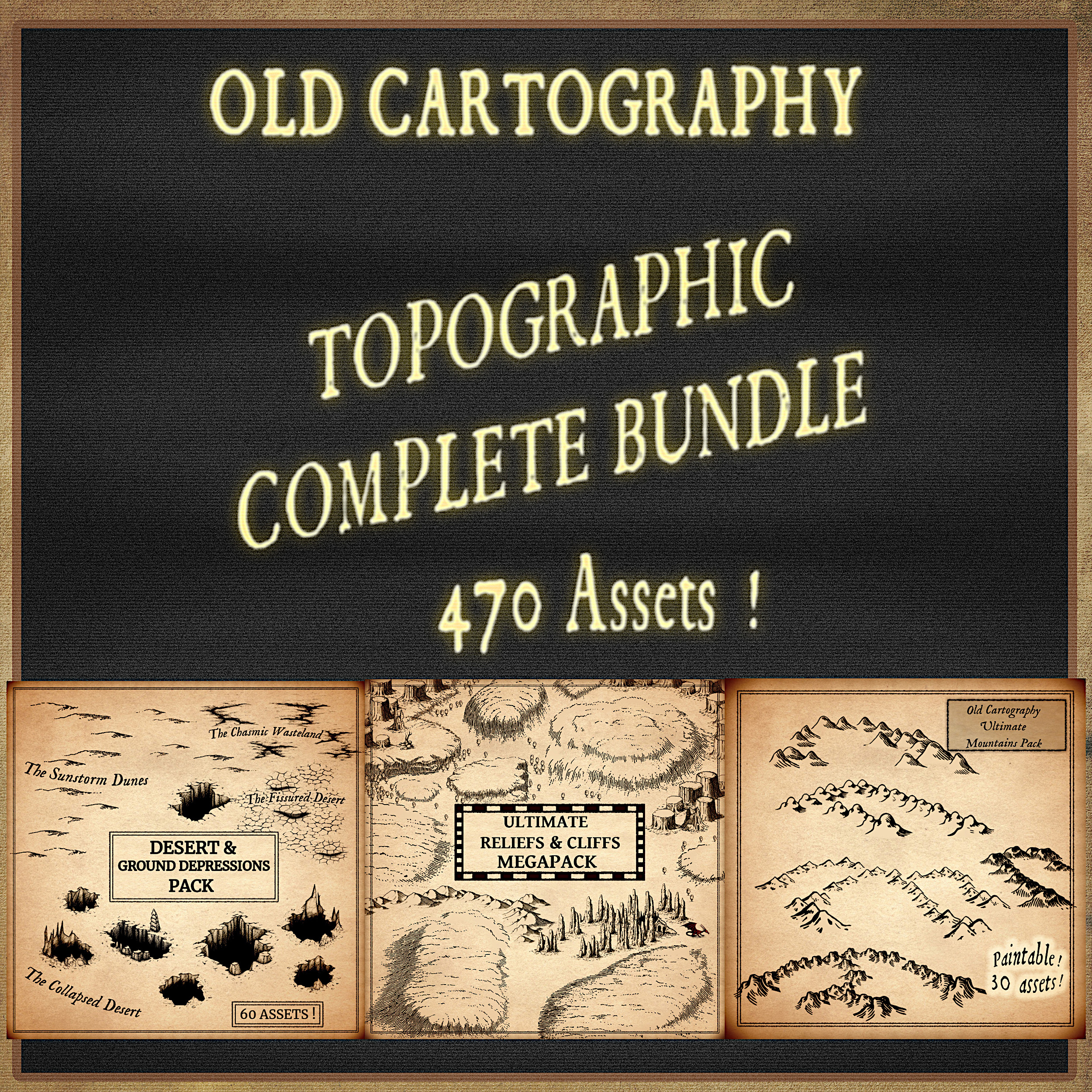
BUY AND DOWNLOAD the Old Cartography Topographic Assets Complete Bundle :
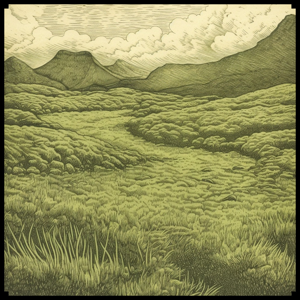
Mountains
Mountains hold a prominent place in maps, both ancient and fantasy. In ancient maps, generic mountains were simple triangular shapes, symbolizing grandeur and mystery. Rocky antique mountains, on the other hand, were depicted with rugged terrain and intricate shading, evoking danger and creating natural barriers in fantasy realms.

Deserts
Deserts in maps are often filled with intriguing landmarks. Desert caves offer shelter or hidden treasures, while desert temples represent ancient knowledge or guarded secrets. Desert butte towns perch atop elevated landforms, providing vantage points and protection. Dunes, cracks, and decorative dead trees further enhance the desert’s mysterious and untamed nature, captivating readers and evoking a sense of exploration.
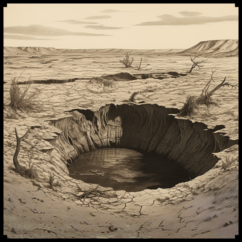
Landforms
Various landforms bring diversity and visual interest to maps. Canyons, with their deep gorges, add drama and a sense of scale. Plateaus, mesas, and cliffs create distinct elevated regions, offering strategic locations or breathtaking viewpoints. Chasms, rifts, sinkholes, and dolines introduce natural formations that can be obstacles, pathways, or hidden wonders, amplifying the sense of adventure in both ancient and fantasy maps.

Dragons and Pinnacles
Dragons and their lairs have long been symbols of power and mystery. In fantasy maps, a dragon’s lair represents a treacherous and awe-inspiring location, often hidden within formidable terrain. Pinnacles, tall and pointed formations, further contribute to the grandeur of these maps, signifying both danger and mythical creatures.

Decorative Elements
Ancient and fantasy maps often incorporate decorative elements to enhance visual appeal. Decorative desert dead trees and cracks create an eerie atmosphere, hinting at the harshness and unforgiving nature of the landscapes. These elements add depth and aesthetic charm to the maps, captivating readers with their intricate details and mysterious allure.

The Old Cartography Topographic Assets Complete Bundle
The Old Cartography Topographic Assets Complete Bundle offers an expansive collection of assets that faithfully replicate the antique style of ancient maps. By utilizing this bundle, map creators can bring their imaginative visions to life. The attention to detail in the portrayal of mountains, deserts, landforms, dragons, and decorative elements ensures an authentic and captivating visual experience for readers.

Conclusion
Geographical features hold immense significance in both ancient and fantasy maps, contributing to the overall narrative and immersive qualities of the depicted worlds. The Old Cartography Topographic Assets Complete Bundle serves as an indispensable resource for map creators, providing them with the tools to craft visually stunning and historically inspired fantasy maps. By incorporating elements such as mountains, deserts, landforms, dragons, and decorative elements, map creators can transport readers to enchanting realms, sparking their imagination and inviting them on thrilling adventures. Immerse yourself in the art of cartography with this remarkable collection, and embark on a captivating journey through awe-inspiring landscapes.

Posted on Leave a comment

Carving the Earth: Exploring the Artistic Rendering of Desert Dunes, Cracks, and Ground Depressions in Cartography assets

etching illustration desert sinkhole, fantasy map assets

One captivating aspect often depicted in maps is the intricate detailing of desert landscapes. In this article, we delve into the historical significance of desert features, such as dunes, cracks, chasms, rifts, sinkholes, and dolines, both in ancient maps and their representation in contemporary fantasy cartography. Furthermore, we highlight the Old Cartography Desert & Ground Depressions Assets Pack, which recreates these elements in a style reminiscent of antique maps.

BUY AND DOWNLOAD the Old Cartography Desert & Ground Depressions Assets Pack :

Deserts have long fascinated cartographers due to their enigmatic nature and vastness. Ancient maps, such as those from the Arab world or medieval European manuscripts, often depicted desert dunes with a sense of grandeur and mystique. These sandy hills were illustrated as undulating waves frozen in time, creating a visually striking representation of the arid landscapes. Fantasy maps, heavily inspired by their historical counterparts, frequently feature desert dunes to evoke a sense of adventure and the unknown.

Cracks in desert terrain present an intriguing visual element. Ancient cartographers occasionally incorporated these cracks, which can be caused by erosion or tectonic activity, into their maps as symbols of treacherous terrain. Often portrayed as jagged lines or symbols resembling a series of fractures, these representations aimed to caution travelers about the potential dangers they might encounter in these regions. In fantasy maps, desert cracks serve a similar purpose, enhancing the feeling of peril and the inherent challenges faced by adventurers.

Chasms and rifts are geological features that have fascinated both ancient and fantasy cartographers. In ancient maps, they were depicted as deep, dark crevices, either explicitly or through symbolic representations. These elements served as natural barriers, separating different regions and emphasizing the immense scale of the depicted landscapes. Similarly, in fantasy maps, chasms and rifts often mark the boundaries of distinct territories or add an element of mystery and exploration, hinting at hidden realms or untold stories.

Sinkholes and dolines, although more commonly associated with karst landscapes, also find their place in ancient and fantasy maps. These natural depressions in the ground were occasionally depicted in ancient maps to indicate areas prone to collapse or subterranean networks. The inclusion of sinkholes and dolines in fantasy maps allows for the creation of unique landscapes and provides opportunities for plot development. These natural formations may harbor hidden treasures, secret passages, or even serve as gateways to other dimensions.

The Old Cartography Desert & Ground Depressions Assets Pack offers a remarkable collection of desert dunes, cracks, chasms, rifts, sinkholes, and dolines, meticulously crafted to resemble the style of antique maps. These assets provide a valuable resource for fantasy map creators, enabling them to add a touch of historical charm to their cartographic works. The pack not only allows for the depiction of visually captivating desert features but also helps in creating a sense of depth, mystery, and adventure within the map’s narrative.

Conclusion:
Desert features have a long-standing presence in both ancient and fantasy maps, serving various purposes from warning travelers of dangers to stimulating the imagination of viewers. The Old Cartography Desert & Ground Depressions Assets Pack empowers map creators with the ability to incorporate these elements seamlessly into their fantasy maps, evoking the allure of ancient cartography while adding depth and intrigue to their creations. By utilizing the pack’s desert dunes, cracks, chasms, rifts, sinkholes, and dolines, map enthusiasts can transport their audience to a world of exploration and adventure.

Posted on Leave a comment

Beyond the Flatlands: Embracing Cartography Assets to Capture the Essence of Reliefs

plateaus, cliffs with grass, etching representation of fantasy map assets from ancient and antique cartography, wonderdraft

Welcome, fellow cartography enthusiasts, to a whimsical exploration of the role of reliefs in both fantasy and ancient maps. For the past decade, I have been immersed in the captivating realm of fantasy cartography, marveling at the intricate details and captivating landscapes depicted in these imaginative creations. Today, we embark on a journey to uncover the significance of reliefs in maps, with a particular focus on the charmingly titled Old Cartography Ultimate Reliefs and Cliffs Megapack. So, grab your compass and strap on your imagination, as we traverse mountains, plateaus, buttes, mesas, and cliffs, while uncovering the subtle nuances that make these features so essential to the art of mapping.

BUY AND DOWNLOAD the Old Cartography Ultimate Reliefs and Cliffs Megapack here :

Throughout the annals of cartographic history, the inclusion of reliefs has played a pivotal role in providing a holistic representation of the Earth’s varied topography. These meticulously crafted additions allow map readers to transcend the two-dimensional plane and envision the undulating terrain that lies beneath their feet. From ancient maps etched onto stone tablets to the mesmerizing realms of fantasy, the depiction of reliefs has captured the imagination of countless adventurers, storytellers, and mapmakers alike.

Within the vast expanse of terrains and landscapes, a myriad of unique landforms awaits our exploration. Let us first venture into the realm of plateaus, those lofty tablelands that grace the pages of both ancient and fantasy maps. With their flat tops and steep edges, plateaus provide a natural vantage point for surveying the surrounding lands, making them ideal locations for fortresses, hidden sanctuaries, or the abodes of mythical creatures.

As we traverse further, we encounter the intriguing formations of buttes and mesas. Rising like sentinels from the earth, these towering monoliths inspire awe and wonder. Buttes, with their solitary and slender structures, often stand as solitary guardians, while mesas beckon with their wide tabletops, enticing adventurers to unravel the secrets that lie atop these elevated realms.

No exploration of reliefs would be complete without acknowledging the whimsical presence of rocky pinnacles. These enchanting formations, often protruding dramatically from the ground, capture the essence of fantasy itself. In ancient maps, they served as markers of treacherous terrains or hidden troves of treasure, whereas in fantasy realms, they are gateways to realms of magic, perches for mythical creatures, or simply scenic wonders to marvel at.

Now, let us turn our attention to the Old Cartography Ultimate Reliefs and Cliffs Megapack, a treasure trove of artistic assets that enables mapmakers to immerse their creations in the time-honored aesthetics of ancient maps. By adopting the distinctive style of antique cartography, this collection brings to life the intricate details and whimsical representations of various reliefs, plateaus, buttes, mesas, cliffs, and more.

From the majestic grandeur of towering mountains to the rugged allure of hidden canyons and desert caves, this Megapack offers a vast array of assets to unleash your imagination. Whether you seek to create a dragon’s lair perched atop a cliff or a sprawling city nestled amidst rolling plateaus, these assets will transport your maps to realms brimming with mystique, adventure, and countless storytelling possibilities.

Happy mapping, my fellow adventurers, and may your explorations be filled with wondrous reliefs and endless possibilities!