Posted on Leave a comment

Ramparts in Fantasy Maps: From isometric castle walls to Wonderdraft assets

In both ancient cartography and fantasy map making, the depiction of ramparts, city walls, and defensive structures has always been more than mere decoration. These symbols tell stories of protection, power, and civilization itself. From the crenellated enclosures of medieval towns to the stylized fortifications of modern Wonderdraft assets and fantasy map icons, the way walls are drawn reflects both history and imagination.

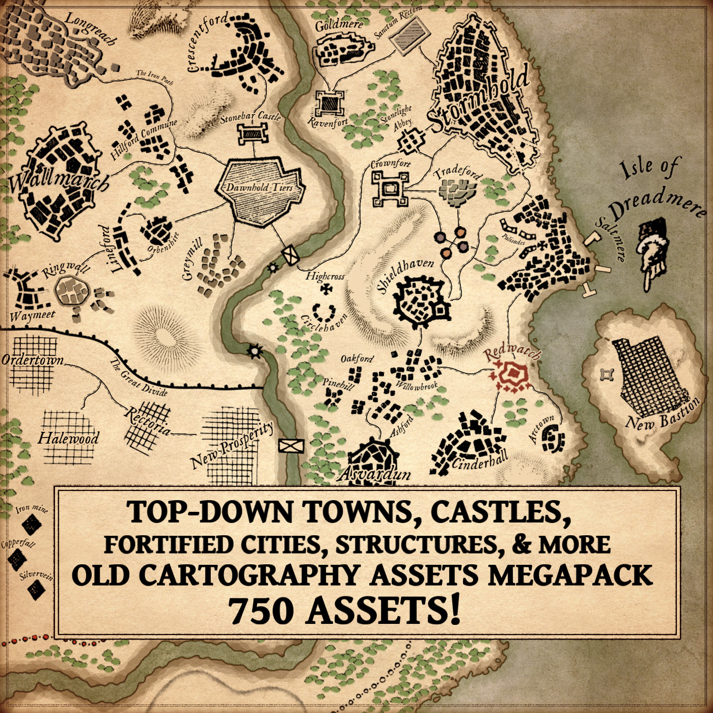
The new Modular Medieval Ramparts & Castle Walls – Vintage Assets Megapack celebrates this rich tradition by bringing to life the artistic language of ancient and fantasy maps. Its hand-drawn style echoes the texture and charm of antique cartography while offering modern creators a vast library of cartography assets to build immersive worlds.

BUY AND DOWNLOAD The Modular Medieval Ramparts & Castle Walls – Vintage Assets Megapack here :


Walls as Borders and Symbols in Ancient Cartography

Long before satellite imagery and GIS data, maps were not purely geographic—they were conceptual. The Babylonian World Map (6th century BCE), etched on clay, is one of the earliest known examples: the world surrounded by a circular ocean, cities marked as fortified dots. The walls drawn around Babylon are not architectural records but symbols of order against chaos.

Similarly, in medieval mappa mundi—such as the famous Hereford Mappa Mundi (c. 1300)—Jerusalem sits encircled by massive ramparts, representing the divine center of the world. These circular walls are less about defense and more about sanctity and separation: the wall as the line between the holy and the profane.

Later, Renaissance cartographers like Sebastian Münster and Abraham Ortelius refined the visual grammar of fortification. Their maps of cities such as Venice or Nuremberg show detailed bastions and geometric ramparts—symbols of engineering pride as much as military might. Every line and crenelation was a proclamation of civilization’s control over the land.


City Walls and the Language of Fantasy Map Icons

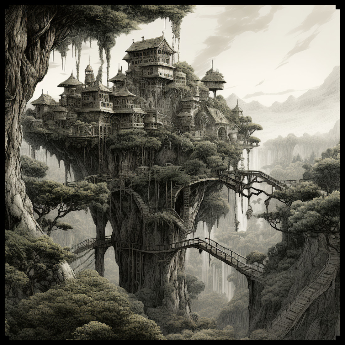
When we shift to fantasy cartography, these traditions endure. Every fantasy map maker knows the satisfying logic of drawing a walled city—its circular perimeter promising safety from monsters, its gates marking trade and adventure. In worlds like Tolkien’s Middle-earth, Minas Tirith and Helm’s Deep are iconic examples of ramparted architecture, where geography and storytelling intertwine.

In Game of Thrones, George R.R. Martin’s King’s Landing and The Wall itself extend this visual heritage: fortifications not only divide nations but define entire mythologies. The map of Westeros—engraved with mountains, castles, and walls—owes much to the aesthetics of medieval European mapmaking.

Today, tools like Wonderdraft and other digital platforms continue this tradition. Through packs like the Modular Medieval Ramparts & Castle Walls – Vintage Assets Megapack, fantasy mapmakers can recreate these timeless symbols with authenticity and flexibility—choosing from medieval, gothic, eastern, Aztec, or Middle Eastern architectural styles to match the lore of their worlds.


The Practical and Cultural Role of Rampart Representation

Historically, the inclusion of ramparts and walls in maps served both utilitarian and symbolic functions.

  • Defensive visualization: Early military engineers—like those of Vauban’s France—used detailed rampart plans to organize sieges, fortify cities, or project imperial power. The accuracy of wall representation could determine victory or defeat.
  • Cultural identity: In ancient maps, walls were marks of prestige. A city without walls was not a city; it was wilderness. The Greek term polis implied both community and enclosure.
  • Decorative artistry: In illuminated manuscripts and portolan charts, ramparts framed the miniature world with rhythmic, ornamental lines. They gave texture and weight to the map, guiding the eye and evoking grandeur.

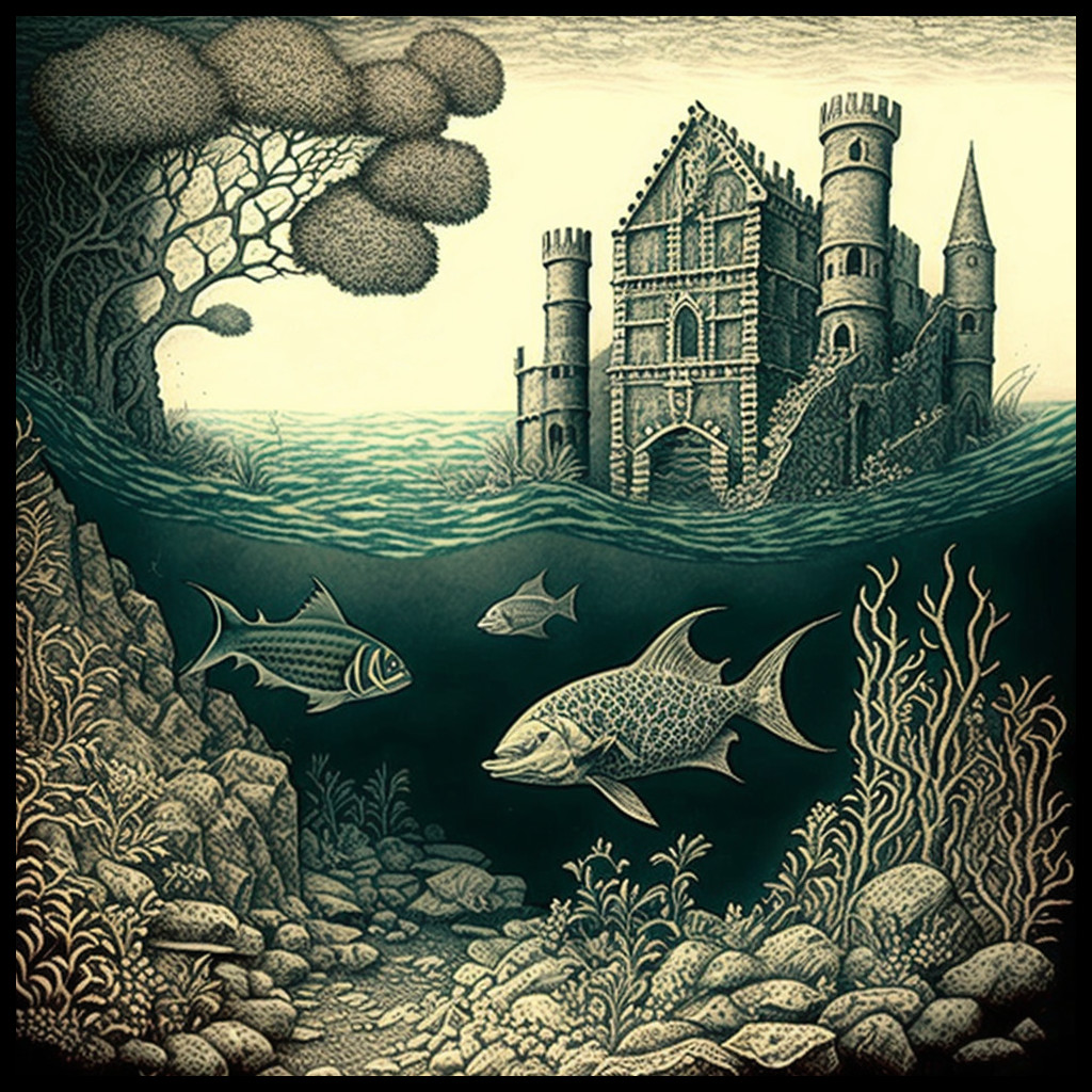
In modern fantasy map making, this duality remains. Ramparts not only define territory—they add visual depth and narrative significance. A ruined wall suggests history; a massive bastion hints at a bygone war. Even the placement of a gate can tell the story of trade, pilgrimage, or invasion.


A Tribute to Historical Styles: The Modular Medieval Ramparts Megapack

The Modular Medieval Ramparts & Castle Walls – Vintage Assets Megapack revives this centuries-old visual language with an artistic nod to antique map engraving. Designed for fantasy cartographers, it provides an extensive collection of modular pieces that can be combined to build believable fortified landscapes.

The pack includes:

  • Ramparts, castle walls, and ruined walls for every architectural taste—from western medieval to eastern or Aztec motifs.
  • Defensive towers, gatehouses, bastions, and watchtowers, allowing creators to illustrate strongholds of any scale.
  • Decorative elements such as gargoyles, shields, flags, stone ornaments, and palisades to enrich the storytelling texture of the map.
  • Natural and civic additions—trees, farms, ponds, churches, and medieval houses—that integrate the fortified city into its surrounding world.

The visual tone imitates the sepia and ink-washed quality of old world cartography, making these fantasy map icons ideal for both historical maps and fantastical realms. Whether you are recreating Constantinople’s Theodosian Walls, the ruins of an ancient Aztec temple city, or an entirely invented fortress kingdom, these assets provide both precision and atmosphere.


The Enduring Appeal of Fortifications in Fantasy Cartography

Why do walled cities continue to fascinate us? Perhaps because they embody the human instinct to draw boundaries—to separate safety from danger, civilization from wilderness, the known from the unknown.

In ancient times, this was a matter of survival. In mapmaking, it became a language of form. In fantasy, it has become a language of emotion. When a reader or player sees a crenellated line on a parchment map, they instantly understand: “Here lies a city of strength.”

Thus, the artistic tradition of rampart representation unites millennia of human creativity—from Babylonian clay tablets to digital fantasy maps. And in tools like Wonderdraft or other modern cartography asset packs, that heritage continues to evolve, allowing every creator to become both historian and world-builder.


Conclusion

The Modular Medieval Ramparts & Castle Walls – Vintage Assets Megapack is not merely a collection of images—it is a bridge between ancient cartographic artistry and the modern imagination. By reviving the timeless symbols of defense, order, and beauty, it empowers creators to craft maps that feel truly alive—rooted in history, yet rich in fantasy.

Whether you are designing a fortified city for a tabletop campaign, illustrating an ancient empire, or mapping a fictional continent, these fantasy map making tools give you the vocabulary of ages past, rendered with modern precision.

Walls may divide lands, but in the realm of cartography, they unite centuries of art, storytelling, and design.

Posted on

Timeless Cartography Assets: The Role of Top-Down Towns, Castles, and Cities

top-down assets, Vintage cartography assets, fantasy map icons, towns, cities, buildings, Wonderdraft, Inkarnate

Maps have always been more than navigation tools. They are storytelling devices, cultural artifacts, and works of art. One of the most fascinating features of both historical and fantasy cartography is the use of top-down representations—miniature towns, villages, castles, piers, temples, and city walls that condense culture and history into symbols.

With modern Wonderdraft assets such as the Top-down towns, castles, villages, & more pack, today’s creators can continue this tradition, bringing life and depth to their fantasy maps while echoing centuries of cartographic practice.

BUY AND DOWNLOAD The Old Cartography top-down towns, castles, villages, & more  Assets Megapack here :

Grid-Planned Towns and Organic Settlements: Classic Fantasy Map Icons

Cartography has always revealed the contrast between organic towns and grid-planned cities.

  • Organic settlements, especially in medieval Europe, grew around castles, rivers, and trade roads. Their winding streets and irregular clusters reflected centuries of adaptation to local geography.
  • Grid-planned cities, by contrast, symbolize order and authority. While rooted in Roman military layouts, this approach became especially prominent in the 18th and 19th centuries in the United States. Cities such as Philadelphia and many Midwestern towns followed strict rectilinear grids, embodying Enlightenment ideals and practical governance.

This duality—wild frontier villages versus orderly planned colonies—remains central in fantasy storytelling. With the right fantasy map icons, you can bring this same historical authenticity into your own worlds.


Cartography Assets in the 18th and 19th Centuries

The Enlightenment and Industrial Age reshaped cartography. In the 18th and 19th centuries, maps were not only decorative—they became precise instruments of power, trade, and expansion.

  • Military maps showed bastioned forts, walls, and ramparts, emphasizing defense.
  • Colonial maps marked gridded towns to project administrative control.
  • Commercial atlases depicted piers, harbors, and watermills, highlighting networks of commerce.

These standardized cartography assets made it possible to instantly read a landscape: every castle spoke of power, every bridge of trade, every temple of belief.


Functional and Symbolic Roles of Fantasy Map Icons

What makes top-down symbols so enduring is their dual function: they are both practical and symbolic.

  • Bridges show strategic crossings and economic lifelines.
  • Temples and churches act as cultural and spiritual centers.
  • Castles and forts embody strength, protection, and political dominance.
  • Mines, watermills, and piers reveal resources, labor, and prosperity.

Just as 19th-century engineers used icons to control colonial territories, today’s worldbuilders use fantasy map icons to create depth, history, and narrative.


Wonderdraft Assets: Timeless and Decorative

From Enlightenment atlases to digital fantasy maps, top-down cartography has proven timeless. These representations are not bound to a single period—they evolve with culture and remain relevant today.

Their beauty lies in versatility: they orient the reader, provide context, and embellish a map with life. A well-placed fortress or walled city transforms a flat map into a living world.

The Top-down towns, castles, villages, & more collection of Wonderdraft assets allows modern creators to combine utility and artistry. These tools produce maps that are not only functional but visually captivating.


Fictional Resonances: From Fantasy Maps to Storytelling

Modern fantasy inherits these traditions:

  • Tolkien’s Minas Tirith, rising as a fortified emblem.
  • Martin’s Winterfell and King’s Landing, echoing medieval strongholds.
  • Countless tabletop RPG maps, where towns, villages, and forts serve both immersion and gameplay.

These examples prove that symbolic cartography is not just history—it is a living art form.


Conclusion: Cartography Assets for Worldbuilders

From grid-planned American cities to medieval strongholds, from Enlightenment atlases to modern fantasy campaigns, top-down cartography remains a universal language. Each bridge, rampart, or temple encodes both utility and meaning.

The Top-down towns, castles, villages, & more pack of fantasy map icons is more than a toolkit—it is a continuation of centuries of symbolic cartography. By using these cartography assets, you bridge history and imagination, building maps that are useful, decorative, and deeply cultural.

Posted on

Mapping Enchantment: Treehouse Cities and the Language of Cartography Assets and Symbols

wonderdraft assets, fantasy map assets, nature, elven treehouse town and city, cartography assets

In the realm of fantasy cartography, the portrayal of treehouse settlements and cities has become an iconic and cherished element. Today, we explore the historical significance and evolution of these captivating representations, drawing a parallel between ancient maps and the modern pack of assets for fantasy maps titled: Vintage Treehouse Settlements and Cities + Treehouse Settlement Creation Kit – 117 Assets MEGAPACK.

BUY AND DOWNLOAD The Vintage Treehouse settlements and cities + treehouse settlement creation kit – 117 Assets MEGAPACK :

The concept of treehouse settlements has roots in ancient cultures across the globe. From the tree-dwelling tribes of Papua New Guinea to the elaborate treehouses of the Alerce Coast in Chile, humans have long sought refuge in the canopy of trees. Ancient maps, such as the Babylonian World Map dating back to the 6th century BCE, occasionally featured symbols representing treehouse-like structures that held a special significance in various cultures.

These early depictions often represented sacred spaces or spiritual realms, highlighting the profound connection between humans and nature. As the art of cartography evolved, so did the representation of treehouse symbols, which began to find their way into maps of fantasy worlds.

With the rise of fantasy literature in the 20th century, maps became an essential component of the genre, guiding readers through the intricate worlds created by authors. Notable authors like J.R.R. Tolkien and C.S. Lewis incorporated treehouse settlements into their fantasy realms, further cementing the fascination with these magical abodes.

The Vintage Treehouse Settlements and Cities + Treehouse Settlement Creation Kit takes inspiration from this rich tradition, providing artists and mapmakers with a treasure trove of assets to bring their dreamlike visions to life. From the sprawling treehouse human cities to the enchanting treehouse elven cities, the pack offers a diverse range of options to cater to every mapmaker’s imagination.

Among the most beloved elements of fantasy cartography are the elven treehouse towns. Elven culture, known for its affinity with nature and ethereal elegance, perfectly complements the concept of treehouse settlements. The pack provides numerous assets for creating these captivating elven havens, allowing mapmakers to infuse their worlds with the allure of elven charm.

One of the standout features of the Vintage Treehouse Settlements and Cities + Treehouse Settlement Creation Kit is its homage to the antique style of cartography. By mirroring the design elements found in ancient maps, this pack transcends the boundaries of time, blending the allure of the past with the magic of fantasy.

To conclude, the representation of treehouse settlements in both ancient maps and modern fantasy cartography has a profound significance. It reflects humanity’s historical connection with nature, the appeal of magical realms, and the timeless allure of the unknown. The Vintage Treehouse Settlements and Cities + Treehouse Settlement Creation Kit stands as a testament to the enduring fascination with treehouse abodes, providing artists and mapmakers with the tools to weave extraordinary tales in the realms of fantasy.

As you embark on your cartographic adventures, remember that every treehouse city, castle, fort, and temple you create carries a piece of history within it – a connection between the fantastical worlds of fiction and the ancient cartographic wonders that have inspired generations. Let your creativity flourish and your maps transport readers and viewers to lands of enchantment and wonder. Happy mapping!

Posted on

Exploring the Fascinating World of Aquatic and Coral Cities and Reefs in Fantasy Maps

etching illustration of a medieval coral castle town on a coral reef with fishes

Fantasy maps have always been a popular medium for world-building, and one of the most interesting aspects of these maps is the inclusion of underwater and coral cities. The Amphibious & Coral towns, Aquatic settlements, and Coral Reefs pack is a comprehensive collection of assets that provides a unique perspective on the world being depicted in fantasy maps. The pack features 51 assets of cities, towns, and other settlements, both above and below the water’s surface, that are inspired by the aesthetics of coral and aquatic environments.

The concept of an underwater city or settlement has been present in popular culture and mythology for centuries, but the idea of a city built on coral is also intriguing. Coral is an organism that grows slowly over time, forming intricate structures and patterns, and these features can be incorporated into the architecture of a city. The Amphibious & Coral towns, Aquatic settlements, and Coral Reefs pack features a range of coral-inspired assets, from small buildings to larger structures like forts and castles.

BUY & DOWNLOAD IT HERE :

The inclusion of aquatic cities in fantasy maps has a long history, and one of the most famous examples is the legend of the underwater city of Ys. This Breton myth tells the story of a city that was built below sea level and protected by a magical dam. When the city’s ruler became too arrogant, he broke the dam, causing a catastrophic flood that destroyed the city. This story has inspired many works of art, literature, and music over the centuries.

Similarly, the inclusion of coral reefs in fantasy maps has a long history as well. Coral reefs are not only fascinating and beautiful but also play a vital role in marine ecosystems. Early maps often depicted the locations of coral reefs as a warning to sailors of potential hazards. Today, coral reefs are a subject of fascination for both cartographers and conservationists.

The Amphibious & Coral towns, Aquatic settlements, and Coral Reefs pack features a diverse range of coral reef assets, designed to blend seamlessly into any map. These assets include both small and large reefs, as well as a variety of coral formations and sea plants, allowing cartographers to create beautiful and realistic environments.

In conclusion, the inclusion of underwater and coral cities and coral reefs in fantasy maps adds another layer of detail and beauty to any map, while also highlighting the importance of these environments in our world. The Amphibious & Coral towns, Aquatic settlements, and Coral Reefs pack is an excellent choice for cartographers looking to create captivating and unique maps that draw on the rich history and culture of aquatic and coral cities and reefs in both cartography and popular culture.