Cartography has long served as a vital tool for explorers, rulers, and scholars, offering a visual representation of the known world and its myriad landscapes. Among these varied terrains, swamps and marshes hold a distinctive place, both in terms of their utilitarian significance and their cultural resonance. These wetland regions were often depicted on ancient maps with a characteristic set of symbols and textures that provided essential information to those who relied on them. The Old Cartography Swamps & Marshes – Wetland Assets Megapack seeks to emulate these time-honored techniques, offering a rich collection of assets that can breathe life into any fantasy map. But to fully appreciate the utility and beauty of these assets, one must first understand their historical and cultural context.
BUY AND DOWNLOAD The Old Cartography Swamps & Marshes – Wetland assets Megapack here :
Historical Depictions of Swamps and Marshes
In ancient and medieval cartography, swamps and marshes were depicted with a variety of symbols, each designed to convey the terrain’s distinctive characteristics. These wetland areas were often represented using hatching, a technique involving closely spaced parallel lines that suggested the presence of waterlogged ground. In some cases, these lines were supplemented with small clusters of dots or tiny grass-like strokes to emphasize the presence of water and vegetation. For instance, in the Tabula Peutingeriana, an ancient Roman map of the road network across the Roman Empire, wetlands were denoted with careful hatching and small dots, highlighting the treacherous and often impassable nature of these areas.
Another fascinating example is the Ebstorf Map, a medieval mappa mundi (world map) from the 13th century. Although the original was destroyed during World War II, copies and descriptions of the map reveal that marshes were indicated by small, detailed symbols, often accompanied by images of reeds, trees, and waterfowl. The inclusion of such details was not merely decorative; it provided crucial information to travelers and traders about the difficulties they might face when navigating these regions.
Utility and Cultural Significance
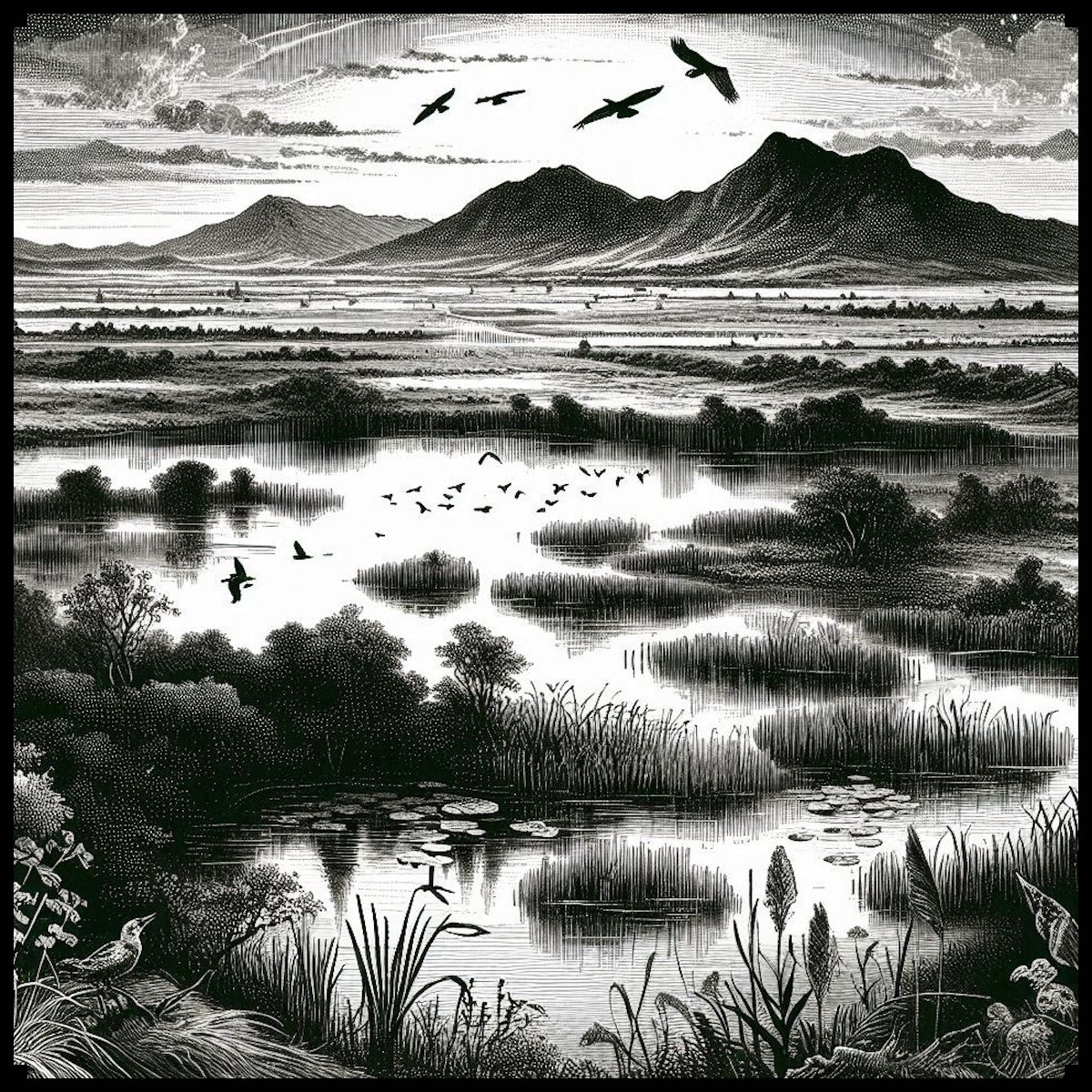
The representation of swamps and marshes on ancient maps served several purposes. Primarily, these depictions were practical. Wetlands were often hazardous areas, difficult to traverse and prone to harboring diseases like malaria. By marking these regions clearly, cartographers provided vital warnings to those planning their journeys. For example, medieval maps of the British Isles often included marshlands such as the Fens, depicted with characteristic symbols to indicate their challenging nature. Such details were indispensable for military planners, traders, and pilgrims.
Beyond their practical applications, the depiction of swamps and marshes also carried cultural significance. In many cultures, wetlands were seen as liminal spaces—regions on the edge of civilization, where the boundaries between land and water, life and death, were blurred. This cultural perception is reflected in the way these areas were depicted on maps. For instance, on some medieval maps, marshes were adorned with mythical creatures or fantastical beasts, reinforcing their status as mysterious and otherworldly places.
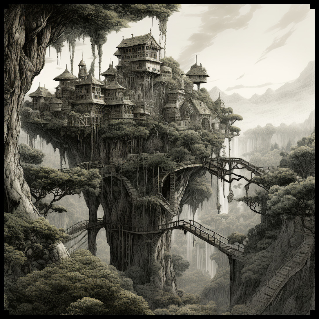
Castles, Towers, and Villages in the Marshes
The inclusion of human-made structures like castles, towers, and villages within marshes on ancient maps adds another layer of complexity to these representations. In reality, such structures were often built in marshes for defensive purposes; the difficult terrain provided a natural barrier against invaders. The Motte-and-Bailey castles, for instance, were sometimes constructed in or near marshy areas, where the waterlogged ground made direct assaults more difficult. These strategic choices are reflected in the cartographic symbols used to denote these structures.
On ancient maps, castles and towers in marshes were often depicted with a combination of symbols: a small tower or castle icon surrounded by hatching or marsh symbols. This visual combination indicated both the presence of a fortified structure and the challenging nature of the surrounding terrain. The Gough Map of Great Britain, dating to the 14th century, provides an example of this, where the wetlands around the River Trent are shown alongside small fortified icons, signaling both the military and geographical challenges of the area.
The Old Cartography Swamps & Marshes – Wetland Assets Megapack
The Old Cartography Swamps & Marshes – Wetland Assets Megapack offers a meticulously crafted set of tools that draw directly from these historical traditions. The pack includes a variety of marsh and swamp elements, such as hatching, tall grasses, ponds, and marsh trees, each designed to replicate the look and feel of ancient maps. The assets also include symbols for castles, towers, and villages within these wetland areas, allowing mapmakers to create complex and historically resonant representations of their fantasy worlds.
These assets are more than just decorative; they are deeply rooted in the cartographic practices of the past. By using these symbols, modern mapmakers can evoke the same sense of mystery, danger, and strategic complexity that ancient cartographers sought to convey. Whether creating a map for a fantasy novel, a role-playing game, or a historical simulation, the inclusion of these wetland elements can add depth and authenticity to the final product.
Decorative and Aesthetic Considerations
While the primary function of swamp and marsh symbols on ancient maps was utilitarian, there is no denying their aesthetic appeal. The careful attention to detail in the hatching, the graceful curves of the reeds, and the stark simplicity of the dotted lines all contribute to the overall beauty of the map. These elements were as much about creating an artwork as they were about conveying information. The same is true for the Old Cartography Swamps & Marshes – Wetland Assets Megapack. The assets in this pack are designed with an eye for detail, ensuring that each symbol not only serves a functional purpose but also enhances the visual appeal of the map.
Conclusion
The depiction of swamps and marshes on ancient maps is a fascinating blend of utility, culture, and art. These representations provided essential information for travelers, while also reflecting deeper cultural attitudes towards these mysterious and often feared landscapes. The Old Cartography Swamps & Marshes – Wetland Assets Megapack captures this rich tradition, offering a suite of tools that can bring the same depth and authenticity to modern fantasy maps. By drawing on the techniques and symbols of the past, mapmakers can create maps that are not only functional but also beautiful, resonating with the same sense of wonder and discovery that has captivated explorers and cartographers for centuries.