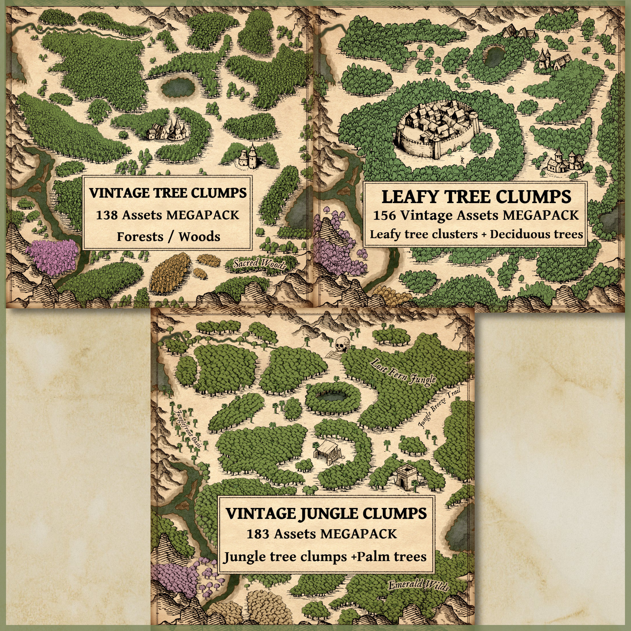
The art of cartography, especially in ancient and fantasy mapmaking, has always been more than a mere representation of geography. Maps tell stories—about the land, its people, its history, and even its culture. The Old Cartography Ground Details & Low Landforms – Assets Megapack masterfully revives the essence of ancient maps, offering 291 high-quality assets that bring fantasy worlds to life with unparalleled authenticity. Through these assets—grass, tall grass, thickets, shrubs, vines, low landforms, old cartography paths, and shading lines—I’ve tried to capture both the functional and artistic aspects of old maps, blending utility with the storytelling of map art. To understand the significance of these elements, let’s take a journey through history and explore the practical and cultural importance of these details in real-world and fictional cartography.
BUY AND DOWNLOAD The Old Cartography Ground Details & Low Landforms – Assets Megapack here :
Historical Role of Ground Details in Ancient Maps
In the ancient world, maps were not just tools of navigation; they were artistic representations of knowledge, power, and perception of the world. The earliest known maps, such as the Babylonian clay tablets (circa 600 BCE), utilized symbolic elements to represent terrain features like mountains, rivers, and fields. Greek and Roman maps, such as the Tabula Peutingeriana (a 4th-century Roman map), used illustrations to show paths, towns, and geographic boundaries, often with artistic flourishes that had cultural or religious significance.
The vegetation, landforms, and ground details on these maps were functional, serving as navigational aids, but they were also deeply intertwined with the mapmaker’s worldview. For example, in medieval European maps like the Hereford Mappa Mundi (circa 1300), vegetation such as forests and fields weren’t just geographical features but were also imbued with symbolic meanings, often representing danger, wilderness, or the untamed frontier.
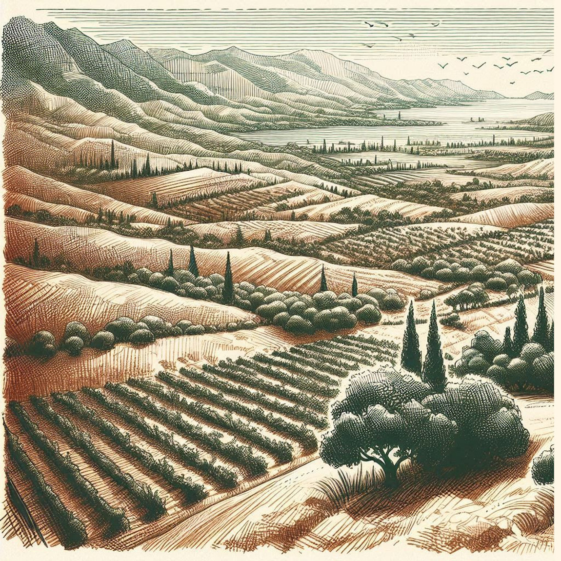
In a similar vein, vineyards represented not just agricultural lands but also the bounty of civilization and the fertility of the land. Vines symbolized order amidst chaos, a cultivated landscape in contrast to the wild thickets and forests. By including these elements in the Old Cartography Ground Details & Low Landforms – Assets Megapack, mapmakers today can evoke these same meanings, giving their fantasy maps depth and narrative.
Utilitarian and Cultural Functions of Ground Details
The ground details featured in this asset pack—thickets, shrubs, grass, tall grass, and vines—are essential for adding realism and functional depth to maps. Here’s how each of these elements historically and culturally enriched maps:
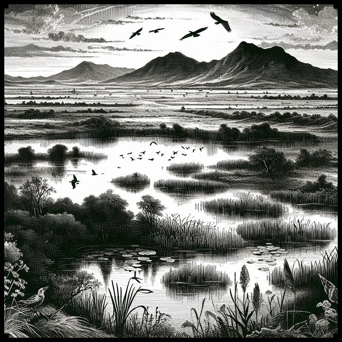
- Grass and Tall Grass: In ancient cartography, grassy areas were often used to demarcate agricultural lands, grazing fields, or open plains. In Roman maps, open grassy areas indicated places suitable for settlement or military encampment. In fantasy mapmaking, these assets help fill empty spaces, providing a realistic representation of nature. Additionally, they guide the eye, offering visual breaks and texture that add to the immersive quality of the map.
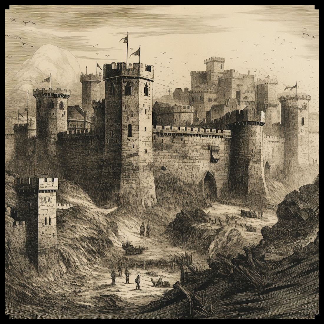
- Thickets and Shrubs: Thickets and shrubs have always served a practical role in representing the wild or unexplored regions of a map. In medieval cartography, forests were depicted as dense, dark regions often filled with dangers, and thickets signaled impassable areas or natural boundaries. In fantasy maps, they similarly serve to delineate areas that may be difficult to navigate, creating natural obstacles or strategic points for adventurers. Culturally, thickets have often represented the boundary between civilization and wilderness—a theme that persists in many fantasy worlds today.
- Vines (Vineyards): Historically, vines have symbolized abundance and cultivation. In maps from the Roman Empire, vineyards were depicted to showcase agricultural wealth, and in medieval maps, they were often a symbol of prosperity. The inclusion of vines in a fantasy map offers not only a visual representation of farmland but also adds a layer of cultural richness, suggesting a region’s agricultural history and its ties to civilization.
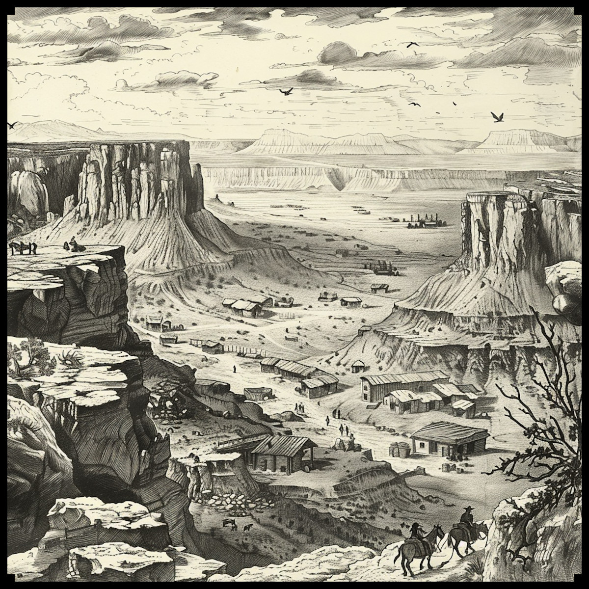
- Low Landforms: Landforms have always been a critical element in cartography. In ancient times, low landforms such as hills, valleys, and plateaus were marked using shading and elevation lines to give the map depth and to inform travelers about the terrain they would encounter. These landforms, while subtle in appearance, were vital in shaping how people navigated the world. In fantasy maps, low landforms serve a similar function, creating natural obstacles or strategic vantage points while adding a dynamic three-dimensional feel to a two-dimensional medium.
- Paths: One of the oldest and most essential elements in maps, paths (or roads) symbolize human movement and interaction with the land. Roman maps like the Tabula Peutingeriana meticulously depicted road networks, crucial for military campaigns and trade. In fantasy cartography, the representation of paths provides a narrative direction for the map, guiding players or readers toward destinations, indicating trade routes, or highlighting the easiest ways through dangerous terrain.
- Shading Lines: The use of shading lines on old maps was not just an artistic choice; it was a practical method for representing elevation and depth. These lines helped travelers understand the topography of the land, particularly in mountainous or hilly regions. In the Old Cartography Ground Details & Low Landforms – Assets Megapack, shading lines play a crucial role in grounding the various elements within the map, ensuring they feel cohesive and integrated. Shading lines prevent assets from appearing to “float” and give a better sense of depth and solidity. They allow assets to be anchored naturally into the terrain, enhancing the overall flow and realism of the map.
Decorative and Symbolic Aspects in Fantasy Mapmaking
While ancient maps were utilitarian, they were also highly decorative. Maps like the Carta Marina (1539), created by Swedish cartographer Olaus Magnus, didn’t just depict the geography of Scandinavia—they also featured sea monsters, ships, and mythological creatures, blending fact with fiction. This decorative aspect has carried over into modern fantasy cartography. The elements in the Old Cartography Ground Details & Low Landforms – Assets Megapack serve both functions: they add real-world detail to the map while also creating a sense of mystery and adventure.
For instance, a thicket in the middle of a map could signal a dangerous zone filled with monsters, while vines may indicate an ancient, abandoned vineyard. Each element tells a story and invites players to explore further.
Bringing Your Fantasy Maps to Life
The Old Cartography Ground Details & Low Landforms – Assets Megapack is not merely a set of decorative assets; it is a storytelling tool. By using these assets, mapmakers can evoke the same sense of adventure, danger, and discovery that ancient cartographers did in their work. Whether you’re filling in empty spaces with tall grass or breaking up the landscape with thickets and shrubs, these elements provide both visual interest and narrative depth.
For creators inspired by the likes of Tolkien’s maps in The Lord of the Rings or George R. R. Martin’s maps in A Song of Ice and Fire, the pack offers a treasure trove of possibilities. These assets allow for the creation of detailed fantasy worlds that feel as alive and intricate as the real world, with a timeless vintage aesthetic that grounds the fantastical in the familiar.
In conclusion, the Old Cartography Ground Details & Low Landforms – Assets Megapack offers a rich set of tools for fantasy mapmakers who seek to blend historical cartographic techniques with creative storytelling. Through the use of grass, thickets, vines, and shading lines, this pack not only enhances the visual quality of maps but also imbues them with the depth and meaning seen in the greatest maps of the ancient and medieval worlds. Whether you’re creating maps for a tabletop RPG, a novel, or a video game, these assets will help you craft a world that feels authentic, immersive, and steeped in history.