Posted on

Crystal Biomes : Fantasy Map Icons & Crystals

Crystals, crystal biome, fantasy map landmarks, fantasy map symbols, Wonderdraft assets, vintage cartography resources, crystal mines

Few landscape features capture the imagination as powerfully as crystal formations. Towering crystal mountains, glittering cities, hidden mines and colossal crystal pillars have become iconic elements of fantasy worldbuilding, instantly suggesting ancient civilizations, magical energy and forgotten kingdoms. Although these spectacular landscapes belong to fantasy, the way they are represented on maps has deep roots in the artistic traditions of historical cartography.

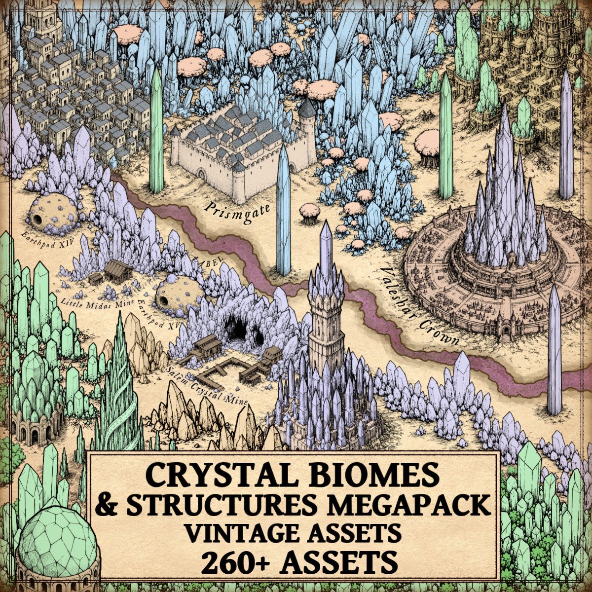
The Crystal Biomes Megapack (Crystals, Settlements, Mines, Cities, Mountains, Trees) – Vintage Assets draws inspiration from these traditions with a complete collection of cartography assets designed in the style of antique engraved maps. Featuring crystal cities, fortified cities, crystal towns, settlements, temples, castles and towers, crystal mines, crystal mountains, crystal woods, trees, giant crystal pillars, crystal deposits, various crystal formations and natural crystal troglodyte structures, the collection allows mapmakers to build complete crystal civilizations with a consistent vintage aesthetic.

Discover the Crystal Biomes Megapack (Crystals, Settlements, Mines, Cities, Mountains, Trees) – Vintage Assets here:

Far more than simple decoration, these Wonderdraft assets continue a cartographic tradition that dates back centuries, where illustrated landscapes identified important locations, valuable resources, cultural landmarks and legendary places. Whether creating a forgotten empire, an enchanted kingdom or an unexplored magical frontier, crystal formations immediately tell the reader that these lands possess a unique history, wealth and significance.

The Historical Origins of Crystal Cartography Assets and Fantasy Map Symbols

Modern fantasy maps inherited much of their visual language from medieval and Renaissance cartography. Long before modern topographic maps existed, cartographers illustrated mountains, forests, cities, castles and monuments using carefully engraved symbols that made every region immediately recognizable. These illustrations were both practical and decorative, helping readers identify important landmarks while transforming maps into genuine works of art.

Crystal landscapes naturally fit within this artistic tradition. Although historical cartographers obviously never illustrated magical crystal kingdoms, they frequently emphasized extraordinary mountain ranges, famous mining districts, prosperous cities and sacred monuments using highly distinctive illustrations. Fantasy cartography simply extends these centuries-old conventions into imaginary worlds.

Wonderdraft Assets and the Evolution of Crystal Mountains

Among every landscape feature ever represented on maps, mountains have always occupied a special place. They define borders, shape climates, separate kingdoms and create some of the strongest visual landmarks across an entire continent.

Fantasy cartography inherited this importance but transformed ordinary geology into something far more spectacular.

Crystal mountains immediately communicate that a region belongs to another world. Their sharp mineral silhouettes suggest ancient magical catastrophes, enormous concentrations of arcane energy or forgotten civilizations hidden beneath glittering peaks. Unlike ordinary mountains, they become narrative landmarks before the reader has even looked at the accompanying text.

The Crystal Biomes Megapack offers an impressive variety of crystal mountain formations. Some resemble traditional rocky ranges pierced by enormous crystal veins, creating believable transitions between natural geology and magical landscapes. Others appear almost entirely crystalline, with towering mineral peaks dominating the horizon. Smaller crystal outcrops complement larger mountain systems, allowing cartographers to create gradual geological transitions instead of abrupt changes.

This diversity closely reflects historical cartography itself. Antique mapmakers rarely copied the exact same mountain dozens of times. Instead, they constantly varied the shape, orientation and density of mountain symbols to prevent landscapes from becoming repetitive. The result was a far more organic and believable representation of terrain, and the same principle greatly benefits fantasy cartography today.

Fantasy Map Icons and the Rise of Crystal Cities

Cities have always been among the most important symbols on historical maps. Medieval cartographers often exaggerated their size because their symbolic importance mattered far more than geographical accuracy. Jerusalem, Rome, Constantinople and Alexandria frequently appeared much larger than neighboring settlements simply because they represented centers of religion, commerce or political power.

Fantasy maps continue this tradition.

Crystal cities immediately distinguish themselves from ordinary settlements. Their soaring crystalline architecture evokes prosperity, magical mastery and cultural refinement before the reader even begins imagining the civilization that inhabits them.

Rather than focusing solely on monumental capitals, the Crystal Biomes Megapack provides an entire hierarchy of settlements. Great crystal cities represent thriving capitals, while crystal fortified cities suggest military strongholds capable of defending priceless mineral wealth. Crystal towns and smaller settlements create believable regional networks, making crystal civilizations feel complete rather than isolated.

This hierarchy reflects the organization found throughout real historical maps. Medieval atlases rarely represented kingdoms through a single city alone. Villages, monasteries, trading towns and regional capitals all appeared together to communicate political organization and territorial influence. Fantasy worlds become considerably more immersive when crystal civilizations are built with the same philosophy.

Crystal temples further enrich this cultural landscape. Throughout history, temples, monasteries and sacred sanctuaries occupied prominent places on maps because they represented pilgrimage destinations and centers of religious authority. Crystal temples naturally inherit this role, suggesting places of worship, ancient magical knowledge or forgotten spiritual traditions.

Crystal castles and towering crystal fortresses reinforce the military dimension of these civilizations. Rising above surrounding landscapes, they immediately establish strategic importance while providing memorable visual landmarks for the reader.

Fantasy Map Resources and the Importance of Crystal Mines

Throughout human history, natural resources have shaped civilizations.

Gold financed kingdoms.

Silver transformed economies.

Salt controlled trade.

Iron built empires.

Although magical crystals belong primarily to fantasy, they fulfill exactly the same narrative purpose.

Crystal mines therefore represent far more than decorative scenery. Their presence immediately suggests commerce, industry, specialized craftsmanship, political rivalry and extensive transportation networks linking remote mountains to prosperous cities.

The Crystal Biomes Megapack illustrates crystal mines as ancient excavations integrated directly into extraordinary geological formations. Instead of resembling modern industrial complexes, these mines evoke centuries of patient excavation beneath enchanted mountains, blending naturally with the surrounding landscape.

Historically, famous mining regions such as the silver mines of Laurion in Ancient Greece, the Roman gold mines of Las Médulas in Spain or the gemstone trade routes crossing Central Asia profoundly influenced the development of civilizations. Fantasy worlds simply replace precious metals with magical crystal formations while preserving exactly the same geographical logic.

A single crystal mine on a map immediately encourages readers to imagine merchants, caravans, guilds, territorial conflicts and kingdoms whose prosperity depends upon these extraordinary mineral resources.

Crystal Woods, Giant Crystal Pillars and Natural Wonders

Historical maps have always balanced geographical information with artistic beauty.

Forests filled otherwise empty regions while simultaneously indicating woodland terrain. Mountains framed continents. Rivers guided the eye across the page.

Crystal woods extend this artistic tradition beautifully. Rather than replacing ordinary forests, they introduce magical ecosystems where vegetation and mineral formations coexist. Scattered crystal trees gradually evolve into entire enchanted forests, creating believable transitions between natural and supernatural landscapes.

The inclusion of ordinary trees alongside crystal woods allows cartographers to construct these transitions naturally, making magical regions feel like genuine parts of the world rather than isolated decorations.

Among the most spectacular elements of the collection are the giant crystal pillars.

Unlike mountain ranges, these monumental formations function almost as natural monuments. They resemble colossal obelisks rising directly from the earth, inviting countless questions. Are they remnants of an ancient civilization? Did unimaginable magical forces create them? Are they sacred landmarks, forgotten fortresses or immense natural formations untouched for thousands of years?

The finest fantasy maps often leave such mysteries unanswered, allowing the illustrations themselves to inspire imagination.

Crystal Deposits, Various Crystals and Geological Storytelling

One of the greatest strengths of the Crystal Biomes Megapack lies in its geological diversity.

Rather than relying exclusively on enormous crystal mountains, the collection includes scattered crystal deposits, isolated formations and numerous crystal clusters that enrich every landscape. Some appear as modest mineral outcrops emerging from rocky terrain. Others spread across entire valleys, while larger formations become dominant geographical landmarks.

This variety closely resembles real geological processes. Valuable minerals rarely appear in uniform distributions. Instead, landscapes are shaped by countless different formations created through volcanic activity, tectonic pressure, erosion and mineral deposition.

Fantasy geology becomes significantly more believable when crystal formations display similar diversity. A continent filled exclusively with gigantic crystal mountains quickly becomes repetitive. One that combines deposits, towering ranges, crystal woods, monumental pillars, mining complexes and flourishing settlements feels like a living world.

Natural crystal troglodyte structures complete this geological storytelling. Rather than depicting buildings constructed from crystal, these formations suggest civilizations that adapted directly to extraordinary mineral environments by carving homes, sanctuaries and refuges into immense crystalline caverns. They strengthen the connection between culture and landscape, making crystal civilizations feel deeply rooted in their environment.

From Antique Maps to Modern Wonderdraft Assets

Perhaps the greatest achievement of vintage fantasy cartography is its ability to preserve the elegance of historical engraved maps while illustrating entirely fictional worlds.

The Crystal Biomes Megapack never aims for photorealism. Instead, every illustration embraces the engraved aesthetic of antique cartography through clean linework, balanced shading and carefully designed silhouettes. Whether depicting monumental crystal cities, fortified settlements, crystal mines, towering mountain ranges, enchanted woods or spectacular geological formations, every asset belongs to the same coherent artistic language.

This consistency is precisely what transforms a simple asset collection into a complete library of cartography assets. Every symbol naturally complements the others, allowing mapmakers to build continents that feel as though they were lifted directly from a forgotten Renaissance atlas describing mythical kingdoms.

For creators using Wonderdraft assets, this artistic coherence is invaluable. Mountains, forests, cities, mines, temples and natural formations all share the same vintage engraving style, ensuring that every map maintains a unified visual identity from the smallest settlement to the largest mountain range.

Why Crystal Landscapes Continue to Fascinate Fantasy Cartography

Crystal landscapes remain enduring symbols of fantasy because they combine humanity’s fascination with extraordinary minerals and the timeless artistic traditions of historical mapmaking.

Across ancient Greece, Rome, Persia, India and medieval Europe, crystals and gemstones were associated with wealth, purity, wisdom, healing and divine power. Medieval lapidaries attributed supernatural properties to precious stones, while alchemists viewed crystals as manifestations of hidden natural forces. Fantasy literature simply expanded these beliefs into entire civilizations built around magical minerals.

At the same time, antique cartography taught generations of artists that maps could tell stories through illustration alone. Mountains, forests, cities and monuments became visual language long before modern symbols were standardized.

The Crystal Biomes Megapack (Crystals, Settlements, Mines, Cities, Mountains, Trees) – Vintage Assets celebrates both traditions by offering an extensive library of cartography assets, elegant Wonderdraft assets, richly detailed fantasy map icons, expressive fantasy map symbols and immersive fantasy map resources. Rather than merely decorating a fantasy map, these illustrations help shape believable civilizations, memorable landscapes, ancient cultures and compelling stories that appear as though they belong within the pages of a centuries-old atlas.

Like the masterpieces of medieval and Renaissance cartography that inspired them, the finest fantasy maps are far more than geographical diagrams. They are invitations to explore unknown lands, discover forgotten histories and imagine worlds where every crystal mountain, every hidden mine and every shimmering city promises another story waiting to be told.
Posted on

Cartography Assets & Map Resources: Slums, filth, and towns in Fantasy Mapping

Wonderdraft assets, fantasy medieval castles, cartography assets, medieval cartography symbols, medieval towns, villages, hamlets, slums

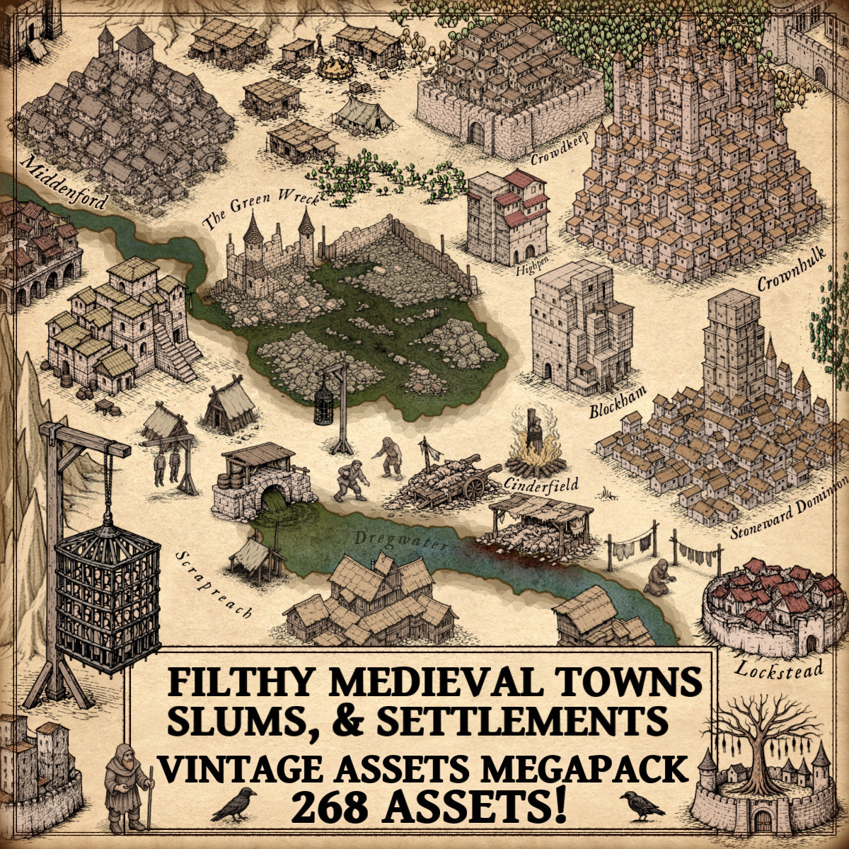
In contemporary fantasy cartography, creators increasingly seek tools capable of expressing not only grandeur but hardship, inequality, and decay. Among the most evocative collections designed for this purpose is the Filthy Medieval Towns, Slums, Villages, & Settlements – Vintage Assets Megapack, a richly detailed set of vintage-style cartography assets dedicated to the overlooked realities of medieval-inspired worlds. Rather than presenting idealized settlements, it provides a visual vocabulary of slums, filthy towns, ruined settlements, decaying castles, waste systems, prisons, execution structures, and marginal figures, elements that resonate deeply with the historical logic of mapmaking itself.

Maps have never been neutral objects. From the earliest medieval world diagrams to Renaissance city views, cartography has always been an art of selection, exaggeration, omission, and symbolism. What a map chooses to show, and what it chooses to hide, tells us as much about culture as it does about geography.

Modern fantasy cartography, particularly through detailed cartography assets and expressive map resources, inherits this long visual tradition. While towers, walls, and grand halls dominate many fictional landscapes, another vocabulary exists beneath the surface: slums pressed against city walls, sewer outfalls draining unseen refuse, gallows looming over roads, ruined settlements fading into memory. These are not simply darker embellishments. Historically speaking, they are profoundly authentic.

To understand why such imagery feels so convincing in fantasy worlds, one must look back at the cultural logic of ancient and medieval mapping.

Discover the Filthy Medieval Towns, Slums, Villages, & Settlements – Vintage Assets Megapack here :

Cartography Assets & Fantasy Map Symbols: Cities Beyond Idealization

When modern audiences imagine historical maps, they often picture elegant parchment sheets adorned with symmetrical cities and noble fortifications. Yet historical cartography rarely functioned as pure beautification. Medieval and early modern maps encoded ideology, morality, authority, and fear.

Take the Hereford Mappa Mundi. Though cosmological rather than urban in its primary structure, it demonstrates a crucial principle: maps were narratives. They contained monsters, dangers, moral allegories, and symbolic hierarchies. Geography and meaning were inseparable.

Later, Renaissance works such as Braun & Hogenberg’s Civitates Orbis Terrarum offered elaborate bird’s-eye city portraits. At first glance, these appear celebratory, emphasizing walls, churches, plazas, and civic pride. But closer inspection reveals subtle indicators of inequality. Density shifts. Peripheral clutter. Areas where order dissolves into compression. Even when filth was not drawn explicitly, urban realities emerged through structure.

Fantasy mapping draws from this same logic. A settlement composed entirely of orderly buildings lacks historical credibility. Real cities were layered organisms, shaped by trade, migration, poverty, waste, punishment, and collapse. In visual terms, this complexity is conveyed through carefully designed fantasy map symbols.

Wonderdraft Assets & Fantasy Map Icons: The Geography of Slums

Slums are among the most historically grounded features one can introduce into a fictional city.

In medieval Europe, urban poverty was not an incidental phenomenon. It was spatially organized. Economic exclusion, guild restrictions, population influx, and defensive architecture combined to produce districts defined by density and fragility. Poor quarters gathered near walls, rivers, workshops, or marginal land unsuitable for elite construction.

London, Paris, and countless smaller towns displayed this pattern. Constrained by fortifications, cities grew inward, generating overcrowded zones where sanitation deteriorated and buildings leaned precariously into one another. These were not aberrations. They were systemic outcomes.

When translated into fantasy cartography, slums perform an extraordinary narrative function. A sprawling slum belt hugging the outer defenses instantly suggests demographic pressure. Ramshackle slum buildings imply improvisation, survival, instability. Slum tents evoke transience, migration, or disaster.

Such imagery does not merely decorate a map. It transforms urban space into social space.

This is where thoughtfully crafted Wonderdraft assets become particularly powerful. The ability to integrate entire slum districts, irregular buildings, and improvised structures allows mapmakers to depict settlements that feel inhabited rather than staged.

Fantasy Map Resources & Wonderdraft Resources: Poverty as Landscape

Beyond urban slums lies the quieter, equally significant reality of poor medieval villages.

Historical villages varied enormously. Soil fertility, taxation burdens, warfare, and climate shaped settlement morphology. Some villages appeared as dense clusters bound by necessity; others scattered loosely across marginal terrain. Roof quality, building size, and spatial cohesion conveyed economic status as clearly as written records.

In fantasy mapping, poor villages perform a subtle yet essential role. They articulate regional disparity. They suggest neglected frontiers, exhausted lands, or oppressive governance. A map populated exclusively by prosperous towns and imposing castles lacks the unevenness that defines believable worlds.

Through expressive fantasy map icons, poverty becomes legible geography.

Cartography Assets & Fantasy Map Symbols: Waste, Water, and Urban Reality

Sanitation, though rarely romanticized, fundamentally structured historical settlements.

Medieval waste management depended heavily on proximity to water. Rivers functioned simultaneously as lifelines and disposal systems. Sewer outfalls, open drains, refuse heaps, and human waste accumulation defined the ecological metabolism of cities. Trades associated with unpleasant byproducts, tanning, dyeing, butchery, clustered accordingly.

Ancient precedents reinforce this logic. Roman engineering achievements such as the Cloaca Maxima illustrate how waste infrastructure was inseparable from urban identity. Even in highly advanced societies, the management of filth shaped spatial organization.

In fantasy cartography, sewer outfalls and refuse heaps communicate technological level, population scale, and civic order. They anchor cities in material processes. The presence of waste piles, rotting remains, or rubble piles suggests not only daily life but also neglect, catastrophe, or decay.

These details elevate cartography assets from architectural markers to environmental storytelling tools.

Wonderdraft Assets & Fantasy Map Icons: The Spectacle of Punishment

Public punishment occupied visible, deliberate space in medieval society.

Execution sites such as gallows were frequently positioned along roads or near city approaches, functioning as territorial statements. Structures like pillories and cages transformed justice into spectacle. Authority manifested through visibility.

The Tyburn Tree in London and the Montfaucon Gibbet in Paris stand as historical reminders that punishment landscapes were deeply embedded in civic geography. These were not hidden institutions. They were performative architecture.

When gallows, hanging prison cages, wooden cages, or pillories appear on fantasy maps, they carry centuries of symbolic weight. They evoke governance style, legal severity, and cultural atmosphere. A fortified city accompanied by prominent execution imagery communicates something profoundly different from one defined solely by towers and banners.

Fantasy Map Symbols & Cartography Assets: Ruins and the Memory of Collapse

Ruins may be the most enduring symbols in mapping history.

Ancient, medieval, and Renaissance cartography alike recognized the power of depicting decay. Ruined settlements, abandoned towns, and crumbling fortifications represent temporal depth made visible. They transform space into history.

A decaying castle on a map is not merely an architectural variation. It is a statement about succession, war, economic decline, or forgotten catastrophe. Rubble piles and corpse mounds intensify this narrative, implying recent violence or plague.

In fantasy worlds, ruins function as visual historiography.

Cartography Assets & Fantasy Map Resources: Filth as Narrative Infrastructure

What emerges from this historical perspective is a crucial insight. Filth, poverty, punishment, and decay are not peripheral themes. They are structural components of settlement realism.

Maps that incorporate slums, waste systems, prisons, ruins, and marginal populations resonate because they mirror historical urban dynamics. They depict worlds governed by forces rather than aesthetic symmetry.

This is precisely why dark, vintage-style fantasy map resources have gained such prominence among worldbuilders.

Within this artistic and historical lineage, the Filthy Medieval Towns, Slums, Villages, & Settlements – Vintage Assets Megapack occupies a distinctive position. Rather than offering generic settlement markers, it embraces the neglected vocabulary of medieval reality. Filthy medieval towns, sprawling slums, ruined settlements, decaying castles, sewer outfalls, human waste, dungeons, gallows, hanging cages, pillories, wooden sheds, rubble piles, ravens, brigands, beggars — each element contributes to a cartographic language of lived experience.

The vintage hand-drawn style reinforces this effect. It does not simply mimic old maps aesthetically; it participates in their symbolic tradition. The assets feel as though they belong to the same visual universe as engraved city plans and manuscript marginalia.

What makes such a collection compelling is not its darkness alone, but its narrative density. A city assembled from these Wonderdraft assets does not merely exist; it breathes with tension, inequality, history, and atmosphere.

Wonderdraft Resources & Cartography Assets: Building Worlds That Feel True

Fantasy cartography thrives on suggestion. Every icon implies systems, every symbol hints at stories. Slums imply migration and poverty. Waste heaps imply population scale and sanitation limits. Gallows imply law and fear. Ruins imply memory and loss.

By integrating richly detailed wonderdraft resources, mapmakers gain the ability to encode social, political, and environmental realities directly into geography. The result is not simply a darker map, but a more convincing one.

Historical cartography teaches us that beauty and discomfort have always coexisted on maps. Grandeur derives meaning from contrast. Order becomes legible through the presence of disorder.

In this sense, filth is not an intrusion into fantasy mapping. It is a return to cartographic authenticity.

And for creators seeking worlds marked by decay, oppression, survival, and history, the visual vocabulary provided by carefully designed cartography assets becomes not just useful, but indispensable.

Posted on

Fantasy Map Icons and Wonderdraft Assets: Trees and Nature

Wonderdraft assets, vintage cartography assets, trees, nature, flora, tree assets, forests, fantasy map icons

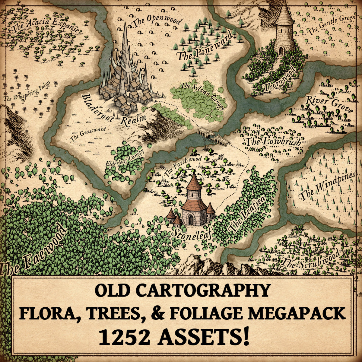
Trees, Flora, & Foliage – Old Cartography Assets Megapack

The Trees, Flora, & Foliage – Old Cartography Assets Megapack draws its strength from a long and venerable tradition. It does not merely offer visual elements for mapmaking; it echoes centuries of cartographic practice in which trees, vegetation, and textured ground were essential tools for understanding the world. Rooted in antique aesthetics and symbolic clarity, this collection belongs to the lineage of maps where nature was not background decoration, but meaning itself.

Discover the Trees, Flora, & Foliage – Old Cartography Assets Megapack here :

From the earliest hand-drawn maps scratched onto parchment to the richly illustrated fantasy maps of today, vegetation has always played a central role in cartography. Trees, oaks, fir trees, palms, acacias, bushes, soil textures, meadow grass, brushland, and top-down forests are not mere ornaments. They are symbols of climate, culture, economy, and myth, carefully placed to speak a visual language older than modern geography itself.

In the tradition of antique mapmaking, land was never empty. Every forest breathed meaning, every grove hinted at resources or danger, and every textured soil told a silent story of fertility or desolation. Modern Wonderdraft assets and cartography assets rooted in old cartographic styles naturally inherit this deep visual heritage, especially when used to build convincing and immersive fantasy worlds.

The Origins of Vegetation Symbols in Antique Cartography Assets

Ancient and medieval cartographers did not aim for scientific realism. Instead, they sought legibility, symbolism, and narrative clarity. Trees were drawn not as individuals, but as types: oak forests for temperate lands, fir trees for cold or mountainous regions, palms and acacias for distant, sun-burned realms.

A clear example can be found in Ptolemaic maps (2nd century AD), where wooded regions were marked with repeated tree symbols to distinguish fertile lands from deserts. Later, medieval mappaemundi, such as the Hereford Mappa Mundi (c. 1300), used stylized vegetation to frame the inhabited world and emphasize divine order in nature.

These early cartography assets established a visual grammar that still defines how fantasy map icons communicate terrain today.

Oaks, Fir Trees, Pines, and the Cultural Meaning of Forest Types

Oaks: Power, Ancestry, and Civilization

In European tradition, oak forests symbolized permanence, lineage, and authority. Roman maps and later Renaissance atlases often placed oak-heavy woodlands near settlements, roads, and political centers. In fantasy maps, oak tree clumps and woods continue this role, signaling stable kingdoms, ancient druidic sites, or regions settled for generations.

Fir and Pine Trees: Wilderness and the Unknown

Fir trees and pine forests, common in Alpine and Northern European maps such as Sebastian Münster’s Cosmographia (1544), represented harsher climates and untamed lands. Their sharp, vertical silhouettes became visual shorthand for cold winds, high altitudes, and perilous journeys, an essential cue still widely used in modern fantasy map icons.

Palm Trees, Acacias, and the Exoticism of Distant Lands

Palm trees and acacias entered Western cartography through trade routes, conquest, and imagination. Portolan charts and early maps of Africa and the Near East, such as those by Abraham Cresques in the 14th century, used palms to indicate unfamiliar climates and economically valuable regions.

In fantasy maps, palms and savanna trees instantly convey heat, distance, and otherness. Landscapes dotted with acacias suggest open horizons, nomadic cultures, and fragile ecosystems. These elements remain vital Wonderdraft assets for worldbuilders seeking clarity and atmosphere without relying on written explanations.

Bushes, Brushland, and Low Vegetation as Functional Cartography Assets

Not all landscapes are forests, and antique mapmakers understood this well. Bushes, brushland, and low vegetation were used to indicate transitional terrain, lands neither fully wild nor fully cultivated.

On Renaissance military maps, brushland often marked areas suitable for ambush or difficult movement. In fantasy cartography, bushland flora and trees help define biome boundaries, soften harsh transitions, and add realism without overwhelming the composition.

These subtle cartography assets are essential for visual rhythm and believable geography.

Soil Texture, Dots, and the Language of the Ground

One of the most understated yet powerful tools in antique cartography is soil texture, often represented by small dots, stippling, or scattered marks. These textures appear in early cadastral maps, medieval travel charts, and even ancient Roman land surveys.

Soil texture serves several purposes:

  • It fills empty space without overpowering the map
  • It indicates aridity, fertility, or wasteland
  • It creates depth and visual hierarchy beneath trees and vegetation

In fantasy maps, dotted soil textures beneath forests or meadows reinforce the continuity of the terrain. They are silent yet essential fantasy map icons, grounding imaginary worlds in historical visual logic.

Meadow Grass and the Idealized Landscape

Meadow grass appears frequently in early modern maps depicting “civilized” lands. These open, lightly textured areas suggested agriculture, safety, and prosperity. Dutch Golden Age cartographers such as Joan Blaeu used grassy plains to contrast dense forests and mountainous regions.

In fantasy cartography, meadow grass provides breathing space. It frames forests, supports settlements, and creates visual balance, an artistic necessity inherited directly from antique traditions.

Top-Down Trees and the Evolution of Perspective

While most antique maps relied on oblique or symbolic views, some late medieval and Renaissance works experimented with top-down representations for clarity, especially in city plans and regional surveys.

Modern fantasy maps adopt top-down trees and foliage to improve readability at smaller scales. This evolution does not break tradition, it refines it. These elements preserve the antique aesthetic while embracing functional clarity, making them indispensable Wonderdraft assets for contemporary mapmakers.

Vegetation Clumps, Forest Masses, and Visual Storytelling

Antique cartographers rarely scattered trees at random. Forests appeared as intentional masses, guiding the eye along roads, rivers, and borders. Vegetation clumps were compositional tools as much as geographic indicators.

In fantasy maps, oak forests, pine woods, Mediterranean woodland vegetation, rounded shrubs, and low vegetation serve the same narrative function. They guide the viewer, suggest deep history, and imply unseen stories: lost roads, ancient battles, forgotten sanctuaries.

This is where cartography assets become art.

Why These Elements Are Both Useful and Decorative

Vegetation symbols endure because they fulfill three functions at once:

  • Utility – conveying terrain, climate, and movement
  • Culture – reflecting myths, economies, and worldviews
  • Decoration – enriching the map as an illustrated object

Antique maps were not merely tools; they were precious objects. Fantasy maps follow the same philosophy. Carefully designed fantasy map icons for trees, flora, and foliage honor this legacy while empowering modern creators.

A Living Tradition in Modern Wonderdraft Assets

The visual language of trees, bushes, soil textures, meadow grass, brushland, and forests has survived centuries because it works. It is intuitive, symbolic, and endlessly adaptable.

The Trees, Flora, & Foliage – Old Cartography Assets Megapack firmly belongs to this tradition, offering a coherent collection of vegetation forms rooted in historical cartography. It does not invent a new language, it refines an ancient one.

For fantasy cartographers, worldbuilders, and storytellers, these Wonderdraft assets and .png cartography assets are not just tools. They are the continuation of a craft that once mapped the known world, and now maps imagined ones.

Posted on

Fantasy Map Icons & Wonderdraft Assets – Slavic Settlements in Vintage Cartography

slavic castles, slavic settlements, fantasy map symbols, vintage cartography assets, gimp, Wonderdraft assets, Photoshop

Introduction: Why Slavic Aesthetics Matter in Fantasy Map Making

In the world of fantasy map making, visual language is everything. Long before modern cartography prioritized scale and accuracy, antique maps relied on fantasy map icons and symbolic representations to communicate culture, power, danger, and belief. Among these traditions, Slavic-inspired settlements and landscapes occupy a unique place—both historically grounded and visually evocative.

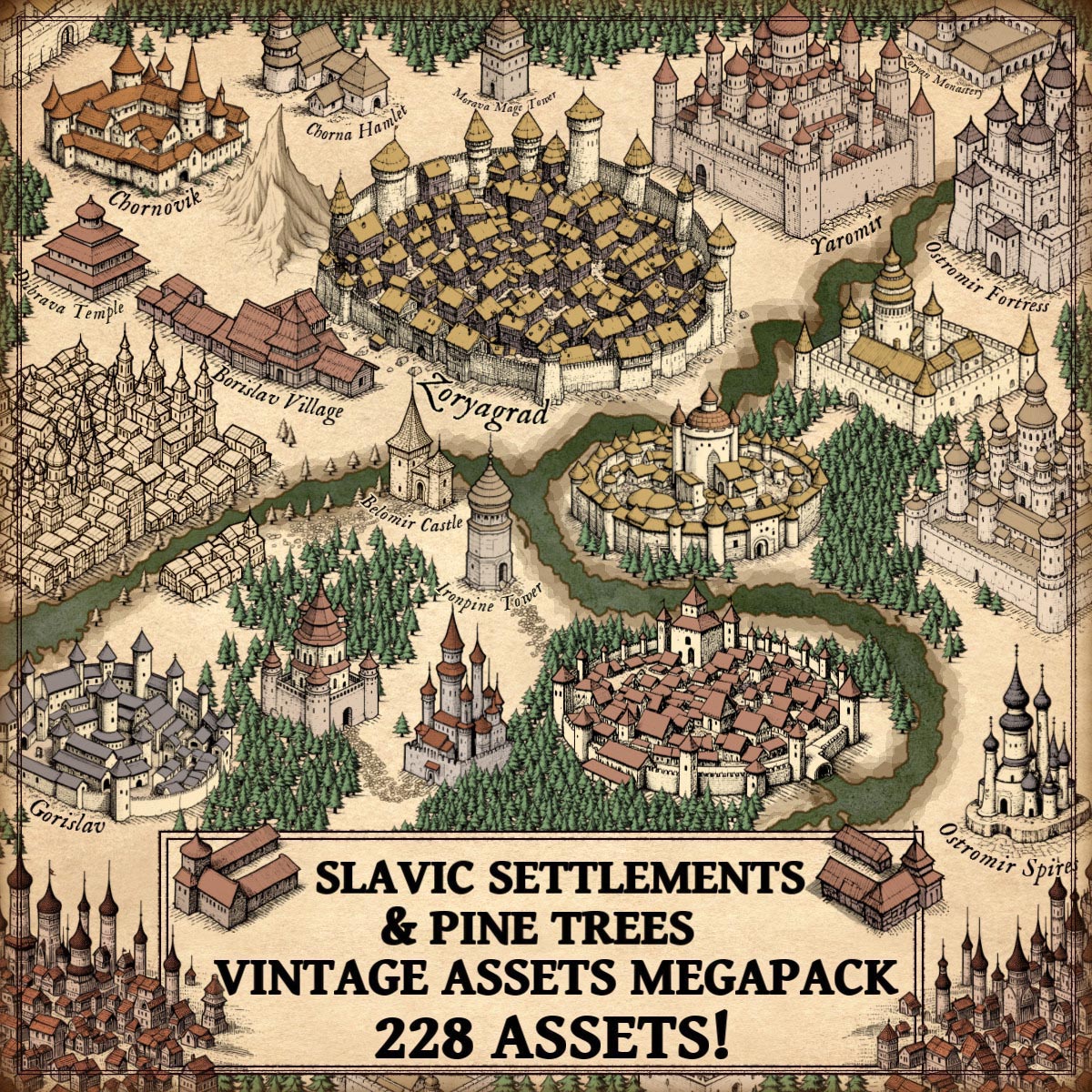
The Fortified Slavic Settlements, Towns, Castles, & Pine Trees – Vintage Assets Megapack draws directly from this legacy. Inspired by medieval and early modern cartography, the assets in the pack echo the same principles found in real antique maps: clarity, symbolism, hierarchy, and artistic storytelling. These wonderdraft assets are not merely decorative; they are functional heirs to centuries of cartographic practice.

Discover the Fortified Slavic Settlements, Towns, Castles, & Pine Trees – Vintage Assets Megapack here :

Slavic Settlements as Core Fantasy Map Icons in Fantasy Map Making

Slavic settlements form the structural backbone of many historical and fictional maps. From early medieval villages to organized towns, Slavic societies developed settlement patterns shaped by forests, rivers, and communal defense.

On antique maps, settlements were rarely drawn to scale. Instead, they were represented through:

  • Compact clusters of houses
  • Repeated architectural motifs
  • Simplified silhouettes readable at a distance

This megapack follow the same logic. Each Slavic settlement icon conveys population level, permanence, and importance at a glance. In fantasy map icons, these symbols allow mapmakers to build believable regions without overwhelming the composition.

Historically comparable examples include:

  • The city vignettes in the Nuremberg Chronicle (1493)
  • Early Eastern European regional maps where towns appear as emblematic miniatures

These assets translate that tradition directly into modern vintage cartography assets for fantasy worlds.

Fortified Slavic Towns in Vintage Cartography Assets and Medieval Fantasy Maps

Fortified Slavic towns—often known historically as gords or grads—were central to political and military life. Built with timber walls, earthworks, and later stone fortifications, they guarded trade routes and borders.

In antique cartography, fortified towns were emphasized visually:

  • Thick walls
  • Towers multiplied beyond reality
  • Circular or geometric layouts

Maps such as Olaus Magnus’ Carta Marina (1539) demonstrate this exaggeration clearly. Fortifications were symbolic first, accurate second.

The fortified towns in this pack embrace this same visual philosophy. As fantasy map symbols, they instantly communicate:

  • Strategic importance
  • Military control
  • Regional authority

For fantasy map making, these wonderdraft assets provide visual hierarchy—guiding the viewer’s eye across the map.

Slavic Towns, Hamlets, and Villages as Everyday Fantasy Map Icons

Not all power lies behind walls. Slavic hamlets and villages represent the daily life of the land: farmers, woodcutters, traders, and craftsmen.

Historically:

  • Villages were loosely organized
  • Houses were primarily wooden
  • Roofs and layouts reflected climate and local resources

Antique maps often depicted such settlements as small clusters of buildings, sometimes no more than a symbol. This abstraction is faithfully preserved in the megapack, making these assets ideal fantasy map icons for:

  • Filling rural spaces
  • Indicating population spread
  • Supporting narrative realism

In vintage cartography assets, these elements serve as connective tissue between cities and wilderness.

Slavic Castles, Fortresses, and Citadels as Fantasy Map Symbols of Power

Slavic castles and fortresses mark the transition from tribal organization to feudal authority. From early hillforts to later stone complexes, they symbolized rulership, defense, and permanence.

Historical counterparts include:

  • Wawel Castle in Kraków
  • Early fortified centers of Kievan Rus

In antique maps, castles were often oversized and idealized. Their purpose was symbolic dominance rather than architectural precision.

The castles, fortresses, and citadels in this megapack continue this tradition. As fantasy map icons, they:

  • Anchor political regions
  • Serve as narrative focal points
  • Reinforce medieval atmosphere

These wonderdraft assets excel at translating authority into visual form.

Slavic Cities and Dense Urban Medieval Blocks in Fantasy Map Making

Large Slavic cities developed around trade, religion, and defense. Dense housing, narrow streets, and layered fortifications defined their character.

Antique maps frequently represented cities as:

  • Dense masses of rooftops
  • Repeated towers and domes
  • Highly stylized urban blocks

This megapack’s dense urban medieval city blocks reflect those conventions precisely. In fantasy map making, they allow cartographers to suggest urban complexity without sacrificing clarity—an essential trait of effective vintage cartography assets.

Slavic Temples, Monasteries, and Sacred Architecture in Fantasy Map Icons

Spiritual geography was as important as political geography. Before Christianization, Slavic cultures maintained sacred temples and ritual spaces; later, monasteries became centers of learning and influence.

Antique maps routinely emphasized religious structures, often regardless of their actual size. This tradition is visible in:

  • Medieval pilgrimage maps
  • Early ecclesiastical atlases

The Slavic temples and monasteries in the pack act as fantasy map symbols for:

  • Faith systems
  • Cultural identity
  • Ideological influence

They enrich fantasy worlds with layers of belief and history.

Gatehouses, Watchtowers, Mage Towers, and Defensive Infrastructure

Infrastructure elements—gatehouses, watchtowers, and towers—were critical to medieval landscapes. On antique maps, such features often appeared as standalone symbols marking borders, roads, or dangerous zones.

In fantasy cartography, mage towers inherit the same symbolic role once held by keeps and signal towers. The assets in this pack respect antique visual logic, ensuring stylistic cohesion across realistic and fantastical elements.

As fantasy map icons, they guide movement, suggest danger, and support storytelling.

Pine Trees and Forest Landscapes in Vintage Cartography Assets

Forests defined the Slavic world. Vast pine woodlands shaped settlement patterns, warfare, and mythology.

Antique cartographers represented forests through repeated tree symbols, not shaded terrain. Pines often signaled:

  • Cold climates
  • Untamed regions
  • Natural borders

The pine trees in the pack fulfill exactly this role. They are not background decoration; they are cultural markers. In fantasy map making, they:

  • Frame settlements
  • Shape travel routes
  • Enhance regional identity

These vintage cartography assets remain faithful to historical precedent.

Utility, Culture, and Decoration in Fantasy Map Icons

Antique maps balanced three essential purposes:

  1. Utility — conveying information clearly
  2. Culture — expressing identity and worldview
  3. Decoration — engaging the viewer

The Fortified Slavic Settlements, Towns, Castles, & Pine Trees – Vintage Assets Megapack succeeds because it respects all three. Every asset is:

  • Readable at map scale
  • Historically inspired
  • Artistically cohesive

These wonderdraft assets are tools, but also storytelling instruments.

Conclusion: Slavic Heritage as a Foundation for Fantasy Map Making

Slavic-inspired fantasy map icons are not niche embellishments—they are foundational elements rooted in real cartographic history. By drawing from antique representations and medieval visual logic, this asset pack allows creators to build worlds that feel authentic, layered, and timeless.

In continuing the traditions of antique maps, these vintage cartography assets do what the best fantasy cartography has always done:
transform geography into narrative, and symbols into stories.

Posted on

Beyond Ink and Stone: Fortified Towns and Cities in Fantasy Map Symbols

walled towns and cities for Wonderdraft assets, old cartography assets and symbols

I have always been captivated by the allure of fantasy maps, particularly the intricate representations of fortified towns and cities. In this article, we will explore the historical and imaginative significance of these symbols in both fantasy and antique maps. Additionally, I will introduce the Vintage Fortified Medieval Cities and Towns Megapack, which not only provides individual assets but also includes complete representations of fortified cities, simplifying the map-making process.

BUY AND DOWNLOAD The Vintage Fortified Medieval cities and towns Megapack :

Fortified towns and cities have been crucial throughout history, serving as bastions of power, trade, and culture in various epochs and civilizations. During the medieval period, they represented both strength and prosperity. Encircled by imposing walls or ramparts, these settlements symbolized safety and wealth while safeguarding against external threats.

Antique maps are a treasure trove of historical and cartographic knowledge. They not only served navigational purposes but also offer insights into past worldviews and knowledge. Many antique maps, especially those from the medieval and Renaissance periods, feature intricate illustrations of fortified towns and cities. These depictions provided valuable information to travelers and explorers, emphasizing the importance of these urban centers.

Fantasy maps draw inspiration from history, mythology, and creative imagination. The portrayal of fortified towns and cities in fantasy maps evokes a sense of grandeur and adventure. These maps often serve as settings for epic quests, battles, and tales of heroism. The majesty of fortified city walls and ramparts adds an unmistakable depth to the fantasy world, creating a stunning backdrop for the unfolding narratives.
Secondly, fortified walls create a visual spectacle on a map. Their imposing presence immediately captures attention and conveys the idea of an impregnable stronghold. They provide a focal point for adventures, offering opportunities for daring escapes, epic battles, or covert infiltrations.

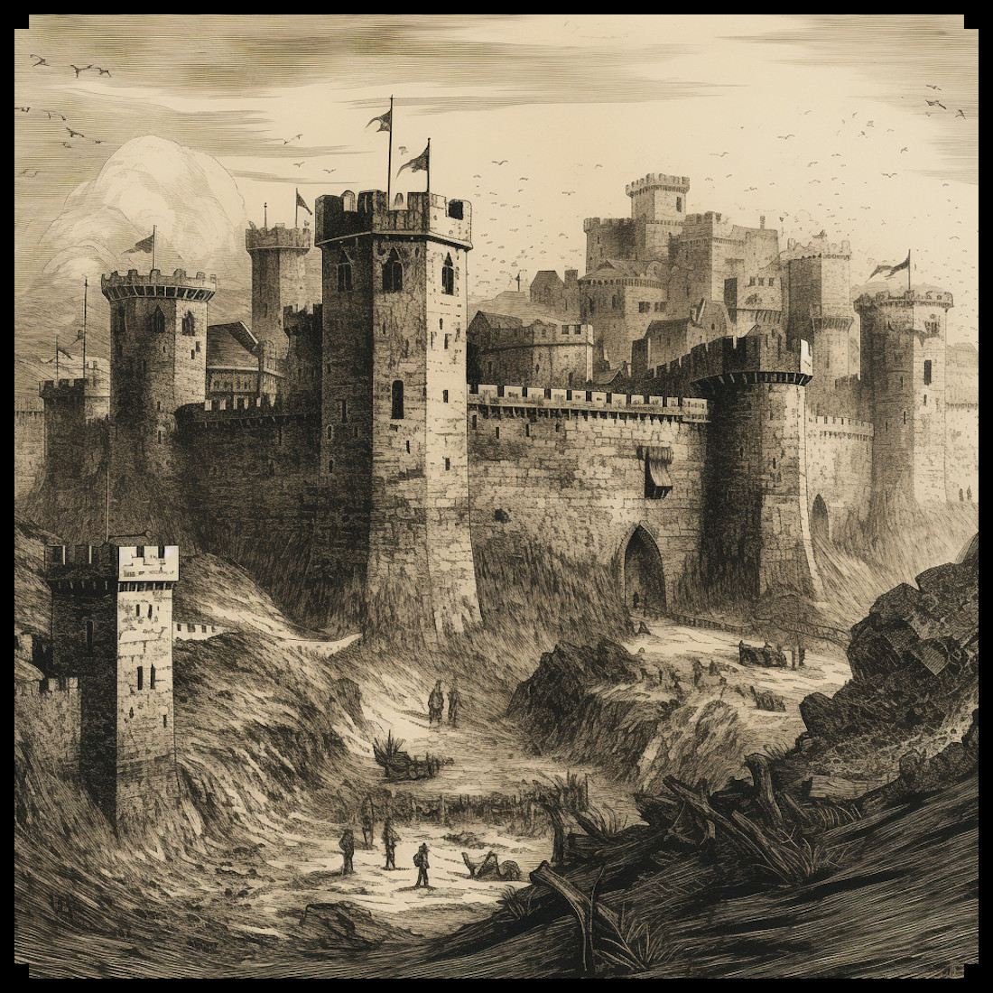
The Vintage Fortified Medieval Cities and Towns Megapack is a game-changer for fantasy map enthusiasts, offering not only individual assets but also complete representations of fortified towns and cities. In addition to elements such as ramparts, towers, and medieval buildings, this pack provides full-fledged fortified city designs, eliminating the need to piece together individual components. These complete representations maintain the vintage aesthetic of antique maps, ensuring an authentic and captivating fantasy experience.

Conclusion

The representation of fortified towns and cities holds a special place in both fantasy and antique maps. These symbols signify the strength and prosperity of civilizations throughout history and continue to inspire our imaginations today. With the Vintage Fortified Medieval Cities and Towns Megapack, map creators and enthusiasts can effortlessly bring these captivating worlds to life, bridging the gap between history and fantasy in a truly remarkable way. As a long-time fan of fantasy maps, I am excited to see how this asset pack will inspire new adventures and stories within the grandeur of fortified towns and cities.