Few landscape features capture the imagination as powerfully as crystal formations. Towering crystal mountains, glittering cities, hidden mines and colossal crystal pillars have become iconic elements of fantasy worldbuilding, instantly suggesting ancient civilizations, magical energy and forgotten kingdoms. Although these spectacular landscapes belong to fantasy, the way they are represented on maps has deep roots in the artistic traditions of historical cartography.
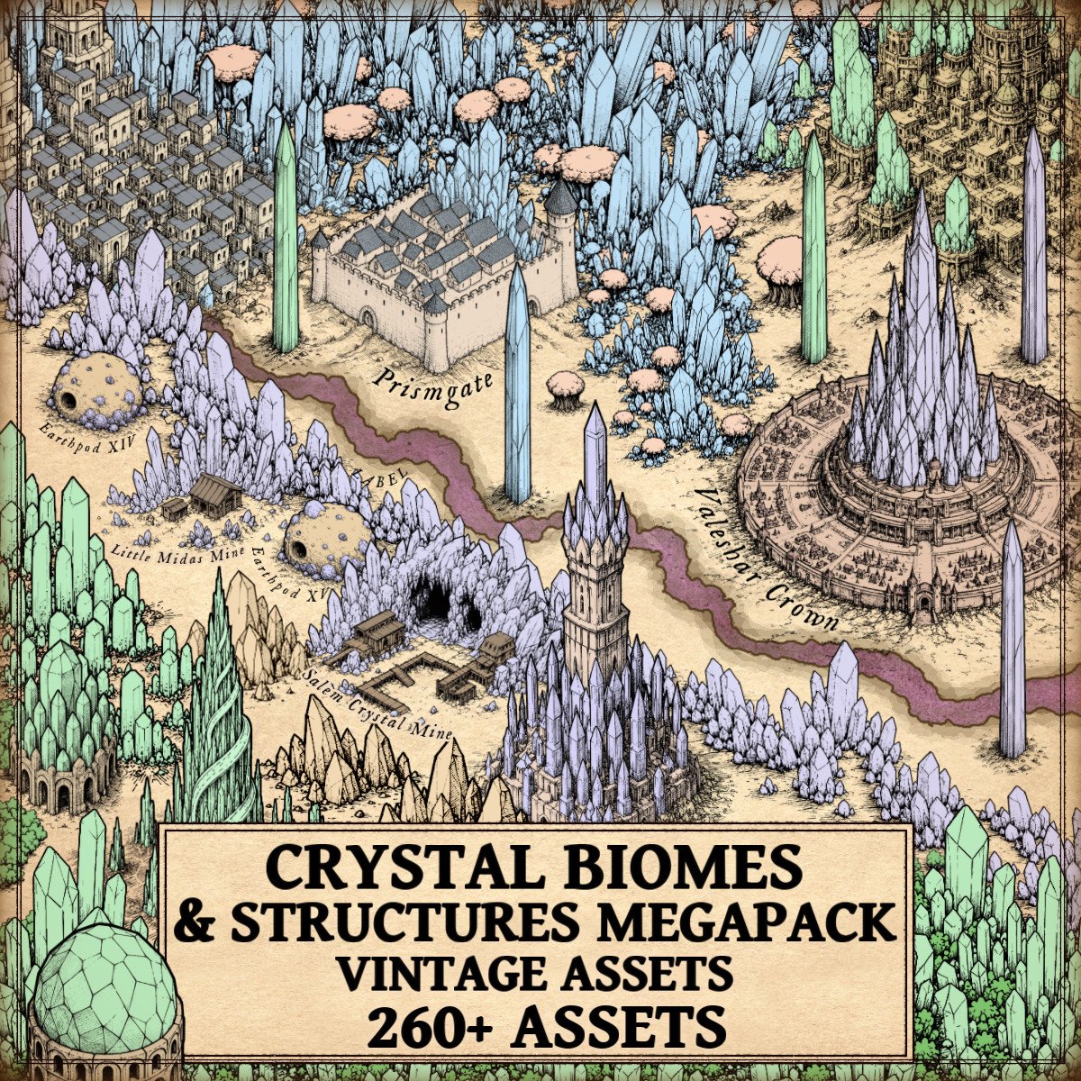
The Crystal Biomes Megapack (Crystals, Settlements, Mines, Cities, Mountains, Trees) – Vintage Assets draws inspiration from these traditions with a complete collection of cartography assets designed in the style of antique engraved maps. Featuring crystal cities, fortified cities, crystal towns, settlements, temples, castles and towers, crystal mines, crystal mountains, crystal woods, trees, giant crystal pillars, crystal deposits, various crystal formations and natural crystal troglodyte structures, the collection allows mapmakers to build complete crystal civilizations with a consistent vintage aesthetic.
Discover the Crystal Biomes Megapack (Crystals, Settlements, Mines, Cities, Mountains, Trees) – Vintage Assets here:
Far more than simple decoration, these Wonderdraft assets continue a cartographic tradition that dates back centuries, where illustrated landscapes identified important locations, valuable resources, cultural landmarks and legendary places. Whether creating a forgotten empire, an enchanted kingdom or an unexplored magical frontier, crystal formations immediately tell the reader that these lands possess a unique history, wealth and significance.
The Historical Origins of Crystal Cartography Assets and Fantasy Map Symbols
Modern fantasy maps inherited much of their visual language from medieval and Renaissance cartography. Long before modern topographic maps existed, cartographers illustrated mountains, forests, cities, castles and monuments using carefully engraved symbols that made every region immediately recognizable. These illustrations were both practical and decorative, helping readers identify important landmarks while transforming maps into genuine works of art.
Crystal landscapes naturally fit within this artistic tradition. Although historical cartographers obviously never illustrated magical crystal kingdoms, they frequently emphasized extraordinary mountain ranges, famous mining districts, prosperous cities and sacred monuments using highly distinctive illustrations. Fantasy cartography simply extends these centuries-old conventions into imaginary worlds.
Wonderdraft Assets and the Evolution of Crystal Mountains
Among every landscape feature ever represented on maps, mountains have always occupied a special place. They define borders, shape climates, separate kingdoms and create some of the strongest visual landmarks across an entire continent.
Fantasy cartography inherited this importance but transformed ordinary geology into something far more spectacular.
Crystal mountains immediately communicate that a region belongs to another world. Their sharp mineral silhouettes suggest ancient magical catastrophes, enormous concentrations of arcane energy or forgotten civilizations hidden beneath glittering peaks. Unlike ordinary mountains, they become narrative landmarks before the reader has even looked at the accompanying text.
The Crystal Biomes Megapack offers an impressive variety of crystal mountain formations. Some resemble traditional rocky ranges pierced by enormous crystal veins, creating believable transitions between natural geology and magical landscapes. Others appear almost entirely crystalline, with towering mineral peaks dominating the horizon. Smaller crystal outcrops complement larger mountain systems, allowing cartographers to create gradual geological transitions instead of abrupt changes.
This diversity closely reflects historical cartography itself. Antique mapmakers rarely copied the exact same mountain dozens of times. Instead, they constantly varied the shape, orientation and density of mountain symbols to prevent landscapes from becoming repetitive. The result was a far more organic and believable representation of terrain, and the same principle greatly benefits fantasy cartography today.
Fantasy Map Icons and the Rise of Crystal Cities
Cities have always been among the most important symbols on historical maps. Medieval cartographers often exaggerated their size because their symbolic importance mattered far more than geographical accuracy. Jerusalem, Rome, Constantinople and Alexandria frequently appeared much larger than neighboring settlements simply because they represented centers of religion, commerce or political power.
Fantasy maps continue this tradition.
Crystal cities immediately distinguish themselves from ordinary settlements. Their soaring crystalline architecture evokes prosperity, magical mastery and cultural refinement before the reader even begins imagining the civilization that inhabits them.
Rather than focusing solely on monumental capitals, the Crystal Biomes Megapack provides an entire hierarchy of settlements. Great crystal cities represent thriving capitals, while crystal fortified cities suggest military strongholds capable of defending priceless mineral wealth. Crystal towns and smaller settlements create believable regional networks, making crystal civilizations feel complete rather than isolated.
This hierarchy reflects the organization found throughout real historical maps. Medieval atlases rarely represented kingdoms through a single city alone. Villages, monasteries, trading towns and regional capitals all appeared together to communicate political organization and territorial influence. Fantasy worlds become considerably more immersive when crystal civilizations are built with the same philosophy.
Crystal temples further enrich this cultural landscape. Throughout history, temples, monasteries and sacred sanctuaries occupied prominent places on maps because they represented pilgrimage destinations and centers of religious authority. Crystal temples naturally inherit this role, suggesting places of worship, ancient magical knowledge or forgotten spiritual traditions.
Crystal castles and towering crystal fortresses reinforce the military dimension of these civilizations. Rising above surrounding landscapes, they immediately establish strategic importance while providing memorable visual landmarks for the reader.
Fantasy Map Resources and the Importance of Crystal Mines
Throughout human history, natural resources have shaped civilizations.
Gold financed kingdoms.
Silver transformed economies.
Salt controlled trade.
Iron built empires.
Although magical crystals belong primarily to fantasy, they fulfill exactly the same narrative purpose.
Crystal mines therefore represent far more than decorative scenery. Their presence immediately suggests commerce, industry, specialized craftsmanship, political rivalry and extensive transportation networks linking remote mountains to prosperous cities.
The Crystal Biomes Megapack illustrates crystal mines as ancient excavations integrated directly into extraordinary geological formations. Instead of resembling modern industrial complexes, these mines evoke centuries of patient excavation beneath enchanted mountains, blending naturally with the surrounding landscape.
Historically, famous mining regions such as the silver mines of Laurion in Ancient Greece, the Roman gold mines of Las Médulas in Spain or the gemstone trade routes crossing Central Asia profoundly influenced the development of civilizations. Fantasy worlds simply replace precious metals with magical crystal formations while preserving exactly the same geographical logic.
A single crystal mine on a map immediately encourages readers to imagine merchants, caravans, guilds, territorial conflicts and kingdoms whose prosperity depends upon these extraordinary mineral resources.
Crystal Woods, Giant Crystal Pillars and Natural Wonders
Historical maps have always balanced geographical information with artistic beauty.
Forests filled otherwise empty regions while simultaneously indicating woodland terrain. Mountains framed continents. Rivers guided the eye across the page.
Crystal woods extend this artistic tradition beautifully. Rather than replacing ordinary forests, they introduce magical ecosystems where vegetation and mineral formations coexist. Scattered crystal trees gradually evolve into entire enchanted forests, creating believable transitions between natural and supernatural landscapes.
The inclusion of ordinary trees alongside crystal woods allows cartographers to construct these transitions naturally, making magical regions feel like genuine parts of the world rather than isolated decorations.
Among the most spectacular elements of the collection are the giant crystal pillars.
Unlike mountain ranges, these monumental formations function almost as natural monuments. They resemble colossal obelisks rising directly from the earth, inviting countless questions. Are they remnants of an ancient civilization? Did unimaginable magical forces create them? Are they sacred landmarks, forgotten fortresses or immense natural formations untouched for thousands of years?
The finest fantasy maps often leave such mysteries unanswered, allowing the illustrations themselves to inspire imagination.
Crystal Deposits, Various Crystals and Geological Storytelling
One of the greatest strengths of the Crystal Biomes Megapack lies in its geological diversity.
Rather than relying exclusively on enormous crystal mountains, the collection includes scattered crystal deposits, isolated formations and numerous crystal clusters that enrich every landscape. Some appear as modest mineral outcrops emerging from rocky terrain. Others spread across entire valleys, while larger formations become dominant geographical landmarks.
This variety closely resembles real geological processes. Valuable minerals rarely appear in uniform distributions. Instead, landscapes are shaped by countless different formations created through volcanic activity, tectonic pressure, erosion and mineral deposition.
Fantasy geology becomes significantly more believable when crystal formations display similar diversity. A continent filled exclusively with gigantic crystal mountains quickly becomes repetitive. One that combines deposits, towering ranges, crystal woods, monumental pillars, mining complexes and flourishing settlements feels like a living world.
Natural crystal troglodyte structures complete this geological storytelling. Rather than depicting buildings constructed from crystal, these formations suggest civilizations that adapted directly to extraordinary mineral environments by carving homes, sanctuaries and refuges into immense crystalline caverns. They strengthen the connection between culture and landscape, making crystal civilizations feel deeply rooted in their environment.
From Antique Maps to Modern Wonderdraft Assets
Perhaps the greatest achievement of vintage fantasy cartography is its ability to preserve the elegance of historical engraved maps while illustrating entirely fictional worlds.
The Crystal Biomes Megapack never aims for photorealism. Instead, every illustration embraces the engraved aesthetic of antique cartography through clean linework, balanced shading and carefully designed silhouettes. Whether depicting monumental crystal cities, fortified settlements, crystal mines, towering mountain ranges, enchanted woods or spectacular geological formations, every asset belongs to the same coherent artistic language.
This consistency is precisely what transforms a simple asset collection into a complete library of cartography assets. Every symbol naturally complements the others, allowing mapmakers to build continents that feel as though they were lifted directly from a forgotten Renaissance atlas describing mythical kingdoms.
For creators using Wonderdraft assets, this artistic coherence is invaluable. Mountains, forests, cities, mines, temples and natural formations all share the same vintage engraving style, ensuring that every map maintains a unified visual identity from the smallest settlement to the largest mountain range.
Why Crystal Landscapes Continue to Fascinate Fantasy Cartography
Crystal landscapes remain enduring symbols of fantasy because they combine humanity’s fascination with extraordinary minerals and the timeless artistic traditions of historical mapmaking.
Across ancient Greece, Rome, Persia, India and medieval Europe, crystals and gemstones were associated with wealth, purity, wisdom, healing and divine power. Medieval lapidaries attributed supernatural properties to precious stones, while alchemists viewed crystals as manifestations of hidden natural forces. Fantasy literature simply expanded these beliefs into entire civilizations built around magical minerals.
At the same time, antique cartography taught generations of artists that maps could tell stories through illustration alone. Mountains, forests, cities and monuments became visual language long before modern symbols were standardized.
The Crystal Biomes Megapack (Crystals, Settlements, Mines, Cities, Mountains, Trees) – Vintage Assets celebrates both traditions by offering an extensive library of cartography assets, elegant Wonderdraft assets, richly detailed fantasy map icons, expressive fantasy map symbols and immersive fantasy map resources. Rather than merely decorating a fantasy map, these illustrations help shape believable civilizations, memorable landscapes, ancient cultures and compelling stories that appear as though they belong within the pages of a centuries-old atlas.
Like the masterpieces of medieval and Renaissance cartography that inspired them, the finest fantasy maps are far more than geographical diagrams. They are invitations to explore unknown lands, discover forgotten histories and imagine worlds where every crystal mountain, every hidden mine and every shimmering city promises another story waiting to be told.