Posted on Leave a comment

The Art of Aging: Fantasy Map Resources Featuring Stains & Distress Marks

Fantasy map effects, fantasy map assets, aging effects, distressed, distress effects, ink stains, blood stains, Wonderdraft

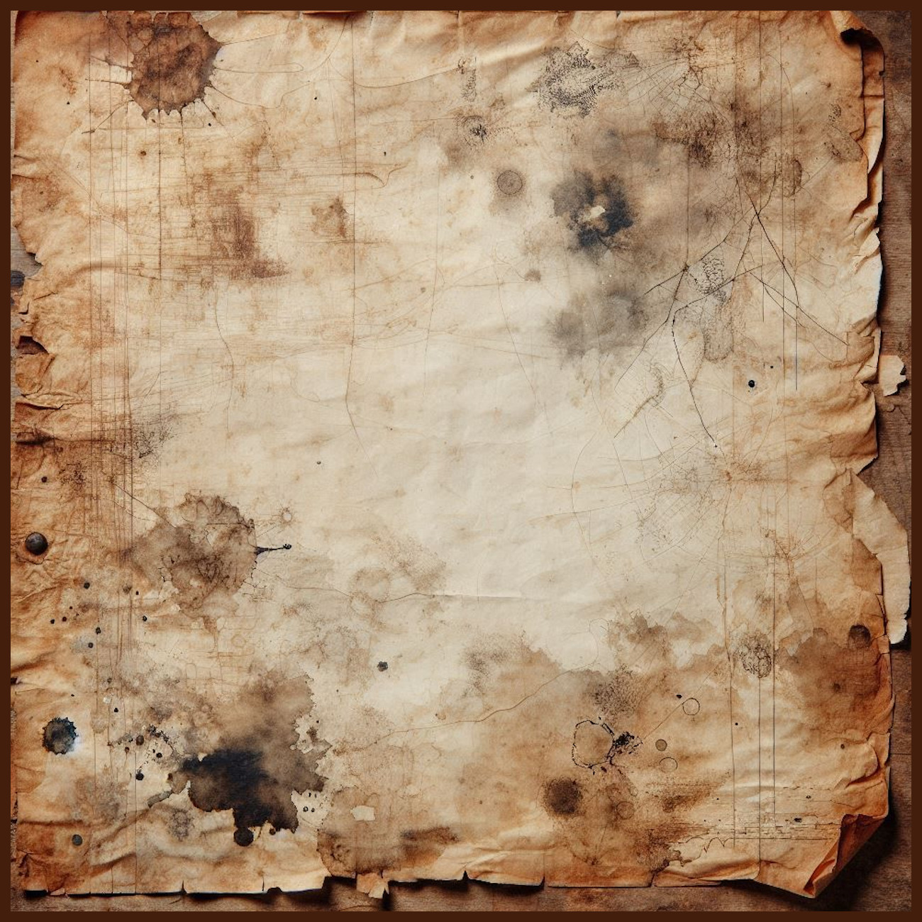
Maps have long held a dual role as tools of navigation and works of art. Whether found on the tanned hide of a medieval cartographer or a modern fantasy enthusiast’s parchment scroll, the marks of time and use—stains, smudges, tears, and more—evoke stories that stretch beyond the maps themselves. The Stains & Distress Marks – Aging Effects Kit – Assets Megapack masterfully captures this tradition, offering creators the tools to bring the soul of antique maps to their fantasy worlds.

This article delves into the history, utility, and aesthetic value of these aging effects, exploring their roots in antique cartography, their narrative power in fantasy map-making, and the cultural allure of these symbols of time.

BUY AND DOWNLOAD The Stains & Distress Marks – Aging Effects Kit – Assets Megapack here :


Antique Maps: A Legacy of Imperfection

Antique maps are as much historical artifacts as they are navigation tools. Consider the 1507 Waldseemüller Map, often hailed as the first map to name America. Its edges are worn, the ink is faded, and creases cut through its cartographic artistry. Such imperfections are not merely the result of age—they tell the story of its use and transport.

The Hereford Mappa Mundi, a 13th-century masterpiece, is another fine example. Though exquisitely detailed, the vellum is stained, its edges frayed. These blemishes reflect centuries of handling, environmental exposure, and reverence, encapsulating the journey of both the map and the world it sought to represent.


Marks of Time: Aesthetic and Functional Roles

Distress marks on antique maps served both practical and aesthetic functions:

  1. Utility and Preservation:
    • Wear Marks: Frequent handling would lead to natural wear, particularly at folds and edges, which can also reveal the map’s popularity and importance.
    • Tears and Creases: Indicate where the map was frequently folded or stored, providing insight into its use—whether tucked into a sailor’s chest or pinned to a scholar’s study wall.
    • Water Stains and Smudges: Often born from accidents, these marks are telltale signs of voyages, fieldwork, or hurried consultations.
  2. Symbolism and Cultural Value:
    • Burn Marks: On pirate treasure maps (real or fictional), singe marks suggest a dramatic backstory, possibly a rescue from destruction or a hidden existence near flames.
    • Aging Effects: Cracks, faded spots, and erasure marks mirror the human fascination with antiquity, signaling authenticity and connecting users to a sense of history.

Fantasy Maps: Bridging the Real and Imagined

Fantasy maps owe much of their visual language to antique cartography. J.R.R. Tolkien’s maps of Middle-earth and the detailed world-building of George R.R. Martin’s Westeros exemplify this. But why are distress marks so prevalent in these imaginary landscapes?

  1. Narrative Immersion:
    • Coffee Rings and Ink Stains: Suggest that the map was a working document, handled by explorers or adventurers within the fictional world.
    • Tears and Burn Marks: Imply perilous journeys, battles, or even deliberate attempts to conceal information.
    • Smudges and Smears: Evoke a sense of immediacy, as though the map was hastily sketched or altered in the heat of the moment.
  2. Aesthetic Appeal:
    • Distress marks lend an air of authenticity to fantasy maps, connecting audiences to the world as though the map had existed for generations.
    • The artistry of such marks—when done well—becomes a decorative feature that enhances the map’s overall beauty and allure.

Cultural Resonance: The Timeless Appeal of Distress

The cultural allure of aged maps goes beyond utility and storytelling. These imperfections carry emotional weight. They remind us of the passage of time, the fragility of human endeavors, and the enduring power of knowledge.

  • Maps as Heirlooms: Antique maps are often passed down through generations, with their blemishes serving as cherished reminders of familial or national history.
  • Artifacts of Exploration: For collectors, each stain or tear on an antique map represents a story—a ship’s journey, a scholar’s study, or the rough conditions of an expedition.

The Stains & Distress Marks – Aging Effects Kit: A Creative Toolkit

The Stains & Distress Marks – Aging Effects Kit – Assets Megapack captures the essence of these marks with an impressive variety of assets. Here’s how they enhance fantasy maps:

  1. Authenticity:
    • Ink Blots and Circular Marks: Perfect for recreating the look of hurried note-taking or accidental spills.
    • Water Stains and Smudges: Ideal for maps meant to look as though they’ve endured rain-soaked travels or misty libraries.
    • Cracks and Fissures: Add depth and texture, imitating the wear of centuries.
  2. Narrative Depth:
    • Burn Marks and Tears: Suggest danger and intrigue, enriching the story a map tells.
    • Faded Spots: Imply forgotten or hidden knowledge, drawing the viewer deeper into the fantasy.
  3. Aesthetic Beauty:
    • Dirt and Speckled Marks: Provide a touch of realism while enhancing the visual complexity of a map.
    • Drip Stains and Abrasions: Offer subtle decoration, turning a plain parchment into a piece of art.

Conclusion: A Marriage of History and Imagination

The Stains & Distress Marks – Aging Effects Kit – Assets Megapack is more than just a set of tools—it is a bridge between the historical and the fantastical, inviting creators to imbue their maps with the richness of age, wear, and use. From antique atlases to fantasy scrolls, distress marks breathe life into cartography, turning maps into storytellers.

By understanding the legacy and significance of these marks, mapmakers can craft creations that resonate not only with the eye but also with the imagination and the heart. Whether you’re charting the seas of reality or the realms of fantasy, these aging effects connect your work to a timeless tradition of exploration and artistry.

Posted on Leave a comment

The Role of Belle Époque Cities and Structures in Fantasy Map Assets

Fantasy map assets, belle epoque cities and towns, Wonderdraft assets, cartographic symbols, fantasy map resources

Introduction to Fantasy Mapmaking and the Belle Époque Era

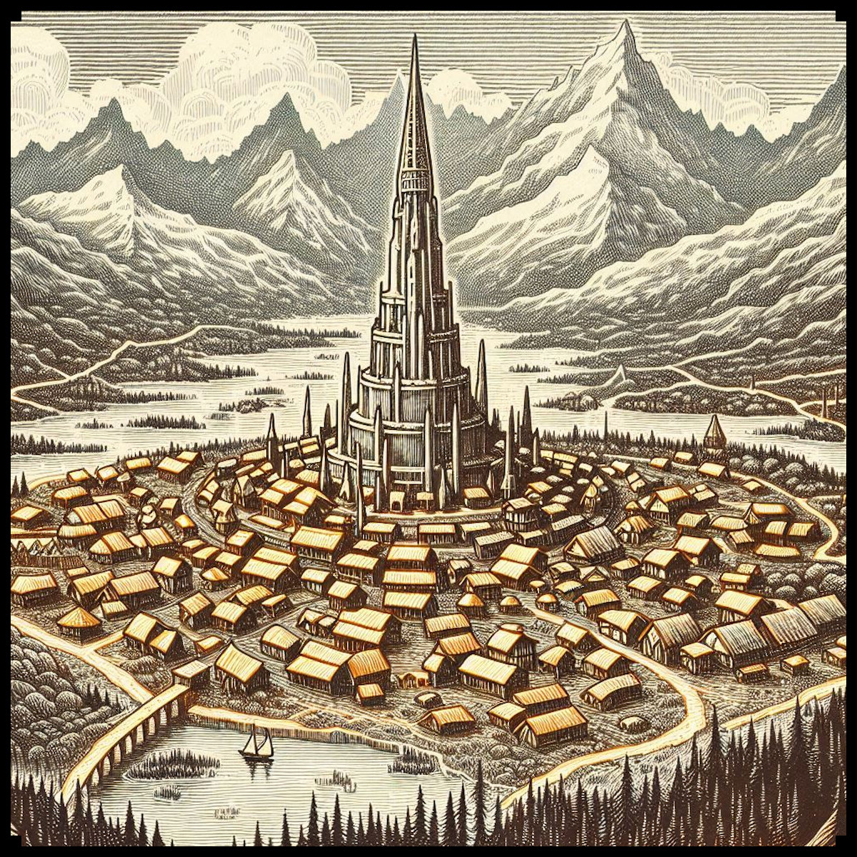
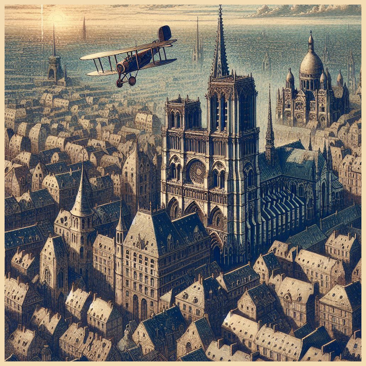
The allure of fantasy and antique maps lies in their ability to tell rich and immersive stories. The Belle Époque Cities, City Buildings & Structures – Vintage Assets Megapack draws inspiration from an era celebrated for its architectural splendor and cultural advancement. This pack introduces sprawling cities, iconic buildings, intricate structures, and atmospheric details that echo the grandeur of 19th and early 20th century Europe. To understand the significance of these assets, we must explore their historical, cultural, and artistic roles in mapmaking and how they elevate both utility and aesthetics. The Belle Époque (“Beautiful Era”) marked a period of peace, prosperity, and creativity in Europe between 1870 and 1914. Cities grew into cultural epicenters adorned with architectural masterpieces, including neo-gothic cathedrals, Haussmannian buildings, grand glass domes, and ornate clock towers. These structures now find a second life on fantasy maps, where they serve both as narrative focal points and decorative landmarks.

BUY AND DOWNLOAD The Belle Epoque Cities, City buildings, & Structures – Vintage assets Megapack here :

Sprawling Cities and Colossal Cathedrals

During the Belle Époque, cities like Paris, Vienna, and London experienced rapid urban growth. These cities became canvases of innovation, with colossal cathedrals and basilicas rising as cultural and religious symbols. Examples include the Sacré-Cœur Basilica in Paris and the Neo-Gothic St. Vitus Cathedral in Prague, which blended medieval inspiration with modern construction techniques. In antique and fantasy maps, sprawling cities are often rendered as compact urban landscapes with a central cathedral towering above surrounding structures. This layout mirrors the real-world medieval city design, where churches served as the heart of towns. Real-world examples, such as the medieval maps of Nuremberg with the Frauenkirche at its center, showcase this influence. Similarly, Tolkien’s depiction of Minas Tirith in The Lord of the Rings mirrors this centralization with its iconic tiered city crowned by a grand structure.

In fantasy settings, sprawling cities often symbolize power and prosperity. They serve as capitals, hubs of trade, or centers of cultural significance. The inclusion of cathedrals or colossal buildings gives these cities a clear visual hierarchy and a point of narrative interest, whether as seats of religious or magical power, royal authority, or key plot locations. Such visual anchors elevate the storytelling aspect of maps while making the environment more immersive and realistic.

Belle Époque City Buildings and Haussmannian Architecture

The late 19th century saw cities transform through urban renovation, most notably in Paris under Baron Haussmann. His renovation projects introduced uniform city blocks, wide boulevards, and symmetrical facades that defined the Belle Époque aesthetic. These Haussmannian buildings brought elegance and order to the cityscape, creating an urban harmony that shaped both real-world cartography and its fantasy counterparts. Antique maps, such as the Turgot Map of Paris (1739), already displayed a preference for structured layouts, but the Belle Époque brought further refinement to city designs, influencing how maps today depict organized and elegant urban zones.

In fantasy cartography, such orderly city blocks provide a sense of grandeur and prosperity. They divide sprawling cities into manageable and visually distinct districts—wealthy quarters, merchant areas, or residential neighborhoods—offering layers of storytelling and realism. The assets for Haussmannian buildings reflect this detail, giving creators tools to showcase sophisticated urban centers while maintaining visual cohesion on their maps.

Neo-Gothic, Neo-Renaissance, and Baroque Structures

The Belle Époque celebrated architectural revivalism, drawing on Gothic, Renaissance, and Baroque styles. Cathedrals and basilicas of this era featured intricate designs with spiked towers, pointed arches, domes, and ornate decorations. Real-world landmarks like Notre-Dame de Paris or London’s St. Paul’s Cathedral exemplify these styles. This architectural language, rich with detail and historical resonance, translates seamlessly into fantasy mapmaking.

On maps, these structures symbolize both beauty and power. Neo-Gothic cathedrals can serve as seats of divine influence or arcane energy, adding layers of cultural significance. Neo-Renaissance basilicas, with their symmetrical grandeur, represent centers of authority or knowledge, such as royal courts or academic institutions. Whether as centers of worship, magical academies, or imperial palaces, these structures add depth to a fantasy world’s lore while serving as essential visual focal points.

Fictional works frequently draw on these influences. The Cathedral of Light in World of Warcraft evokes Neo-Gothic grandeur, symbolizing divine power and protection. In the same vein, the assets for cathedrals and towers in the Belle Époque Megapack allow creators to recreate such monumental structures with ease, providing tools to evoke cultural history and architectural beauty.

Clock Towers, Statues, and Obelisks

The Belle Époque saw cities punctuated by iconic structures such as clock towers, statues, and obelisks. These elements reflected advancements in engineering and served as symbols of progress, remembrance, or mystery. Landmarks like London’s Big Ben or the ancient Egyptian obelisks relocated to European capitals, such as the Luxor Obelisk in Paris, demonstrate how these icons became integrated into the cityscape. In maps, clock towers and statues serve both practical and narrative functions. Clock towers signify centers of authority or progress, while statues and obelisks can mark sacred sites, historic events, or hidden lore within a fantasy world.

Fantasy maps use these structures to create points of navigation and storytelling. For example, an obelisk may hint at forgotten magic or ancient civilizations, while a statue might commemorate a legendary hero whose deeds are central to the narrative. The assets provided in the Megapack allow creators to incorporate these timeless icons into their maps, enhancing both realism and depth.

Glass Domes, Greenhouses, and Café Terraces

The Belle Époque was a time of industrial progress and artistic expression, and nowhere was this more apparent than in the rise of glass and iron architecture. Structures like the Crystal Palace in London and the Grand Palais in Paris became symbols of modernity, innovation, and cultural enlightenment. Glass domes and greenhouses, often associated with botanical gardens and exhibition spaces, reflected the era’s fascination with science and exploration.

In fantasy maps, these structures can serve as magical academies, botanical sanctuaries, or places of innovation. Their elegance adds layers of sophistication to cityscapes, marking them as centers of knowledge and culture. Similarly, café terraces, emblematic of Belle Époque leisure, bring a human element to urban spaces, showcasing the social vibrancy of a city and its people.

Technology and Atmosphere: Vintage Cars, Biplanes, Balloons, and Fog

The technological advancements of the Belle Époque introduced automobiles, biplanes, and hot air balloons, which reflected humanity’s growing ambition and mastery over movement and travel. Vintage cars can evoke bustling streets and urban energy, while biplanes and balloons symbolize exploration and innovation. In maps, these assets add dynamism, marking trade routes, skyports, or hubs of adventure.

Meanwhile, atmospheric elements such as fog and smog provide mood and mystery. Industrial cities of the Belle Époque often featured thick smog, a detail that can enhance dark, mystical, or hidden regions on a map. Fog-shrouded ruins, smog-filled streets, or misty valleys add depth and layers of intrigue to any fantasy setting.

Conclusion: The Belle Époque in Fantasy Mapmaking

The Belle Époque Cities, City Buildings & Structures Megapack captures the architectural beauty, innovation, and cultural richness of this historical era, transforming it into a versatile toolkit for mapmakers. From sprawling cities and Haussmannian buildings to grand cathedrals, glass domes, and atmospheric details, these assets offer the tools needed to create immersive and visually stunning maps. Whether serving as narrative anchors, cultural symbols, or decorative landmarks, these elements breathe life into fictional worlds, honoring the grandeur of a bygone era while inspiring new stories in fantasy and beyond.

Posted on Leave a comment

The Magic of Fantasy Map Symbols: Flowers and Fairy Tales in Cartography

giant flowers, fantasy map symbols, Wonderdraft assets, fairy tale map assets, vintage cartography assets

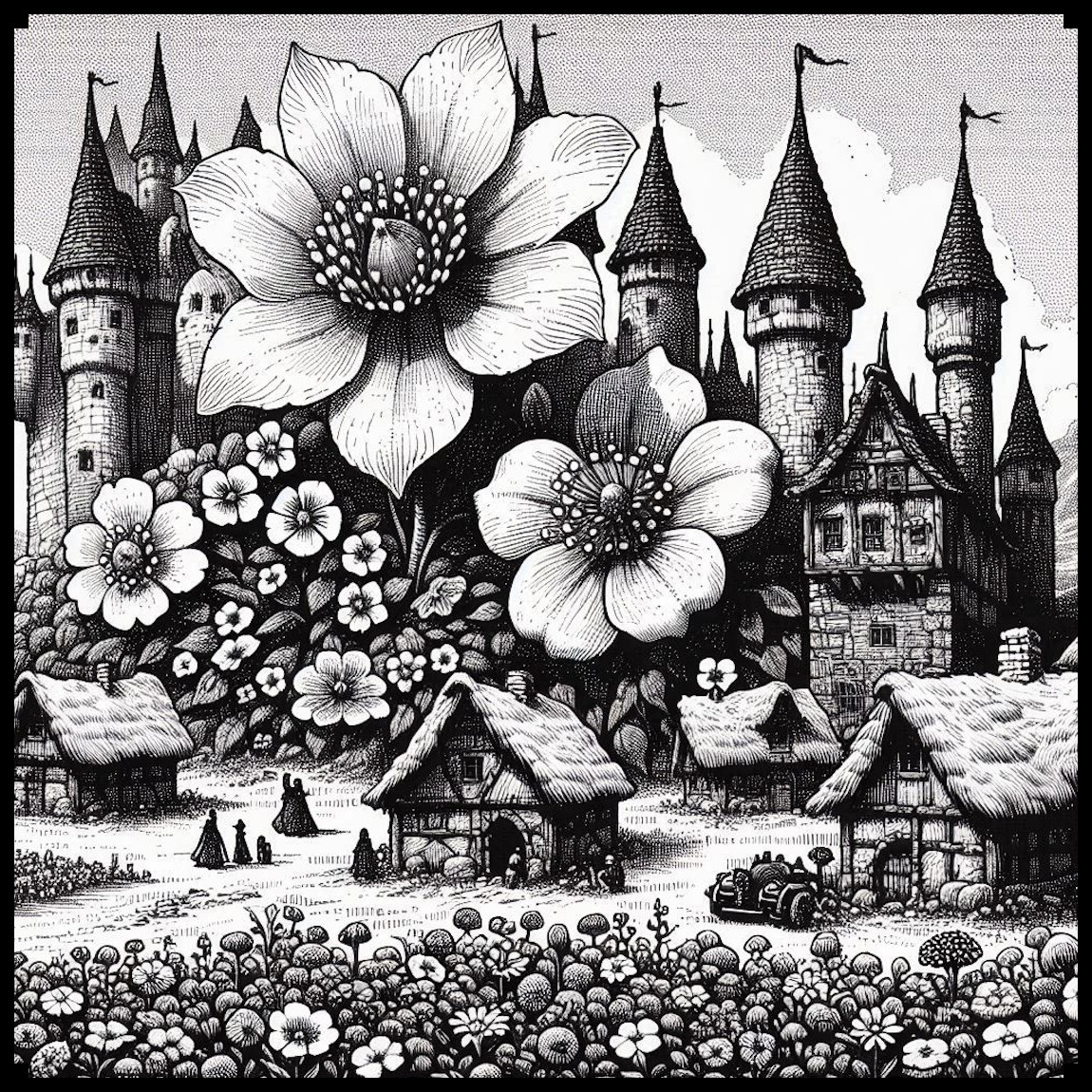
Maps are powerful tools for storytelling, blending utility with artistic expression. The Fantasy Flowers, Flower Towns, & Fairy Tale Inhabitants – Vintage Assets Megapack offers a unique set of symbols to enrich fantasy maps, drawing from the artistic traditions of antique cartography and the cultural significance of flowers, mythical beings, and nature-inspired architecture. This article explores each asset in detail, examining its historical roots, aesthetic appeal, and storytelling potential, including the fascinating concept of fortified cities with giant flowers.

BUY AND DOWNLOAD The Fantasy Flowers, Flower Towns, & Fairy Tale Inhabitants – Vintage Assets Megapack here :


Floral Beauty and Symbolism in Fantasy Maps

Flowers have always been imbued with rich cultural and symbolic meanings. On maps, they serve both decorative and functional purposes. In medieval and Renaissance maps, flowers were often used to depict paradisiacal lands or regions of abundance. For example, the Ebstorf Map includes lush floral imagery to represent Eden, while 17th-century European maps often decorated fertile regions with floral motifs.

Flowers and Clumps: Breathing Life Into Landscapes

In the context of fantasy maps, individual flowers and flower clumps are versatile tools. They can signify enchanted fields, magical gardens, or even sacred groves. Beyond their narrative function, they serve as decorative elements that break up large, empty spaces on maps, giving landscapes a natural, organic feel.

These floral symbols also evoke mystery and magic. A lone flower on a map might mark the site of a magical relic, while a dense cluster could signify a place teeming with natural energy or hidden life. Historically, flowers like the lotus (a symbol of purity and enlightenment) and roses (associated with divine love or secret knowledge) have carried deep meaning, making them ideal markers for fantastical settings.


Fortified Cities with Giant Flowers: Guardians of Magic and Power

One of the most striking assets in this pack is the concept of fortified cities with one or more giant flowers at their core. These unique settlements combine the grandeur of monumental floral architecture with the practicality of defensive structures, creating an evocative mix of beauty, power, and mysticism.

Symbolism of the Giant Flower

The giant flower at the heart of a city represents growth, life, and magical energy. Historically, large floral imagery has been used to signify divine favor or prosperity. For example:

  • In Mesoamerican temples, floral motifs adorned altars to honor gods of fertility and creation.
  • The Hanging Gardens of Babylon, one of the Seven Wonders of the Ancient World, were an iconic blend of floral beauty and architectural ingenuity.

In a fantasy setting, a giant flower could serve multiple narrative purposes:

  • A magical source: Perhaps the flower is the heart of the city, providing life and energy to its inhabitants.
  • A divine symbol: The flower might represent a deity or spiritual force, making the city a center of pilgrimage.
  • A protective force: The flower could emit magical barriers or deter enemies, aligning its beauty with a practical defensive role.

The Aesthetic of Fortification

Fortified cities have long been staples of cartography, their high walls and strategic layouts symbolizing strength and security. Adding a giant flower to such a city creates a fascinating visual and thematic juxtaposition. The hard, angular lines of the fortifications contrast with the soft, organic curves of the flower, emphasizing the harmony between nature and civilization.

Decoratively, this combination also speaks to the map’s viewer, suggesting a place of unique importance. It draws the eye, much like monumental buildings or castles in historical maps, such as the elaborate depictions of walled cities in the Hereford Mappa Mundi.

Cultural and Narrative Depth

Including such a city on a map opens countless storytelling possibilities:

  • The Flower as a Beacon: The city could be a sanctuary, attracting travelers and pilgrims seeking its magical protection.
  • A City of Guardians: The fortifications might exist to defend the flower from those who would exploit its power.
  • A Mystery to Uncover: What ancient civilization planted the flower, and what secrets does it hold?

Villages and Towns in Bloom

Smaller settlements built around flowers or floral themes exude peace and harmony. Flower villages, with their charming, nature-inspired architecture, suggest communities deeply connected to the land. These could be elven hamlets or fairy enclaves, where residents live in symbiosis with their environment.

Flower towns, on the other hand, are larger, more bustling hubs. Their floral architecture symbolizes prosperity and creativity. Historically, towns often celebrated their natural surroundings through festivals and floral decorations, such as the Battle of Flowers parades in Europe. These influences can inspire fantasy towns where flowers are integral to daily life, industry, or magic.


Flowered Dungeons and Giant Altars

While flowers are often symbols of beauty, they can also evoke mystery and danger. Flowered dungeons are overgrown ruins, their floral decorations hinting at ancient rituals or forgotten powers. These locations could be:

  • Temples reclaimed by nature, much like Angkor Wat, where tree roots and flowers intertwine with stone walls.
  • Dangerous traps, where the beauty of the flowers hides their deadly nature, such as poisonous spores or enchanted guardians.

Giant flower altars serve as focal points for sacred or magical ceremonies. These structures, often surrounded by smaller flowers, could represent places where the natural and supernatural meet. Such altars might be sites of ancient worship or central points in a grand quest.


The Inhabitants of a Fairy Tale World

The inclusion of fairies, elves, and goblins in the megapack allows map creators to populate their worlds with rich characters. Each brings its own cultural and narrative significance:

  • Fairies: Symbolic of magic and mischief, they are natural guardians of floral landscapes.
  • Elves: Masters of craftsmanship and wisdom, their connection to floral towns and fortified cities suggests civilizations built on beauty and magic.
  • Goblins: Inhabitants of rougher, more chaotic regions, their presence contrasts with the elegance of other creatures.

These characters breathe life into the map, giving each settlement or forest a sense of purpose and personality.


Fairy Tale Ships and Tree Towns

The fairy tale ships included in the pack bring an element of whimsy and adventure to waterways. These vessels, with sails shaped like leaves or petals, suggest magical trade routes or voyages of discovery.

Tree towns, meanwhile, add verticality and uniqueness to the map. Built high in the branches of colossal trees, these settlements evoke images of secrecy and safety. Such designs, inspired by real-world examples like the treehouses of Papua or the Ficus villages of India, emphasize the resourcefulness and harmony of their inhabitants.


The Art of Antique-Style Fantasy Maps

The vintage aesthetic of this pack pays homage to the artistry of antique cartography. Maps from the 16th to 18th centuries often featured decorative embellishments—floral patterns, mythical creatures, and ornate cities—that made them as much works of art as navigational tools. This pack replicates that style, with detailed linework and shading that bring a sense of timelessness to fantasy maps.

The inclusion of flowers, fortified cities, and mythical characters creates a layered storytelling experience. These elements do more than decorate; they invite the viewer to imagine the history, culture, and magic behind each symbol.


Conclusion

The Fantasy Flowers, Flower Towns, & Fairy Tale Inhabitants – Vintage Assets Megapack is a celebration of the intersection between art, history, and fantasy. From fortified cities with towering flowers to enchanted fairy tale ships, each asset tells a story and enriches the map it adorns. These symbols bridge the gap between utility and beauty, offering mapmakers the tools to create immersive worlds that feel alive and brimming with magic.

Whether you’re crafting a tabletop RPG campaign, designing a fantasy novel’s world, or simply creating a beautiful map for fun, this pack ensures every location stands out as a unique and vibrant part of your world. Let the flowers bloom, the fairies play, and the fortresses rise—a whole fantasy world awaits creation.

Posted on Leave a comment

The Elder Scrolls Cartography Assets: Illustrating Cities, Temples, and Towers

The Elder Scrolls, Wonderdraft assets, fantasy cartography resources, settlements, towns, ruins, towers, altmer, orsimer, khajiit

Fantasy worlds, especially those as rich as The Elder Scrolls, inspire awe and immersion, largely due to their intricate maps and unique cultural landmarks. Beyond navigation, these maps serve historical, cultural, and aesthetic purposes that deepen players’ connection to the lore and landscapes of Tamriel. The Elder Scrolls-inspired Settlements, Towns, Ruins, & Structures – Vintage Assets Megapack offers an exquisite collection of icons that add an exotic touch and profound depth to any fantasy map, bringing the diversity and complexity of Tamriel’s cultures and architectures to life. From Altmer towers to Orsimer strongholds, these assets provide worldbuilders and cartographers with a set of tools to create maps that feel both historically grounded and visually captivating.

BUY AND DOWNLOAD The Elder Scrolls inspired Settlements, Towns, Ruins, & Structures – Vintage assets Megapack here :

1. Altmer Cities and Towers: Elegance and Legacy

The Altmer, or High Elves, of Summerset Isle are renowned for their sophisticated architectural style, with cities and towers that embody their wisdom, artistry, and pursuit of perfection. Iconic structures like the Crystal Towers and Adamantine Towers represent the Altmer’s reverence for elegance and magical mastery. In this vintage asset pack, Altmer cities are portrayed with intricate spires and graceful designs, mimicking the towering beauty of their real-world counterparts. These soaring structures emphasize the Altmer’s aspirations and their deep connection to celestial forces. Maps featuring Altmer cities are more than simple navigation tools; they serve as visual reminders of the Altmer’s lasting influence and refined aesthetics. These towers don’t just mark locations—they symbolize enlightenment and grandeur, reaching toward Aetherius as if striving for divine perfection.

2. Bosmer Tree Villages: Harmony with Nature

In Valenwood, the Bosmer (Wood Elves) build their homes within the Graht-Oak Trees, enormous living structures that can house entire communities. Unlike traditional wooden buildings, Bosmer settlements are fully integrated into these massive trees, reflecting their Green Pact with Y’ffre, which forbids them from harming plant life unnecessarily. The assets representing Bosmer tree towns capture the organic, interconnected nature of these homes nestled among roots and branches, illustrating the Bosmer’s profound harmony with their environment. Maps that display Bosmer villages highlight the balance between nature and community, marking areas of spiritual and cultural significance where the Bosmer live in unity with the forest. These tree towns serve not only as symbols of shelter but as visual representations of the Bosmer’s naturalist lifestyle, emphasizing their inseparable bond with the lush landscape of Valenwood.

3. Argonian Temples and Pyramids: Mysterious and Resilient

Argonian architecture, often inspired by Aztec or Mesoamerican styles, radiates mystery and resilience. The stone villages and pyramid-like temples depicted in the assets convey a sense of durability and deep connection to the ancient roots of Black Marsh. These Argonian pyramids symbolize the enigmatic spiritual practices of their culture and their strong ties to the Hist, the ancient trees that hold ancestral wisdom. When these structures appear on maps, they not only mark Argonian territories but also represent the enduring spirit of a people who have thrived in Tamriel’s most challenging landscapes. Their structures reflect a steadfast strength, blending with the rugged environment to stand as proud testaments to Argonian survival and independence.

4. Dunmer Settlements and Curved Architecture of Morrowind

The Dunmer (Dark Elves) of Morrowind are known for their unique, curved architectural style that sets them apart from other cultures in Tamriel. Unlike the rigid and angular structures seen elsewhere, Dunmer architecture flows in organic, circular shapes, as seen in their temples, spiraling walkways, and rounded domes. This curved design is deeply rooted in the mystical and volcanic landscape of Morrowind, reflecting the Dunmer’s adaptability to their harsh environment. The assets in this pack capture the elegant and fluid lines of Dunmer structures, with sweeping spirals and softly rounded edges that give their buildings a harmonious, almost ritualistic feel. The Red Mountain, a central landmark often illustrated with fiery eruptions on maps, serves as a potent symbol of the challenges the Dunmer face. Maps featuring these curved structures not only highlight the geography of Morrowind but also express the deeply spiritual and resilient nature of the Dunmer people, whose culture is shaped by both fire and faith.

5. Dwemer Ruins: A Legacy of Lost Knowledge

One of Tamriel’s most mysterious landscapes is dotted with Dwemer ruins, remnants of an ancient, vanished civilization known for its advanced technology and intricate metalwork. These ruins, scattered across Skyrim, Morrowind, and beyond, are depicted as complex, industrial structures that stand in stark contrast to the natural world around them. On maps, Dwemer ruins serve as reminders of a forgotten era, evoking intrigue and speculation about the knowledge and achievements of this enigmatic race. The assets representing Dwemer ruins capture this distinctive design with intricate gears, metallic frameworks, and towering edifices that stand as silent monuments to lost wisdom. Cartographers place these ruins as cultural landmarks, transforming them into prime locations for adventurers and scholars alike to seek the secrets hidden within.

6. Khajiiti Cities and Temples: A Fusion of Cultures

The Khajiit of Elsweyr, with their oriental and Middle Eastern-inspired architecture, bring a unique and exotic flair to Tamriel’s map. Their cities and temples are characterized by domed roofs, pointed arches, and intricate carvings, reflecting their desert homeland and cultural diversity. These structures are symbols of the Khajiit’s adaptability and rich history of trade with other Tamrielic cultures. When represented on maps, Khajiiti cities are visualized as vibrant and exotic hubs, often surrounded by sand dunes or lush greenery. Their architecture provides protection against the harsh desert climate while embodying their spirituality and lively culture. Maps featuring Khajiiti towns and temples immerse players in the multicultural allure of Elsweyr, where the desert’s mysteries blend seamlessly with the ingenuity and artistry of the Khajiit.

7. Orsimer Fortresses and Strongholds: Resilience and Strength

The Orsimer, or Orcs, of Orsinium are famed for their imposing fortresses and rugged structures, which embody their values of resilience and might. Built atop mountains or within heavily fortified compounds, these Orsimer strongholds often feature both solid stone walls and, at times, reinforced wooden walls, designed to withstand both natural elements and hostile forces. The assets in this pack showcase Orsimer architecture with robust wooden or stone defenses, pointed stakes, and spiked towers that capture the Orcs’ warrior spirit and enduring fortitude. When depicted on maps, these strongholds signify the unyielding will of the Orsimer people and their determination to carve out a place in Tamriel despite centuries of struggle. These fortresses are more than strategic outposts; they are powerful cultural symbols, marking Orsimer territory with an unmistakable presence that underscores their fierce independence and pride.

8. Mountain Fortresses and Citadels: Commanding the Peaks

Across Tamriel, mountainous regions host fortresses and citadels that stand high above the surrounding landscapes. These strongholds, including those of the Orsimer, are strategically placed for defense, fortified with stone walls. The assets in the vintage pack illustrate these mountain strongholds with layered settlements and towering structures that embody the strength of a civilization that has endured countless invasions. Mountain fortresses on maps serve as symbols of authority, marking the dominance and resilience of those who inhabit them, from the Orsimer of Orsinium to the isolated tribes who have carved out lives in these lofty realms.

9. The Iconic Towers of Tamriel: White-Gold, Crystal, and Adamantine

No map of Tamriel is complete without the inclusion of its legendary towers: the White-Gold Tower in Cyrodiil, the Crystal Tower in Summerset, and the Adamantine Tower in High Rock. These towers are ancient, mystical landmarks woven deeply into Tamriel’s history, representing the pinnacles of magical and architectural achievement. Each tower holds profound historical and mythological significance, serving as centers of power, governance, and arcane knowledge. The White-Gold Tower, for instance, is both a literal and symbolic heart of the Empire, while the Crystal Tower shines as a beacon of Altmer magic. Maps featuring these towers are not just geographical markers—they are icons of Tamriel’s legacy, standing as emblems of realms of power, mystery, and majesty known across Nirn.

10. The Decorative and Utilitarian Aspects of Antique Map Design

Beyond their lore and geographic details, the vintage design of these map assets serves dual roles: practical navigation and decoration. Antique maps often feature intricate frames and borders, as seen in this asset pack, which not only embellish the map but also provide visual boundaries that draw the viewer’s focus to the contents within. Each icon and structure is crafted with an eye toward historical styles, creating a sense of immersion in a hand-drawn, antique cartographic aesthetic. These maps do more than guide—they tell stories, preserving cultural lore and geographical significance that enrich the player’s understanding of Tamriel.

Conclusion

The Elder Scrolls-inspired Settlements, Towns, Ruins, & Structures – Vintage Assets Megapack offers more than just a collection of icons; it’s a tribute to the complex histories, cultures, and mysteries of Tamriel. Each asset, from Altmer towers to Bosmer tree cities, captures the essence of the race it represents, adding an exotic flair and a profound depth to any fantasy map. By integrating these assets, cartographers and fans of The Elder Scrolls can create maps that are not only visually captivating but also culturally resonant, echoing the age-old stories and mystical landscapes that make Tamriel an unforgettable world.

Posted on Leave a comment

Fantasy Map Symbols and Ground Detail Assets: Adding Depth to Your Maps

shrubs, landforms, low terrain, wonderdraft assets, vintage cartography assets, fantasy map symbols, vines, vineyard

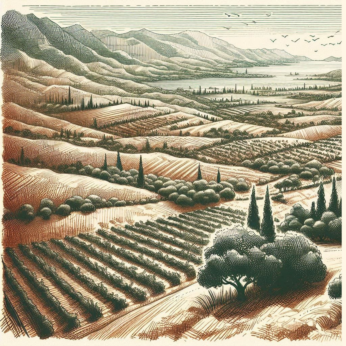
The art of cartography, especially in ancient and fantasy mapmaking, has always been more than a mere representation of geography. Maps tell stories—about the land, its people, its history, and even its culture. The Old Cartography Ground Details & Low Landforms – Assets Megapack masterfully revives the essence of ancient maps, offering 291 high-quality assets that bring fantasy worlds to life with unparalleled authenticity. Through these assets—grass, tall grass, thickets, shrubs, vines, low landforms, old cartography paths, and shading lines—I’ve tried to capture both the functional and artistic aspects of old maps, blending utility with the storytelling of map art. To understand the significance of these elements, let’s take a journey through history and explore the practical and cultural importance of these details in real-world and fictional cartography.

BUY AND DOWNLOAD The Old Cartography Ground Details & Low Landforms – Assets Megapack here :

Historical Role of Ground Details in Ancient Maps

In the ancient world, maps were not just tools of navigation; they were artistic representations of knowledge, power, and perception of the world. The earliest known maps, such as the Babylonian clay tablets (circa 600 BCE), utilized symbolic elements to represent terrain features like mountains, rivers, and fields. Greek and Roman maps, such as the Tabula Peutingeriana (a 4th-century Roman map), used illustrations to show paths, towns, and geographic boundaries, often with artistic flourishes that had cultural or religious significance.

The vegetation, landforms, and ground details on these maps were functional, serving as navigational aids, but they were also deeply intertwined with the mapmaker’s worldview. For example, in medieval European maps like the Hereford Mappa Mundi (circa 1300), vegetation such as forests and fields weren’t just geographical features but were also imbued with symbolic meanings, often representing danger, wilderness, or the untamed frontier.

In a similar vein, vineyards represented not just agricultural lands but also the bounty of civilization and the fertility of the land. Vines symbolized order amidst chaos, a cultivated landscape in contrast to the wild thickets and forests. By including these elements in the Old Cartography Ground Details & Low Landforms – Assets Megapack, mapmakers today can evoke these same meanings, giving their fantasy maps depth and narrative.

Utilitarian and Cultural Functions of Ground Details

The ground details featured in this asset pack—thickets, shrubs, grass, tall grass, and vines—are essential for adding realism and functional depth to maps. Here’s how each of these elements historically and culturally enriched maps:

  • Grass and Tall Grass: In ancient cartography, grassy areas were often used to demarcate agricultural lands, grazing fields, or open plains. In Roman maps, open grassy areas indicated places suitable for settlement or military encampment. In fantasy mapmaking, these assets help fill empty spaces, providing a realistic representation of nature. Additionally, they guide the eye, offering visual breaks and texture that add to the immersive quality of the map.
  • Thickets and Shrubs: Thickets and shrubs have always served a practical role in representing the wild or unexplored regions of a map. In medieval cartography, forests were depicted as dense, dark regions often filled with dangers, and thickets signaled impassable areas or natural boundaries. In fantasy maps, they similarly serve to delineate areas that may be difficult to navigate, creating natural obstacles or strategic points for adventurers. Culturally, thickets have often represented the boundary between civilization and wilderness—a theme that persists in many fantasy worlds today.
  • Vines (Vineyards): Historically, vines have symbolized abundance and cultivation. In maps from the Roman Empire, vineyards were depicted to showcase agricultural wealth, and in medieval maps, they were often a symbol of prosperity. The inclusion of vines in a fantasy map offers not only a visual representation of farmland but also adds a layer of cultural richness, suggesting a region’s agricultural history and its ties to civilization.
  • Low Landforms: Landforms have always been a critical element in cartography. In ancient times, low landforms such as hills, valleys, and plateaus were marked using shading and elevation lines to give the map depth and to inform travelers about the terrain they would encounter. These landforms, while subtle in appearance, were vital in shaping how people navigated the world. In fantasy maps, low landforms serve a similar function, creating natural obstacles or strategic vantage points while adding a dynamic three-dimensional feel to a two-dimensional medium.
  • Paths: One of the oldest and most essential elements in maps, paths (or roads) symbolize human movement and interaction with the land. Roman maps like the Tabula Peutingeriana meticulously depicted road networks, crucial for military campaigns and trade. In fantasy cartography, the representation of paths provides a narrative direction for the map, guiding players or readers toward destinations, indicating trade routes, or highlighting the easiest ways through dangerous terrain.
  • Shading Lines: The use of shading lines on old maps was not just an artistic choice; it was a practical method for representing elevation and depth. These lines helped travelers understand the topography of the land, particularly in mountainous or hilly regions. In the Old Cartography Ground Details & Low Landforms – Assets Megapack, shading lines play a crucial role in grounding the various elements within the map, ensuring they feel cohesive and integrated. Shading lines prevent assets from appearing to “float” and give a better sense of depth and solidity. They allow assets to be anchored naturally into the terrain, enhancing the overall flow and realism of the map.

Decorative and Symbolic Aspects in Fantasy Mapmaking

While ancient maps were utilitarian, they were also highly decorative. Maps like the Carta Marina (1539), created by Swedish cartographer Olaus Magnus, didn’t just depict the geography of Scandinavia—they also featured sea monsters, ships, and mythological creatures, blending fact with fiction. This decorative aspect has carried over into modern fantasy cartography. The elements in the Old Cartography Ground Details & Low Landforms – Assets Megapack serve both functions: they add real-world detail to the map while also creating a sense of mystery and adventure.

For instance, a thicket in the middle of a map could signal a dangerous zone filled with monsters, while vines may indicate an ancient, abandoned vineyard. Each element tells a story and invites players to explore further.

Bringing Your Fantasy Maps to Life

The Old Cartography Ground Details & Low Landforms – Assets Megapack is not merely a set of decorative assets; it is a storytelling tool. By using these assets, mapmakers can evoke the same sense of adventure, danger, and discovery that ancient cartographers did in their work. Whether you’re filling in empty spaces with tall grass or breaking up the landscape with thickets and shrubs, these elements provide both visual interest and narrative depth.

For creators inspired by the likes of Tolkien’s maps in The Lord of the Rings or George R. R. Martin’s maps in A Song of Ice and Fire, the pack offers a treasure trove of possibilities. These assets allow for the creation of detailed fantasy worlds that feel as alive and intricate as the real world, with a timeless vintage aesthetic that grounds the fantastical in the familiar.

In conclusion, the Old Cartography Ground Details & Low Landforms – Assets Megapack offers a rich set of tools for fantasy mapmakers who seek to blend historical cartographic techniques with creative storytelling. Through the use of grass, thickets, vines, and shading lines, this pack not only enhances the visual quality of maps but also imbues them with the depth and meaning seen in the greatest maps of the ancient and medieval worlds. Whether you’re creating maps for a tabletop RPG, a novel, or a video game, these assets will help you craft a world that feels authentic, immersive, and steeped in history.

Posted on Leave a comment

Mapping Medieval Fantasy Industries: The Power of Cartography Assets

wonderdraft assets, medieval fantasy smokestack industries, medieval factories, vintage fantasy map assets

Maps have always served as more than just navigational tools; they are windows into the cultures, economies, and historical periods they depict. In both fantasy and historical settings, maps do more than simply chart landscapes—they bring to life the industrial pulse of a civilization, showcasing the economic heartbeats that keep nations thriving. This article explores the representation of medieval factories, industrial towns, mining hubs, and smokestacks in both historical cartography and fantasy worldbuilding. Additionally, we will delve into the assets available in the Medieval Fantasy Industries & Factories – Vintage Assets Megapack, offering insights into how they can be used to enhance modern fantasy maps.

BUY AND DOWNLOAD The Medieval Fantasy Industries & Factories – Vintage Assets Megapack here :

The Evolution of Industry in Antique Maps

From the earliest Renaissance maps to later Victorian representations, industries and factories were often highlighted as symbols of power and prosperity. In historical maps, cities were adorned with illustrations of ports, warehouses, and factories, reflecting their significance in the economic landscape. For example, Renaissance-era maps of cities like Florence and Venice would frequently include symbols of production centers, denoting the cities’ industrial and economic importance.

In fantasy settings, similar representations are essential in grounding the world with a sense of realism. While not every map in fantasy works features factories or industries, the presence of smokestacks and industrial centers conveys a world in motion—whether powered by magic or steam. These elements offer visual clues that the fantasy world is one of progress, with bustling economies and technological advancements shaping its future.

The Role of Medieval Factories, Industries, and Smokestacks in Fantasy Maps

In the realm of fantasy map-making, the inclusion of factories, industrial towns, and smokestacks brings a new layer of depth and realism to the world being created. These assets, while often subtle, provide valuable information about the economic foundations of a kingdom or city. The presence of smokestacks in particular symbolizes the energy and resources required to power a world steeped in production, from simple smithing to more elaborate magical industries.

Smokestacks: A Symbol of Industry and Power

One of the most striking elements in these fantasy maps is the smokestack, which has become a universal symbol of industry and progress. Historically, smokestacks were associated with the industrial revolution and the rise of manufacturing hubs, representing both economic power and the environmental cost of industrialization. On fantasy maps, these towering structures serve a dual role—both decorative and symbolic. Smokestacks indicate key production areas where materials are processed or enchanted items are forged, underscoring a city’s technological advancement or magical prowess.

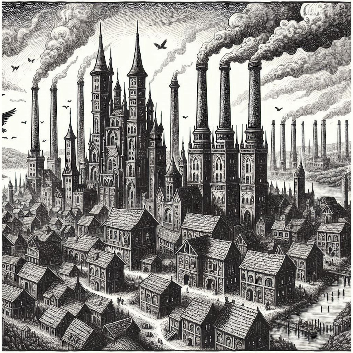
In fantasy maps, the depiction of smokestacks emerging from sprawling factory complexes or forge towns gives a clear indication of the bustling activity within. The contrast between small villages with just a few smokestacks and large industrial cities where the skyline is filled with these towering pillars helps establish the scale of industrialization in each location. This subtle visual cue tells the viewer about the importance of trade and production to the economy of the area.

Key Assets in the Medieval Fantasy Industries & Factories Megapack

The Medieval Fantasy Industries & Factories Megapack offers a rich collection of assets that bring medieval and fantasy industrialization to life. Below are descriptions of key asset categories and how they can be used to enhance fantasy maps.

1. Factories and Forge Complexes

Factories and forge complexes are depicted with a strong visual emphasis on their towering smokestacks. These complexes, consisting of interconnected brick buildings and tall chimneys emitting plumes of smoke, represent large-scale industrial hubs. The detailed representation of multiple smokestacks signals high levels of production—whether in metal forging, magical item crafting, or large-scale weapon manufacturing.

These assets can be used to show critical industrial locations on a map, anchoring the idea of cities driven by production. The smoky plumes add a dynamic quality to the map, suggesting ongoing processes within these factories, creating a sense of life and motion in the fantasy world.

2. Industrial Cities and Towns

The large industrial cities are vast, complex networks of factories and densely packed worker housing, with smokestacks rising over the rooftops. These cities are vital to the economy of the world, representing major hubs where goods are produced, distributed, and traded. The visual density of these cities suggests not only production but also population centers dependent on the industries that sustain them.

On a fantasy map, these industrial cities can be used to mark major economic centers, helping to define trade routes or areas of political importance. The heavy presence of smokestacks emphasizes the scale of production taking place in these cities, serving as a symbol of progress and innovation.

3. Mining Towns

The mining towns featured are smaller but no less vital to the economy of the fantasy world. These towns are characterized by modest industrial structures and smokestacks that mark areas of resource extraction, such as ore refining or mineral processing. In a world-building context, mining towns provide essential raw materials for the larger cities and industrial centers, playing a critical role in the supply chain.

The inclusion of these towns on a map can highlight regions rich in natural resources. The smokestacks symbolize not only the extraction of these materials but also the pollution and environmental impact that often comes with mining operations.

4. Alchemy Workshops and Breweries

Alchemy workshops and breweries are smaller in scale compared to the massive factory complexes but still play an essential role in fantasy worlds. These workshops, often marked by a single smokestack or small cluster of chimneys, represent centers of potion-making, distillation, or magical experimentation.

On a map, these workshops can serve as important narrative points where characters can interact with the magical economy, providing context for potion-based trades or magical brews that fuel a kingdom’s power. The presence of smokestacks here indicates the complex processes occurring within, whether magical or mundane.

5. War Forges and Blacksmith Industries

War forges and blacksmith industries are marked by multiple smokestacks and expansive industrial buildings. These assets represent the mass production of weapons, armor, and other wartime necessities. Their imposing size and numerous smokestacks make them symbols of military might and industrial efficiency.

On fantasy maps, these forges can be placed near battlefronts or military encampments, symbolizing areas of production dedicated to the war effort. The sight of these forges can evoke feelings of power, preparation, and the inevitable cost of conflict.

6. Individual Smokestacks

The individual smokestacks included in the pack, offer versatility for mapmakers. These modular components allow for the customization of industrial sites, adding more smokestacks to signify increased production or pollution. By adding extra smokestacks to existing buildings, cartographers can emphasize the scale and intensity of industrialization.

These smokestacks are a powerful visual tool for storytelling, showing how a once-simple workshop or factory can evolve into a sprawling, polluted industrial complex. The transformation illustrated in the images highlights the flexibility of these assets.


The Cultural and Symbolic Role of Smokestacks and Industry in Maps

Beyond their functional purpose, smokestacks and other industrial symbols hold cultural and narrative significance. Historically, smokestacks symbolized progress, but they also represented the environmental and social costs of industrialization. In a fantasy world, smokestacks may similarly represent the balance between growth and destruction—both economic progress and the potential degradation of the environment or exploitation of workers.

In maps, the presence of these elements serves to deepen the complexity of the world being depicted. By showcasing industrial centers with dense clusters of smokestacks, cartographers can communicate the centrality of industry and production to the economy, but also hint at the conflicts or challenges that come with such rapid expansion.


Conclusion

The Medieval Fantasy Industries & Factories – Vintage Assets Megapack is a versatile and richly detailed collection that allows mapmakers to create immersive, living worlds. From sprawling industrial cities with towering smokestacks to smaller mining towns and magical workshops, these assets provide a visual language that speaks to the economic and industrial heart of a fantasy realm.

By incorporating these elements into your maps, you can convey a sense of progress and production, as well as the costs associated with industrialization. Whether used to build major trade hubs, military forge towns, or mystical alchemical workshops, these assets will bring your fantasy world to life with a sense of vibrancy, history, and purpose. Smokestacks, in particular, offer a powerful symbol of industry, driving home the narrative of a world in motion, teetering on the edge of progress and transformation.

Posted on Leave a comment

Exploring Cartography Assets – The Legacy of Jungle Tree Clumps in Mapmaking

Wonderdraft tree clumps, vintage cartography assets, trees fantasy map resources, jungle trees, fantasy map symbols

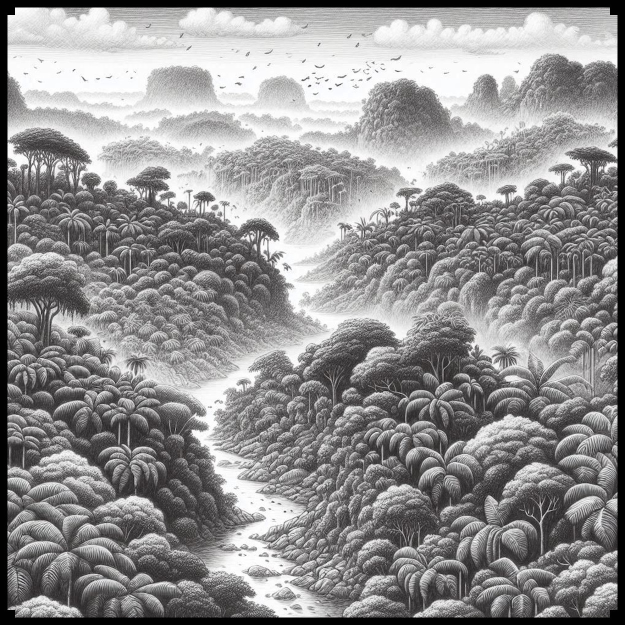
Maps have long been essential tools for navigation, exploration, and storytelling. Over centuries, cartography has evolved from simple diagrams of local areas to elaborate artistic representations of distant lands, infused with myth, legend, and cultural significance. Among the fascinating elements of both antique and fantasy maps are the depictions of landscapes, particularly jungles and forests, with the use of jungle tree clumps, palm trees, and individual jungle trees—a feature well-represented in the Old Cartography Jungle Tree Clumps – Assets Megapack.

BUY AND DOWNLOAD The Old Cartography Jungle Tree Clumps – Assets Megapack here :

Historical Significance of Vegetation in Antique Maps

The depiction of forests and jungles in antique maps was not just a reflection of geographic knowledge, but also an artistic choice steeped in symbolism and utility. Ancient and medieval cartographers often used tree clumps to represent large, forested areas. Unlike modern maps that rely on precise scale and detailed land surveys, early maps employed symbols that conveyed the nature of the terrain more generally. These clusters of trees were crucial in indicating regions of dense vegetation—places that could signify both riches and danger.

Take, for example, Fra Mauro’s Map (1459), one of the most renowned medieval maps. It showcased Africa’s vast forests through clusters of trees, suggesting lush, untamed regions teeming with exotic flora and fauna. Palm trees frequently represented tropical or arid zones, marking areas rich in resources such as dates, coconuts, and medicinal plants. Similarly, in the Tabula Rogeriana by al-Idrisi (1154), palm trees were used to depict specific trade routes and oases across the Middle East and North Africa. These representations were not meant to be literal; instead, they conveyed both geographic and economic information—palm trees indicated fertile and valuable regions along the desert.

In the Renaissance era, maps like Abraham Ortelius’s “Theatrum Orbis Terrarum” (1570) continued this tradition, using tree clumps to illustrate dense forests such as the Amazon or the African Congo. These areas, often depicted as mysterious and remote, stirred the imagination of explorers and armchair travelers alike.

Cultural and Symbolic Meanings

Beyond their practical utility, trees held deep cultural meanings. Palm trees, for instance, symbolized peace, victory, and fertility across many civilizations. The Roman Empire used palm branches as symbols of triumph. In cartography, this symbolism was subtly retained, with palm trees often marking paradisiacal regions, evoking thoughts of luxury and exoticism.

The clustering of jungle trees into tree clumps—as opposed to drawing individual trees—was not only a practical way to represent large expanses of wilderness, but also reflected an artistic approach that sought to balance aesthetics and information. Clusters of trees provided a harmonious and cohesive representation of untamed nature. They mirrored the way people of ancient times viewed these regions: as vast, interconnected ecosystems rather than areas of isolated trees.

In the Old Cartography Jungle Tree Clumps – Assets Megapack, this tradition is masterfully continued. By grouping trees together into natural clumps, the design evokes the feel of hand-drawn, ancient maps. It mirrors the technique of antique cartographers, where individual jungle trees or palms would have felt disjointed. Tree clumps give the impression of wilderness spreading out organically, much like the forests on Ptolemy’s World Map (2nd century CE), where vast jungles in the Indian subcontinent and Africa were depicted as contiguous, impenetrable regions.

The Role of Jungle Trees and Palm Trees in Fantasy Maps

Fantasy maps, particularly in world-building for books, films, and games, draw heavily on the visual language of antique cartography. For example, in J.R.R. Tolkien’s Middle-earth maps, forests like Mirkwood are rendered as clusters of trees, lending a sense of scale and depth to these fantastical regions. Similarly, in George R.R. Martin’s world of Westeros (A Song of Ice and Fire), dense forests like the Wolfswood are depicted through clumps of trees, reinforcing the idea of these areas as vast and ancient.

In fantasy, palm trees and jungle trees frequently symbolize uncharted or exotic lands. From the rainforests of Chult in Dungeons & Dragons to the deserts of Azeroth in World of Warcraft, the use of grouped vegetation—especially tree clumps—communicates the idea of danger and mystery. Jungles are often places where heroes encounter the unknown, reinforcing a sense of adventure.

The Old Cartography Jungle Tree Clumps – Assets Megapack perfectly captures this essence by offering not just individual jungle trees or palms, but entire clusters, allowing fantasy map creators to maintain a consistent, handcrafted feel. These assets can help bring a sense of coherence and unity to the landscape, making the world feel more lived-in and immersive.

Aesthetic and Functional Aspects of Tree Clumps

One of the reasons jungle tree clumps are so effective in maps—both antique and fantasy—is their visual coherence. When trees are drawn individually, especially in large numbers, they can create a disjointed, chaotic look. Grouping them into clumps creates harmony, balancing the dense complexity of forests with the readability of the map.

In addition to aesthetic value, jungle tree clumps serve a utilitarian purpose. By clustering trees, mapmakers can convey a region’s topography more succinctly. Whether indicating dense, impenetrable jungles, or showing navigable spaces between tree clusters, these groupings provide crucial information to the viewer without overwhelming them with detail. For example, in the Hereford Mappa Mundi (circa 1300), forests are often shown as interconnected clumps of trees, making it easy for the viewer to distinguish between wilderness and settled areas.

The Old Cartography Jungle Tree Clumps – Assets Megapack taps into this rich tradition by providing assets that allow for the easy representation of jungles and tropical regions in a way that is both visually appealing and historically informed. The inclusion of individual palm trees, jungle trees, and tree clumps ensures versatility, while the grouped clumps maintain the overall cohesion and handmade feel that antique maps are known for.

Why Tree Clumps Have Stood the Test of Time

The use of tree clumps in cartography has endured for centuries, from ancient maps to modern fantasy creations, because they strike a balance between artistry and functionality. In the real world, forests are not isolated patches of individual trees, but interconnected ecosystems, and tree clumps on maps reflect this reality. They allow cartographers to represent vast areas efficiently, while also imbuing the map with a sense of the organic spread of nature.

Moreover, tree clumps are emblematic of the handmade quality that modern digital maps often lack. Antique maps, with their imperfections and artistic flourishes, convey a sense of human craftsmanship. In an era where many digital maps can feel sterile or overly precise, assets like those found in the Old Cartography Jungle Tree Clumps – Assets Megapack bring back that feeling of a mapmaker’s personal touch.

For map designers in fantasy and historical genres, using jungle tree clumps creates not only a sense of scale but also of authenticity. Whether it’s for a tabletop role-playing game, a fantasy novel, or a video game, these assets evoke the grand tradition of old-world cartography. They remind us of the mystery, adventure, and exploration that jungles and forests represented to ancient peoples—and continue to represent in modern fantasy worlds.

Conclusion

The Old Cartography Jungle Tree Clumps – Assets Megapack stands as a tribute to the rich history of cartographic art, merging the functional aspects of representing jungles, palm trees, and forests with the aesthetic traditions of ancient maps. By using these assets, mapmakers can evoke the feeling of antique hand-drawn maps, where tree clumps were more than mere symbols—they were part of the storytelling process, representing the wild, untamed lands that lay beyond the edges of the known world.

Whether for fantasy or historical maps, the use of jungle tree clumps is not only practical but also a beautiful nod to the cultural and artistic legacy of cartography.

Posted on Leave a comment

Modern Cityscapes in Fantasy Map Symbols: A New Era of Cartography

Wonderdraft modern assets, vintage modern cartography assets, modern fantasy map resources

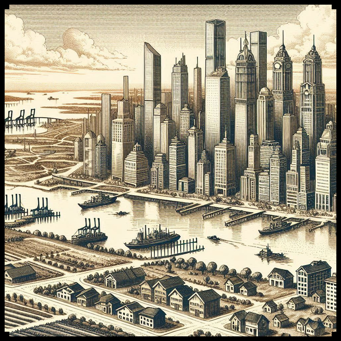
Maps have been fundamental to human civilization, serving as tools for navigation, representation, and cultural expression for centuries. From the intricate medieval mappa mundi to the sweeping landscapes of Renaissance-era cartography, maps have long been a blend of artistry and utility. As fantasy maps continue to gain popularity, especially in world-building for fiction, tabletop RPGs, and games, they have evolved to incorporate not only traditional symbols and motifs but also modern-day elements, such as skyscrapers, airports, and industrial zones. The Modern Era Complete Megapack – 1161 Vintage Assets exemplifies this unique fusion of the ancient and the contemporary, bringing modern infrastructure into the aesthetic of antique-style maps. But why do modern cities, farmlands, and ports hold such significance in these fantasy and antique map styles? Let’s explore the role, history, and utility of modern representations within these maps.

BUY AND DOWNLOAD The Modern Era Complete Megapack – 1161 Vintage assets here :

The Role of Cities and Modern Urban Spaces in Maps

Historically, maps were utilitarian objects. They guided travelers across oceans, through deserts, and over mountains. Yet, they were also deeply cultural artifacts, often adorned with elaborate illustrations and symbols representing both real and imagined places. Take, for instance, the Hereford Mappa Mundi (circa 1300), which combines religious symbolism, mythical creatures, and known geographic locations, all under a worldview dominated by Christian theology. The map was not just a guide but a representation of the spiritual and political landscape.

In a similar vein, contemporary fantasy maps are not merely about geography—they are narratives. The inclusion of modern elements like skyscrapers, industrial zones, and farmlands in these maps adds layers of meaning and utility. These assets, from the Modern Era Complete Megapack, enable creators to imagine sprawling metropolises next to medieval castles or blend futuristic settings into rustic villages. A skyscraper, for example, might signify not just the presence of a modern city but also symbolize power, economic dominance, or a new world order—just as towers and fortresses did in ancient maps.

Similarly, ports with cargo ships, cruise ships, and marinas offer more than just maritime detail. They signify trade, travel, and global connectivity. A map incorporating these modern elements becomes a living, breathing world where characters can move goods, engage in trade wars, or simply observe the transition from an old-world economy to a globalized future.

Cultural and Historical Perspectives on Map Symbols

In the context of historical maps, every symbol had its place and purpose. Churches and cathedrals were often prominent, denoting centers of religious authority. Maps like the 16th-century Carta Marina also included symbols for cities, ports, and natural features, each imbued with cultural or political significance. This symbolic language transcends into modern maps, where symbols for airports, industrial plants, or train stations serve a similar role in identifying essential infrastructure, albeit for a different era.

Incorporating modern farmlands with silos and tractors into a map can serve both practical and decorative functions. Farmlands have always been crucial in maps, representing sustenance, rural life, and the economy. By placing modern silos and tractors into the landscape, a map bridges the gap between an agrarian past and an industrial present. This is not just a decorative flourish; it signifies a transition in the world, from hand-plowed fields to mechanized agriculture, marking progress while retaining the land’s importance in shaping societies.

Airports, meanwhile, offer a fascinating shift in the iconography of maps. In historical maps, pathways and roads were dominant, guiding travelers across the land. In modern maps, the airplane symbol or control tower indicates a completely new form of travel and connection. Where medieval travelers would rely on footpaths and caravans, today’s characters might zip across the globe in hours. Including airports and planes in a fantasy or antique map doesn’t just modernize the world—it revolutionizes how space and time are perceived within that world.

Industrial Zones and Ports: Symbols of Modern Power

Incorporating factories, industrial plants, and smokestacks into a map may seem jarring in a world dominated by castles and forests, but these symbols bring a deeper layer of realism and complexity. Factories represent mass production, labor, and pollution, altering the environmental and economic landscapes. In a fantasy setting, these industrial areas could symbolize a new age of steam power or technological advancement, perhaps even a dystopian turn where ancient magic is replaced by mechanized oppression.

Ports with cargo ships, cruise ships, and marinas are also significant in representing global trade, naval dominance, and exploration. The port city of Venice, for example, was often central in early Renaissance maps due to its influence over Mediterranean trade routes. In modern maps, symbols like cargo ships and cruise ships take on a similar role, suggesting not only commerce but also tourism and cultural exchange. A cruise ship on a map might indicate a wealthy elite traveling for pleasure, while a cargo ship could imply smuggling operations, pirate raids, or the centrality of trade to a nation’s economy.

Ports, factories, and industrial zones in fantasy maps also serve a practical purpose for role-playing games (RPGs) or fictional narratives. These areas might become zones of conflict, where labor strikes, environmental disasters, or political uprisings play out. Characters can explore these spaces, perhaps disrupting production or engaging in espionage, giving the map a sense of dynamism and potential.

Modern Farmsteads and Rural Life

Just as cities and industrial zones shape the landscape of a map, modern farmlands with tractors, silos, and barns offer a glimpse into rural life in an industrialized age. Farmlands were a staple of medieval maps, often symbolized by clusters of small homes and open fields. With the Modern Era Complete Megapack, these symbols evolve. Silos and tractors indicate large-scale farming, mechanization, and the economic importance of agriculture in modern societies.

These farm assets can play a dual role: they are both decorative and functional. Players might explore vast fields, encountering rural communities, or uncovering hidden secrets in the silos and barns. The inclusion of these elements adds depth and believability to a world, suggesting that not every space is dominated by technology—rural areas still thrive, even as cities and industries grow.

Utility and Decoration: The Dual Purpose of Modern Map Icons

At their core, the icons in the Modern Era Complete Megapack serve both functional and decorative purposes. Railway stations, airports, and docks provide practical landmarks for navigating the world. Players and readers alike can understand where key infrastructure exists and how it influences the movement of goods and people.

On the other hand, these icons also enhance the visual appeal of a map. The inclusion of roller coasters, stadiums, and amusement parks adds a playful, modern flair to a world that might otherwise be steeped in medieval or Renaissance aesthetics. These elements suggest leisure, entertainment, and prosperity, offering a contrast to more industrial or agrarian symbols.

Additionally, symbols for churches, chapels, and religious monuments continue to have cultural significance. In older maps, these were often placed prominently to reflect the centrality of religion in both geography and politics. On modern maps, religious buildings might serve a different role, marking heritage sites, centers of community, or places of refuge and sanctuary in a rapidly changing world.

Conclusion: Bridging Eras Through Cartography

The Modern Era Complete Megapack – 1161 Vintage Assets is more than just a collection of modern structures and vehicles; it’s a bridge between the past and the present. By blending skyscrapers, cruise ships, factories, and farmlands into antique map styles, creators can craft worlds that feel dynamic and lived-in. These modern elements offer a new language of symbols, one that reflects industrial growth, globalization, and technological advancement, while still honoring the artistic traditions of the past.

Just as medieval maps reflected the political, religious, and cultural realities of their time, these new maps, adorned with modern symbols, tell stories of a world at the intersection of tradition and progress. Whether used for RPGs, world-building, or as decorative pieces, these maps offer a captivating glimpse into the complexities of blending eras and imagining new worlds.

Posted on Leave a comment

Cartography Assets for Fantasy Maps: Wetlands, Marshes, and Swamps

wonderdraft assets, marshlands, wetlands, marshland, wetland, marsh and swamps, vintage cartography symbols

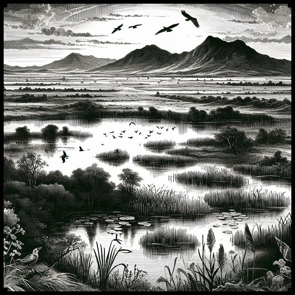
Cartography has long served as a vital tool for explorers, rulers, and scholars, offering a visual representation of the known world and its myriad landscapes. Among these varied terrains, swamps and marshes hold a distinctive place, both in terms of their utilitarian significance and their cultural resonance. These wetland regions were often depicted on ancient maps with a characteristic set of symbols and textures that provided essential information to those who relied on them. The Old Cartography Swamps & Marshes – Wetland Assets Megapack seeks to emulate these time-honored techniques, offering a rich collection of assets that can breathe life into any fantasy map. But to fully appreciate the utility and beauty of these assets, one must first understand their historical and cultural context.

BUY AND DOWNLOAD The Old Cartography Swamps & Marshes – Wetland assets Megapack here :

Historical Depictions of Swamps and Marshes

In ancient and medieval cartography, swamps and marshes were depicted with a variety of symbols, each designed to convey the terrain’s distinctive characteristics. These wetland areas were often represented using hatching, a technique involving closely spaced parallel lines that suggested the presence of waterlogged ground. In some cases, these lines were supplemented with small clusters of dots or tiny grass-like strokes to emphasize the presence of water and vegetation. For instance, in the Tabula Peutingeriana, an ancient Roman map of the road network across the Roman Empire, wetlands were denoted with careful hatching and small dots, highlighting the treacherous and often impassable nature of these areas.

Another fascinating example is the Ebstorf Map, a medieval mappa mundi (world map) from the 13th century. Although the original was destroyed during World War II, copies and descriptions of the map reveal that marshes were indicated by small, detailed symbols, often accompanied by images of reeds, trees, and waterfowl. The inclusion of such details was not merely decorative; it provided crucial information to travelers and traders about the difficulties they might face when navigating these regions.

Utility and Cultural Significance

The representation of swamps and marshes on ancient maps served several purposes. Primarily, these depictions were practical. Wetlands were often hazardous areas, difficult to traverse and prone to harboring diseases like malaria. By marking these regions clearly, cartographers provided vital warnings to those planning their journeys. For example, medieval maps of the British Isles often included marshlands such as the Fens, depicted with characteristic symbols to indicate their challenging nature. Such details were indispensable for military planners, traders, and pilgrims.

Beyond their practical applications, the depiction of swamps and marshes also carried cultural significance. In many cultures, wetlands were seen as liminal spaces—regions on the edge of civilization, where the boundaries between land and water, life and death, were blurred. This cultural perception is reflected in the way these areas were depicted on maps. For instance, on some medieval maps, marshes were adorned with mythical creatures or fantastical beasts, reinforcing their status as mysterious and otherworldly places.

Castles, Towers, and Villages in the Marshes

The inclusion of human-made structures like castles, towers, and villages within marshes on ancient maps adds another layer of complexity to these representations. In reality, such structures were often built in marshes for defensive purposes; the difficult terrain provided a natural barrier against invaders. The Motte-and-Bailey castles, for instance, were sometimes constructed in or near marshy areas, where the waterlogged ground made direct assaults more difficult. These strategic choices are reflected in the cartographic symbols used to denote these structures.

On ancient maps, castles and towers in marshes were often depicted with a combination of symbols: a small tower or castle icon surrounded by hatching or marsh symbols. This visual combination indicated both the presence of a fortified structure and the challenging nature of the surrounding terrain. The Gough Map of Great Britain, dating to the 14th century, provides an example of this, where the wetlands around the River Trent are shown alongside small fortified icons, signaling both the military and geographical challenges of the area.

The Old Cartography Swamps & Marshes – Wetland Assets Megapack

The Old Cartography Swamps & Marshes – Wetland Assets Megapack offers a meticulously crafted set of tools that draw directly from these historical traditions. The pack includes a variety of marsh and swamp elements, such as hatching, tall grasses, ponds, and marsh trees, each designed to replicate the look and feel of ancient maps. The assets also include symbols for castles, towers, and villages within these wetland areas, allowing mapmakers to create complex and historically resonant representations of their fantasy worlds.

These assets are more than just decorative; they are deeply rooted in the cartographic practices of the past. By using these symbols, modern mapmakers can evoke the same sense of mystery, danger, and strategic complexity that ancient cartographers sought to convey. Whether creating a map for a fantasy novel, a role-playing game, or a historical simulation, the inclusion of these wetland elements can add depth and authenticity to the final product.

Decorative and Aesthetic Considerations

While the primary function of swamp and marsh symbols on ancient maps was utilitarian, there is no denying their aesthetic appeal. The careful attention to detail in the hatching, the graceful curves of the reeds, and the stark simplicity of the dotted lines all contribute to the overall beauty of the map. These elements were as much about creating an artwork as they were about conveying information. The same is true for the Old Cartography Swamps & Marshes – Wetland Assets Megapack. The assets in this pack are designed with an eye for detail, ensuring that each symbol not only serves a functional purpose but also enhances the visual appeal of the map.

Conclusion

The depiction of swamps and marshes on ancient maps is a fascinating blend of utility, culture, and art. These representations provided essential information for travelers, while also reflecting deeper cultural attitudes towards these mysterious and often feared landscapes. The Old Cartography Swamps & Marshes – Wetland Assets Megapack captures this rich tradition, offering a suite of tools that can bring the same depth and authenticity to modern fantasy maps. By drawing on the techniques and symbols of the past, mapmakers can create maps that are not only functional but also beautiful, resonating with the same sense of wonder and discovery that has captivated explorers and cartographers for centuries.

Posted on Leave a comment

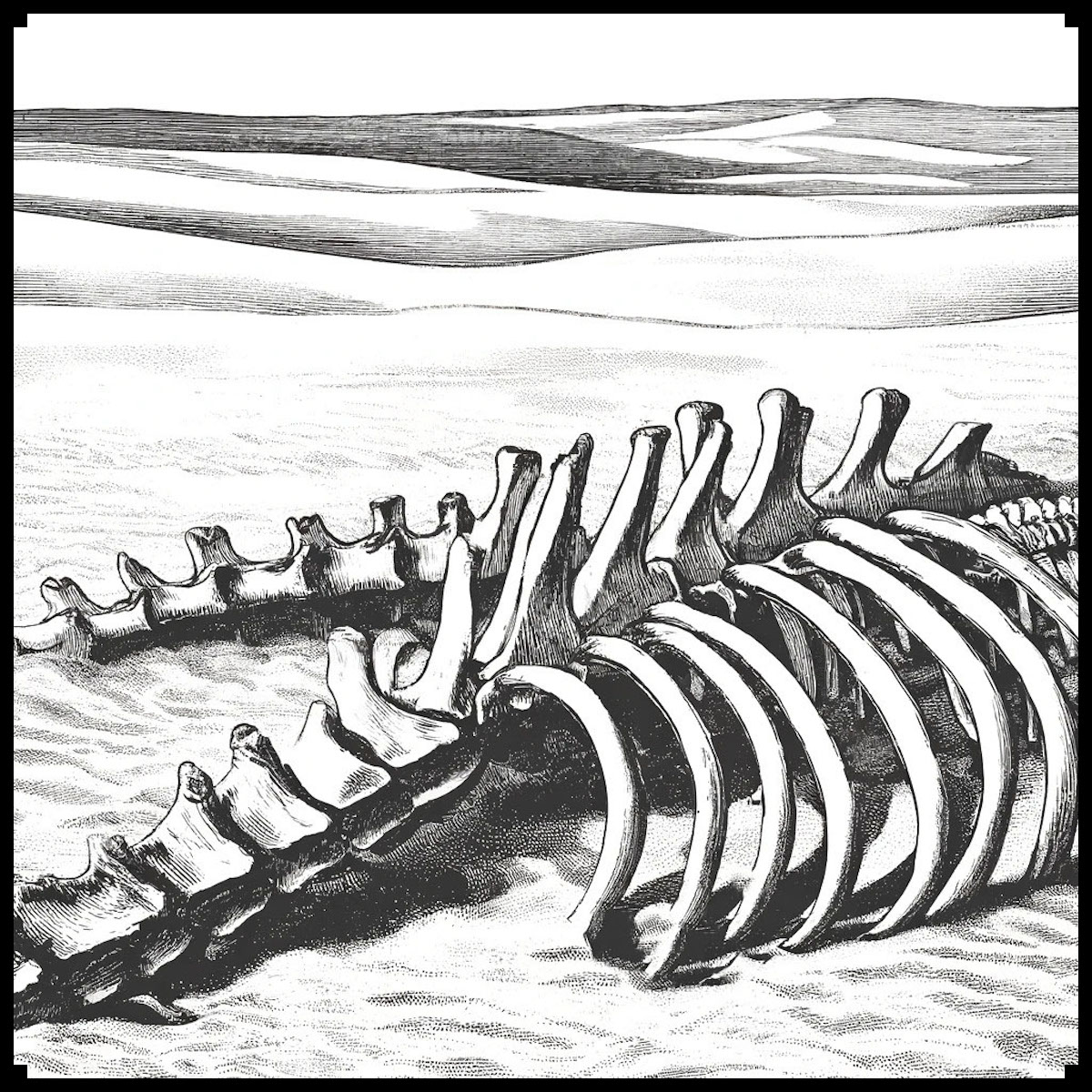
Carcasses & Bones : The Symbolism in Cartography Assets and Fantasy Maps

cartography assets, wonderdraft assets, bones, skulls, carcass assets and symbols for fantasy map, etching illustration

Throughout the ages, maps have served not just as tools for navigation and exploration, but as rich tapestries of symbolism and storytelling. In the realms of both ancient and fantasy cartography, the depiction of carcasses, skeletons, bones, and skulls holds profound significance. These macabre elements, from the eerie remnants of giant creatures to the petrified skulls forming hellmouth entrances, add layers of narrative depth and visual intrigue. This article explores the historical and cultural significance of these skeletal features, highlighting their symbolic meanings and aesthetic contributions. Additionally, we introduce the Carcasses & Bones – Vintage Assets Megapack, a collection designed to enhance fantasy maps with a vintage flair, echoing the art of ancient cartography.

BUY AND DOWNLOAD The Carcasses & Bones ( skulls, bones, carcasses, skeletons, remains ) – Vintage assets Megapack here :

Symbolism of Skeletal Remains in Cartography

In ancient and fantasy maps, skeletal remains serve as powerful symbols:

  1. Markers of Danger: Skeletons, particularly those of giant creatures, signify perilous areas. They warn travelers of potential threats, from treacherous terrain to lurking predators or cursed lands. For instance, the bones of a dragon might indicate a region fraught with magical dangers.
  2. Historical Echoes: The depiction of bones and carcasses often suggests a storied past. They can represent ancient battles, devastating calamities, or the remnants of mythical creatures, thus providing a narrative context that enriches the map’s lore.
  3. Cultural Significance: Skeletons and carcasses are imbued with cultural and mythological meanings. They might symbolize the remnants of ancient civilizations, embodying themes of mortality and the passage of time.
  4. Filling the Void: In vast, unexplored regions—particularly deserts or remote areas—skeletal remains help fill empty spaces, making the map more visually engaging and complete. This technique prevents the map from appearing barren or unfinished.

The Hellmouth: A Gateway to the Underworld

One of the most striking symbols in ancient and fantasy maps is the hellmouth, often depicted as a giant skull or monstrous mouth. This imagery serves multiple purposes:

  1. Symbol of Evil: The hellmouth represents an entrance to the underworld or hell, symbolizing ultimate evil and chaos. It is often used to mark places of extreme danger or malevolence, suggesting that the area is a gateway to darker realms.
  2. Narrative Device: In storytelling, a hellmouth can signify a portal to another world, setting the stage for epic adventures or terrifying encounters. It evokes a sense of dread and curiosity, compelling explorers to either avoid the area or delve into its mysteries.
  3. Artistic Expression: The depiction of a hellmouth, often as a gaping, monstrous skull, showcases the artist’s skill in creating dramatic and evocative imagery. It serves as a focal point on the map, drawing the viewer’s eye and sparking the imagination.

Historical Context and Real-World Examples

The inclusion of skeletal remains on maps is rooted in historical practice. One notable example is the Tabula Rogeriana, a 12th-century map created by the Arab geographer Muhammad al-Idrisi. Although it does not explicitly depict skeletal remains, it features intricate illustrations of landscapes and creatures, offering a glimpse into how ancient cartographers used imagery to convey information.

In medieval Europe, Mappa Mundi maps, such as the Hereford Mappa Mundi, often depicted monstrous creatures and skeletal remains. These maps combined geographical knowledge with mythological and religious elements, portraying a world where the boundaries between reality and legend were blurred. Skeletons of dragons and other mythical creatures were often used to fill unknown or unexplored areas, symbolizing danger and the limits of human knowledge.

The Carcasses & Bones – Vintage Assets Megapack

For modern fantasy cartographers and enthusiasts, the Carcasses & Bones – Vintage Assets Megapack offers a treasure trove of detailed, vintage-style assets to enhance their maps. This collection includes:

  • Carcasses and bones of various creatures
  • Skulls, including giant stone skulls and skull entrances (hellmouths)
  • Bone piles and guts piles
  • Skeletons of dragons, dinosaurs, whales, and humans
  • Remains of giant ribs and other creature carcasses

These assets are designed to mimic the style of old maps, adding an authentic, antique feel to your creations. They provide the tools needed to bring your fantasy worlds to life, imbuing your maps with the same sense of wonder and terror found in historical cartography.

Examples in Fiction

In modern fantasy literature and games, skeletal remains often play a crucial role in setting the scene and advancing the plot. For instance, in J.R.R. Tolkien’s Middle-earth, the Barrow-downs are haunted by the skeletal remains of ancient warriors, adding to the eerie and foreboding atmosphere. Similarly, in the video game The Elder Scrolls V: Skyrim, the landscape is dotted with the remains of dragons, emphasizing the world’s rich history and the ever-present danger.

Conclusion

The depiction of carcasses and bones on maps is a practice steeped in history and tradition. It serves symbolic purposes, enriches cultural narratives, and enhances the visual and emotional impact of cartography. Whether in ancient maps or modern fantasy creations, these macabre elements continue to captivate and inspire. The Carcasses & Bones – Vintage Assets Megapack offers a way for contemporary mapmakers to tap into this rich tradition, creating detailed and evocative maps that resonate with the legacy of ancient cartographers.